Last updated: October 8, 2021
Place
Delaware-Pennsylvania Border Marker
Quick Facts
Location:
39°50'22.1"N 75°32'58.6"W
Significance:
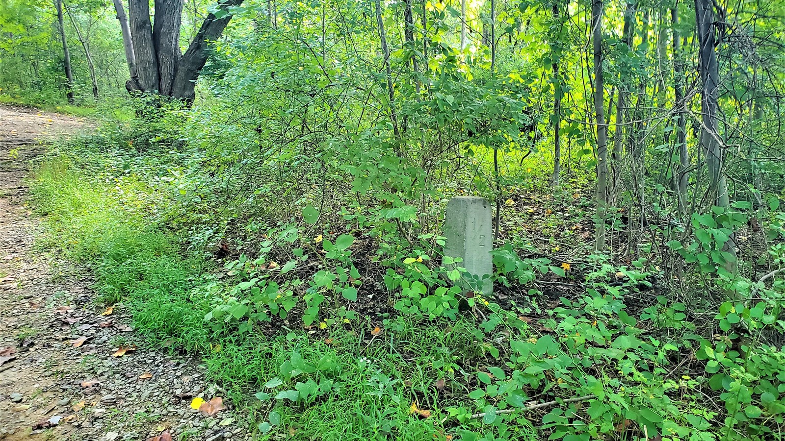
This stone marker is one of many placed by Captain Hodgkins during his 1892 survey of the Twelve-mile Circle, which makes up a large part of the Pennsylvania-Delaware border, and is one of the few circular borders in the United States.
Delaware’s borders with its neighbors have been the subject of much dispute and confusion, including up into the present era. A disagreement with New Jersey over a planned natural gas terminal on the Jersey side of the Delaware river in 2007 for example, which the First State saw as an encroachment on Delaware’s land, led to the Delaware state legislature (half-jokingly) considering a bill to call up the Delaware National Guard to defend the border.
The section of the border with Pennsylvania is probably the source of some of the most confounding problems when it came to determining where exactly the First State began. Starting with the establishment of the proprietary colony of Pennsylvania in 1681, disagreements over borders were born. In 1682, to solve part of the dispute, a 12-mile radius from New Castle was to delineate the northern border of Delaware. However, this seemingly simple solution proved to be anything but. The center point of this circle was not clearly set, and it wasn’t until 1750 that the cupola of the Court House in New Castle was designated as the official center. Further, surveying technology in the Colonial era was lacking in sophistication, and the “Twelve-mile circle” as the arc became known was usually more of an approximation during the 1700s than a hard reality. Given that Delaware was administratively a part of the Province of Pennsylvania, albeit with its own colonial legislature, the unclear border did not cause significant problems, for the time being. The biggest snag was the intersection of the Twelve-mile circle with the border of Maryland. With Colonial surveyors not up to the task, this issue was one of the factors that led to the hiring of the English surveyors Charles Mason and Jeremiah Dixon, who established the famed “Mason-Dixon” line between Delaware, Maryland, and Pennsylvania, commonly seen as the line demarcating the North from the South.
Following Delaware’s declaration of independence from both the British Empire and Pennsylvania in 1776, the disputed border issue became a hotter topic. Several attempts to definitively survey the Twelve-mile circle took place throughout the 1800s, with the last and most conclusive being that of Captain W. C. Hodgkins of the Office of the U. S. Coast and Geodetic Survey in 1892. Hodgkins’ survey produced the stone boundary marker you are looking at. His surveyed arc has larger terminal markers at the points where the circle intersects the current border with Maryland and at the shore of the Delaware river. Every mile there is a marker with a “P” on the Pennsylvania side, and a “D” on the opposite, with a mile count from the initial point. In addition, there are markers every half-mile, with a “1/2” inscribed on the West facing side. The marker in front of you is one of these ½ mile markers from Hodgkins’ survey.
Hodgkins’ work firmly established the arc of the Twelve-mile circle and is now the official demarcation for most of the border between the First State and the Keystone State. Delaware’s strange borders continue to be a source of dispute, as well as interesting historical stories. Think about where you live. How where the borders of your hometown, state, or country formed? How might they have been drawn differently? What does this tell us about the nature of human-made borders? These are questions we may not think about very often, but which can have a huge impact on our lives.