Last updated: March 14, 2024
Place
“Containing the Island" Sign

NPS Photo/M Mark
Historical/Interpretive Information/Exhibits
Description
Low-profile wayside that is 36 x 24 inches, with interpretation panel spanning 36.5 inches wide. It has a grey square base with two rectangular pillars supporting the panel. The panel is framed in grey metal. The sign is located on the perimeter accessible trail on the South Drumlin.
Layout
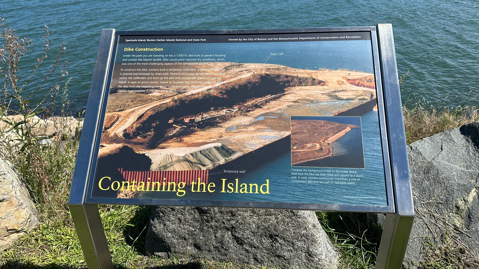
At the top of the sign is a black banner with white text. Aligned to the left is text that reads “Spectacle Island, Boston Harbor Islands National and State Park.” Aligned to the right is text that reads “Owned by the City of Boston and the Massachusetts Department of Conservation and Recreation.” The section of text is titled, “Dike Construction” in yellow text aligned to the left just underneath the black banner. The panel background is made up of an aerial view of the South Drumlin with a sea wall being constructed and trash being covered. The short hill is cut in half where heavy machinery is working to fill it in. There is one column of text on the left side of the panel, made up of two paragraphs. On the bottom right is a single photo for comparison with the background photo. At the bottom of the panel, the title reads “Containing the Island” in yellow text.
Image
An aerial view of the edge of the island by the South Drumlin. It is level and covered in dirt with stone lining the edge of a sea wall. A backhoe is at the edge of the island where the stone ends, adding more stones to the wall. An orange net is deployed in a semicircle in the water starting where the backhoe is working to catch any debris or materials that fall into the water. There is a splash of brown inside the orange netting, showing where materials did get into the water. The entire drumlin is flat and brown. The water around is a deep blue.
Image Caption
Compare the background image to the image above. Note how the dike has been filled and capped by a stone wall. In total, workers constructed more than a mile of containment dike and sea wall on Spectacle Island.
Image (background)
An aerial view of the edge of the South Drumlin on Spectacle Island. It is divided into two sections, the top half of the drumlin has mounds of dirt and a dirt road. The second section is defined by a steep cliff drop, labeled as “Trash Cliff” in white text. At the bottom of the drop-off is lots of machinery and a small dirt road on completely level ground that is permeated with water. Puddles are persistent and areas of the level dirt are much darker where it is clearly soaked through. Where the edge of the island meets the water, the water is held back with a red corrugated metal retaining wall that also extends out to the side at the front of the drumlin, where it meets the beach area. The red corrugated metal retaining wall is labeled in white text as a “Temporary Wall.” The upper left half of the drumlin is obscured by the text.
Image Credit
All photos courtesy The Central Artery/Tunnel Project
Main Text
Under the path you are standing on lies 1,650 ft. Dike built to prevent flooding and contain the island’s landfill. Dike construction required dry conditions, which was one of the most challenging aspects of the remediation project.
To construct the dike, workers built a temporary cofferdam, a watertight area that is drained and enclosed by sheet piles. Workers excavated 35 feet below sea level within the cofferdam and built up the dike with compacted glacial till from the island. A layer of armor stones, twelve to fourteen feet thick was added to protect the dike from the pounding northeast wind and waves. The dike connects to a seawall that stretches 3,100 feet along the northern shoreline of the island.
