Last updated: February 19, 2026
Place
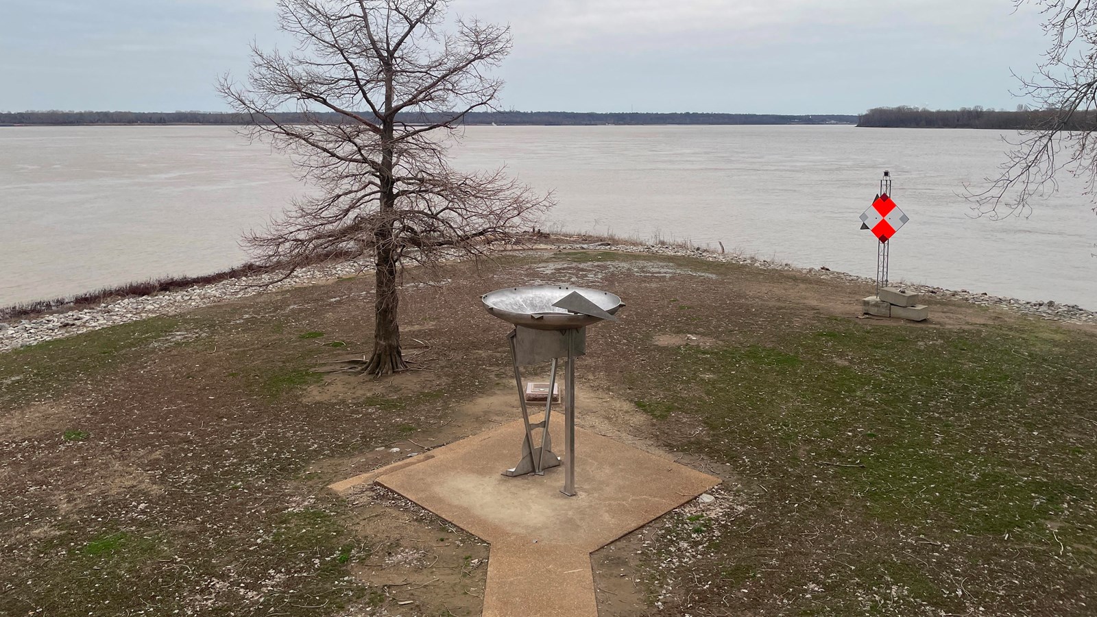
Confluence of the Ohio and Mississippi Rivers
Quick Facts
MANAGED BY:
Amenities
4 listed
Benches/Seating, Historical/Interpretive Information/Exhibits, Information, Parking - Auto
On the evening of November 14, 1803, the expedition arrived “on the point at which the Ohio and Mississippi form there junchon.” For the next six days, Lewis and Clark made observations establishing the longitudinal and latitudinal coordinates of the confluence and explored the region. They encountered a group of Shawnee and Delaware, their first known contact with Native Americans on the expedition, camped on the Missouri side of the river. After visiting the former site of Fort Jefferson downriver of the confluence, Lewis and Clark came to an American trading encampment across the river where they found “a number of our men who had left camp contrary to instructions & drunk.” The expedition departed the confluence area on November 20 and began working their way up the Mississippi River.
In 1803 the confluence of the Ohio and Mississippi Rivers was located within the present-day limits of Cairo below 2nd Street, but over time its location shifted to the south. In 1960 the site was dedicated the Cairo Point-Fort Defiance State Park with the Boatman’s Memorial observation tower constructed at the confluence. The sculpture “Proceeding On” was installed in 2005 to commemorate the activity of the Lewis and Clark Expedition in the area.
Confluence of the Ohio and Mississippi Rivers is a High Potential Historic Site of the Lewis and Clark National Historic Trail.
Lewis and Clark NHT Visitor Centers and Museums
This map shows a range of features associated with the Lewis and Clark National Historic Trail, which commemorates the 1803-1806 Lewis and Clark Expedition. The trail spans a large portion of the North American continent, from the Ohio River in Pittsburgh, Pennsylvania, to the mouth of the Columbia River in Oregon and Washington. The trail is comprised of the historic route of the Lewis and Clark Expedition, an auto tour route, high potential historic sites (shown in black), visitor centers (shown in orange), and pivotal places (shown in green). These features can be selected on the map to reveal additional information. Also shown is a base map displaying state boundaries, cities, rivers, and highways. The map conveys how a significant area of the North American continent was traversed by the Lewis and Clark Expedition and indicates the many places where visitors can learn about their journey and experience the landscape through which they traveled.