Last updated: November 28, 2023
Place
Colt Killed Creek
University of Montana, Mansfield Library
Quick Facts
Significance:
Meriwether Lewis, William Clark, their party, and Pikee Queenah passed through here in 1805 after making a wrong turn. With little to eat, they killed and ate two horses here.
Designation:
Lewis and Clark National Historic Trail, National Register of Historic Places, National Historic Landmark
Amenities
14 listed
Beach/Water Access, Benches/Seating, Fire Pit, Parking - Auto, Parking - Bus/RV, Pets Allowed, Picnic Table, Tent Campsites, Toilet - Flush, Toilet - Vault/Composting, Trailhead, Trash/Litter Receptacles, Water - Drinking/Potable, Water - Hookup - Boat/RV
“All the time, Lewis and Clark were looking for hipt [food], and when they had little or no food they ate dogs and horses. But sometimes they are yuc ciqamqal [pitiable dogs]. Sometimes they were given horses to eat because they looked so yucna [poor/pitiful], and we ate horse with them to be polite and good to them. Ayeaa! We never ate dogs with them! We never ate dogs because they helped us while tracking and hunting.” —Allen V. Pinkham, Sr., Nez Perce, 2007
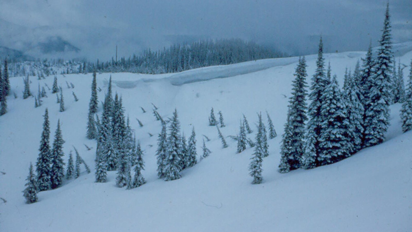
When Meriwether Lewis, William Clark, and their party followed Pikee Queenah (Swooping Eagle), their Shoshone guide, westward across the Lolo Trail in September 1805, they encountered snow and little food to hunt or forage. These visitors did not know the area, and their guide had only been on this trail once, many years ago.
The Flathead, Nez Perce, and other Indigenous people who frequently traveled this path knew that September was a bad time to cross because of the snow and lack of food along the way. As Clark noted in his journal, the grass was “entirely eaten out” by horses and no salmon swam in the stream.
Crossing at this time of year, the expedition members had to resort to drastic measures to feed the men (and woman and baby) with them.
They decided to kill a horse and eat it. Joseph Whitehouse wrote that everyone was very happy with the horse meat. In honor of the meal, they called the nearby stream Colt Killed Creek.
The meal was so satisfying, amid such cold and miserable conditions, that the next day Clark noted they “Killed a Second Colt which we all Suped hartily on and thought it fine meat.”
They had purchased these horses from Shoshone people near the Missouri River Headwaters. Did they know the unprepared travelers would resort to eating these useful animals?
About this article: This article is part of a series called “Pivotal Places: Stories from the Lewis and Clark National Historic Trail.”
Lewis and Clark NHT Visitor Centers and Museums
This map shows a range of features associated with the Lewis and Clark National Historic Trail, which commemorates the 1803-1806 Lewis and Clark Expedition. The trail spans a large portion of the North American continent, from the Ohio River in Pittsburgh, Pennsylvania, to the mouth of the Columbia River in Oregon and Washington. The trail is comprised of the historic route of the Lewis and Clark Expedition, an auto tour route, high potential historic sites (shown in black), visitor centers (shown in orange), and pivotal places (shown in green). These features can be selected on the map to reveal additional information. Also shown is a base map displaying state boundaries, cities, rivers, and highways. The map conveys how a significant area of the North American continent was traversed by the Lewis and Clark Expedition and indicates the many places where visitors can learn about their journey and experience the landscape through which they traveled.