Last updated: November 1, 2021
Place
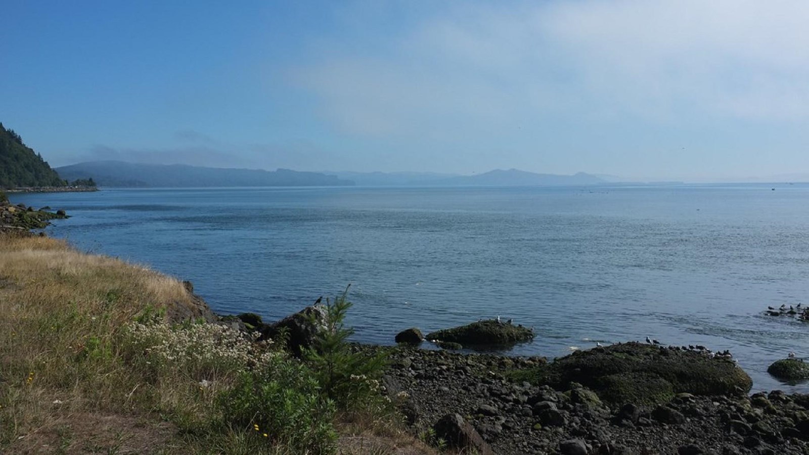
Cliff Point & Hungry Harbor
"Hungry Harbor" by lumachrome is licensed under CC BY-SA 2.0
Quick Facts
Location:
Cliff Point, WA
Lewis and Clark NHT Visitor Centers and Museums
This map shows a range of features associated with the Lewis and Clark National Historic Trail, which commemorates the 1803-1806 Lewis and Clark Expedition. The trail spans a large portion of the North American continent, from the Ohio River in Pittsburgh, Pennsylvania, to the mouth of the Columbia River in Oregon and Washington. The trail is comprised of the historic route of the Lewis and Clark Expedition, an auto tour route, high potential historic sites (shown in black), visitor centers (shown in orange), and pivotal places (shown in green). These features can be selected on the map to reveal additional information. Also shown is a base map displaying state boundaries, cities, rivers, and highways. The map conveys how a significant area of the North American continent was traversed by the Lewis and Clark Expedition and indicates the many places where visitors can learn about their journey and experience the landscape through which they traveled.
When the weather worsened a few days later, the expedition was forced to relocate once more on November 12 in the hopes of finding a drier campsite. Clark describes the dire weather and the new camp in his journal, saying:
The point of land that Clark describes is located at the upstream end of Hungry Harbor and is known as Cliff Point. Unfortunately, this meant that the crew was separated from their cargo by half a mile, as they were unable to carry it with them. The canoes were left to “the mercy of the waves,” having been secured to the best of their ability by using stones to sink them and keep them from being dashed to pieces against the rocks.“A Tremendious wind from the S. W. about 3 oClock this morning with Lightineng and hard claps of Thunder, and Hail which Continued untill 6 oClock a. m. when it became light for a Short time, then the heavens became Sudenly darkened by a black Cloud from the S. W. and rained with great violence untill 12 oClock, the waves tremendious brakeing with great fury against the rocks and trees on which we were encamped. our Situation is dangerous. we took the advantage of a low tide and moved our camp around a point to a Small wet bottom at the mouth of a Brook, which we had not observed when we Came to this cove; from it being verry thick and obscured by drift trees and thick bushes…”
The weather finally let up on November 15, and the expedition hurriedly loaded their gear into the canoes. They made it around Point Distress (modern-day Point Ellice) where they established Station Camp, which would serve as their base of operations until November 24.
Today, Cliff Point can be viewed from the Lewis and Clark Trail Highway (WA-401), approximately two miles southwest of Knappton, Washington. There is no marker at this location, but there is a pullout for vehicles on the harbor side of the road.