Last updated: November 27, 2020
Place
Clark’s Lookout
Quick Facts
Location:
25 Clark's Lookout Road Dillon, MT 59725
Designation:
National Register of Historic Places
MANAGED BY:
Lewis and Clark NHT Visitor Centers and Museums
This map shows a range of features associated with the Lewis and Clark National Historic Trail, which commemorates the 1803-1806 Lewis and Clark Expedition. The trail spans a large portion of the North American continent, from the Ohio River in Pittsburgh, Pennsylvania, to the mouth of the Columbia River in Oregon and Washington. The trail is comprised of the historic route of the Lewis and Clark Expedition, an auto tour route, high potential historic sites (shown in black), visitor centers (shown in orange), and pivotal places (shown in green). These features can be selected on the map to reveal additional information. Also shown is a base map displaying state boundaries, cities, rivers, and highways. The map conveys how a significant area of the North American continent was traversed by the Lewis and Clark Expedition and indicates the many places where visitors can learn about their journey and experience the landscape through which they traveled.
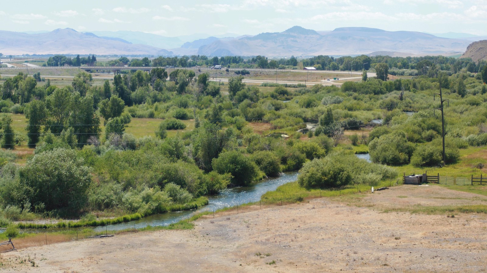
While Lewis’ scouting party proceeded overland, Clark led the main body of the expedition up the Beaverhead River. It was arduous work, with the group “much fatigued and weakened by being continualy in the water drawing the Canoes over the Sholes.” In response to the men’s complaints of the “emence labour they are obliged to undergo,” Clark drily noted, “I passify them.” On August 13, 1805, Clark ascended “a high Point of Limestone rocks on the Stard Side” in order to survey the route ahead. From here he took compass readings to “Point of the Beaver head hill” (Beaverhead Rock), the “Course of the Wisdom river” (Big Hole River), and the “gap at the place the [Beaverhead] river passes thro’ a mountain.”
Clark’s Lookout is located off Highway 91, just north of the town of Dillon. Established in 1985, Clark’s Lookout State Park is a largely undeveloped 8.2-acre site that encompasses the rocky promontory rising about 75 feet above the Beaverhead River. There is a parking area, interpretive signage, and a nearly quarter-mile trail loop. Visitors can hike to the top of the hill, which features a monument commemorating the compass readings taken by Clark and affords a sweeping view of the Beaverhead Valley.