Last updated: November 27, 2020
Place
Clark’s Hill State Historic Site
Quick Facts
Location:
Clark's Hill/Norton State Historic Site, Osage Hickory Street Osage City, MO
MANAGED BY:
Lewis and Clark NHT Visitor Centers and Museums
This map shows a range of features associated with the Lewis and Clark National Historic Trail, which commemorates the 1803-1806 Lewis and Clark Expedition. The trail spans a large portion of the North American continent, from the Ohio River in Pittsburgh, Pennsylvania, to the mouth of the Columbia River in Oregon and Washington. The trail is comprised of the historic route of the Lewis and Clark Expedition, an auto tour route, high potential historic sites (shown in black), visitor centers (shown in orange), and pivotal places (shown in green). These features can be selected on the map to reveal additional information. Also shown is a base map displaying state boundaries, cities, rivers, and highways. The map conveys how a significant area of the North American continent was traversed by the Lewis and Clark Expedition and indicates the many places where visitors can learn about their journey and experience the landscape through which they traveled.
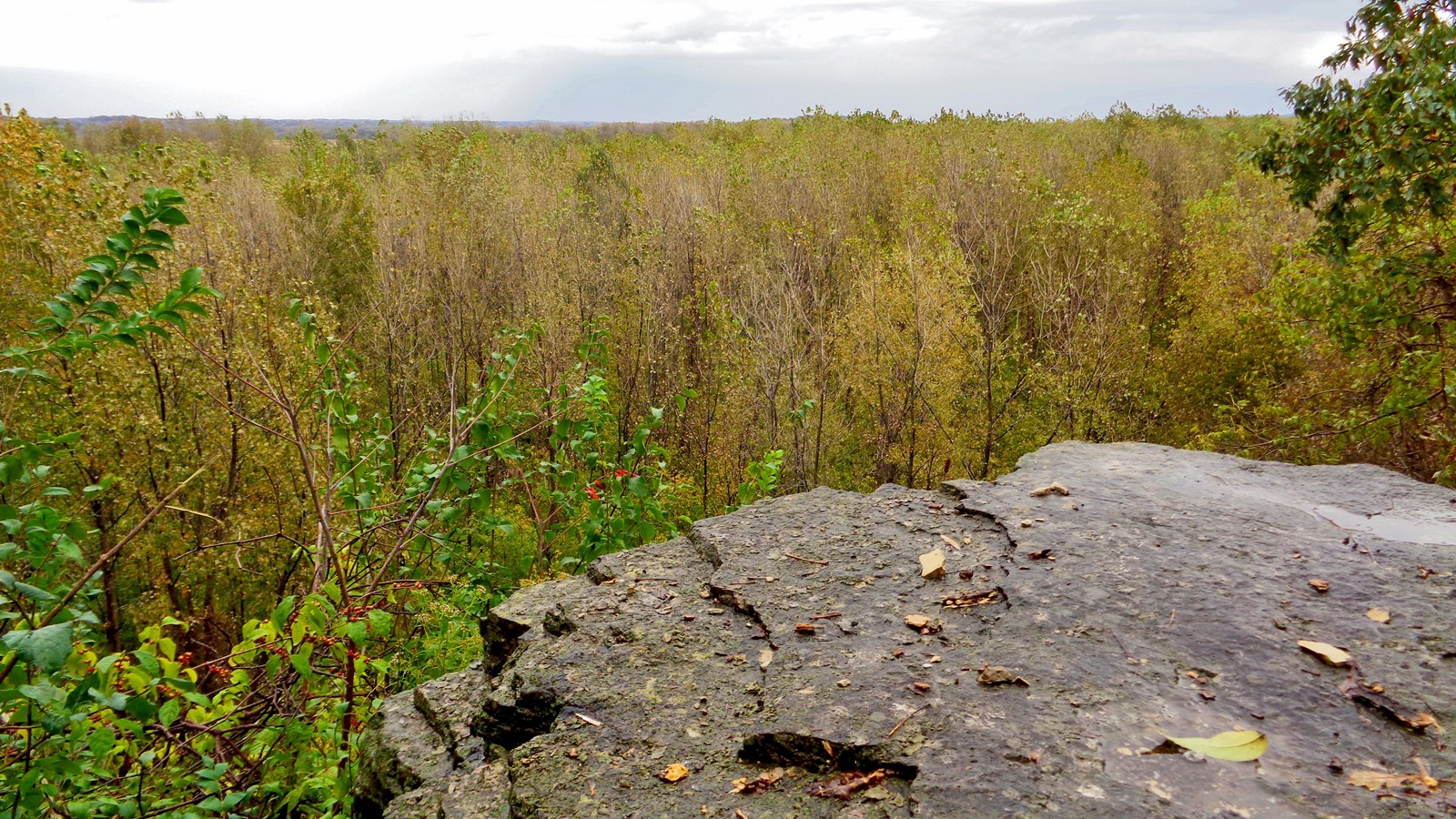
The expedition camped at the confluence of the Osage and Missouri rivers between June 1 and June 3, 1804. As they waited for the arrival of George Drouillard and John Shields, who were traveling separately on horseback, Lewis and Clark took measurements and recorded observations. Clark climbed the hill behind their camp on June 2, noting in his journals that he “assended the hill in the point 80 ps. from the pt. found it about 100 foot high, on the top is 2 graves, or mouns, a Delightfull prospect from this hill which Comds. both rivers.”
Although the confluence of the two rivers was visible from Clark’s Hill in 1804, it subsequently shifted to a location approximately six miles further downstream. However, the woodland character of the river valley remains intact and visitors are afforded views that are relatively undisrupted by modern intrusions. The site is operated as a state park unit, and features a hiking trail that accesses a viewing platform over the rocky outcrop that Clark stood upon. The two burial mounds documented by Clark remain intact, and have been dated to the Late Woodland period (BCE 600-900). Three additional mounds and a village site have also been located in the area.