Last updated: March 28, 2024
Place
"Changing Shape" Sign

NPS Photo/M Mark
Historical/Interpretive Information/Exhibits
Description
Low-profile wayside that is 40.5 x 24 3/8 inches, with interpretation panel spanning 36.5 inches wide. It has a grey square base with two rectangular pillars supporting the panel. The panel is framed in grey metal. The sign is located on the interpretive trail on the North Drumlin.
Layout
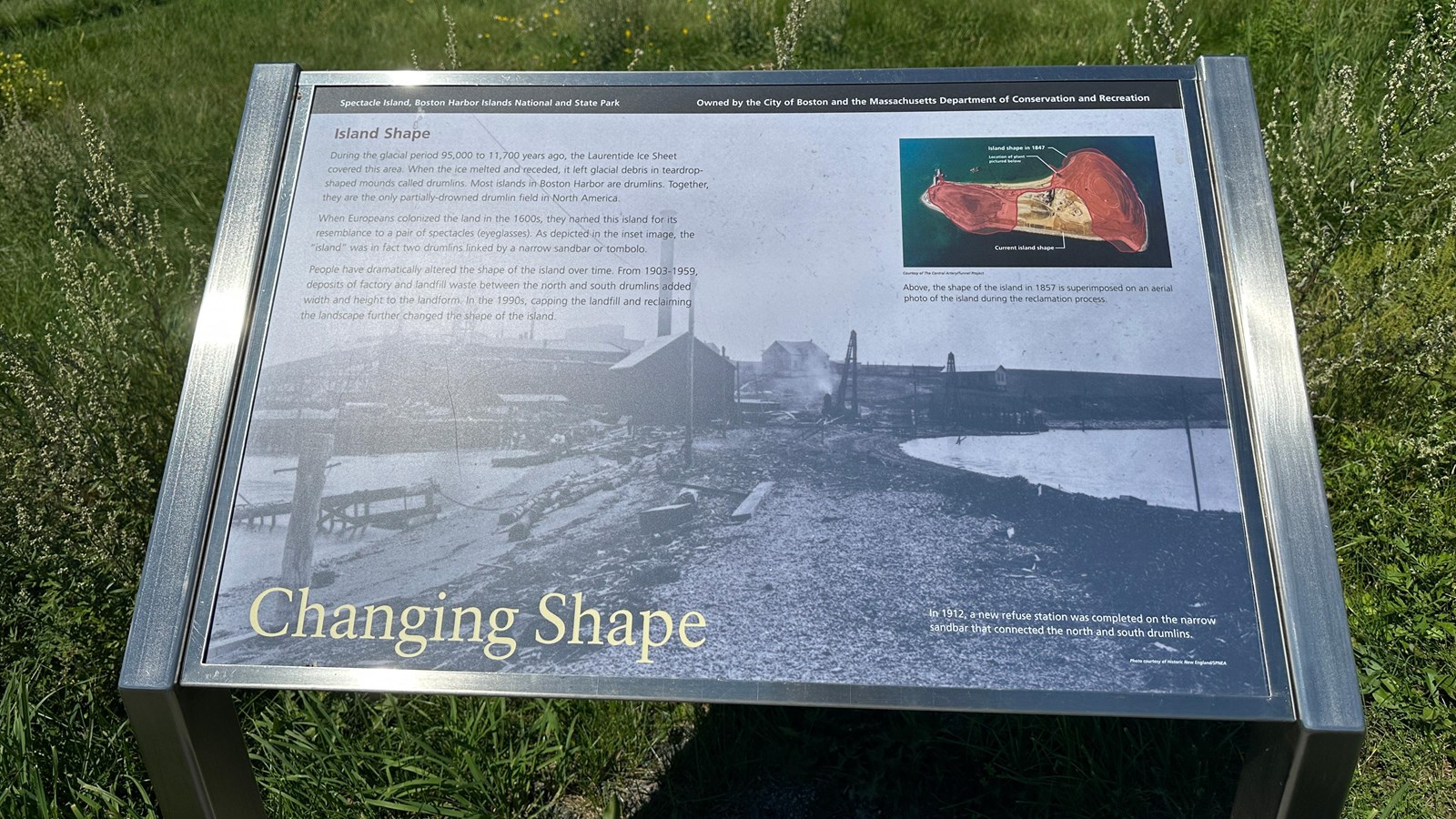
At the top of the sign is a black banner with white text. Aligned to the left is text that reads “Spectacle Island, Boston Harbor Islands National and State Park.” Aligned to the right is text that reads “Owned by the City of Boston and the Massachusetts Department of Conservation and Recreation.” The section of text is titled, “Island Shape,” in red text, aligned to the left just underneath the black banner. The panel background is a black and white image of the 1912 refuse station. There is a single column of text on the left with three paragraphs. And on the right is an overhead view of the island and its land mass. At the bottom of the panel the title reads “Changing Shape” in yellow text.
Image (right)
Rectangular map of Spectacle Island with a red overlay of the island shape in 1847. The red overlay features both the North and South Drumlins and one skinny sandbar connecting them. A white line points from the North Drumlin overlay to white text that reads, “Island shape in 1847.” The present-day island shape depicts the filled in space between the drumlins. A small difference can be seen in the edges of the island, the former shape stretched out further on the beaches. A white line points from the east side of the present-day island with small white text that reads “Current island shape.” And on the northwest side of the North drumlin is a small black box indicating the site of the plant pictured on this panel. A white line points from here to white text that reads “Location of plant pictured below.”
Image Caption
Above, the shape of the island in 1857 is superimposed on an aerial photo of the island during the reclamation process.
Image Credit
Courtesy of The Central Artery Tunnel Project
Image (background)
A dark and grainy black and white photo of the 1912 refuse station on Spectacle Island. Looking at the station from the sandbar that connected the North and South Drumlins, the refuse station is on the drumlin. The sandbar has scatterings of lumber and logs strewn across it and in the water on the left is the remains of a structure or pier. On the left is a big building, with a smokestack reaching up to the middle of the panel. It is connected to a much bigger building, part of the refuse station, with many layers that reach out into the harbor. On the right side of the drumlin is barren with one small building standing alone, across the middle of it is random pieces of scrap and scaffolding standing up, in the middle is another small white building.
Image Caption (background)
In 1912, a new refuse station was completed on the narrow sandbar that connected the north and south drumlins.
Image Credit (background)
Photo courtesy of Historic New England/SPNEA
Main Text
During the glacial period 95,000 to 11,700 years ago, the Laurentide Ice Sheet covered this area. When the ice melted and receded, it left glacial debris in teardrop-shaped mounds called drumlins. Most islands in Boston Harbor are drumlins. Together, they are the only partially drowned drumlin field in North America.
When Europeans colonized the land in the 1600s, they named this island for its resemblance to a pair of spectacles (eyeglasses). As depicted in the inset image, the “Island” was in fact two drumlins linked by a narrow sandbar or tombolo.
People have dramatically altered the shape of the island over time. From 1903-1959 deposits of factor and landfill waste between the north and south drumlins added width and height to the landform. In the 1990s, capping the landfill and reclaiming the landscape further changed the shape of the island.
