Last updated: May 28, 2024
Place
Illinois: Chain of Rocks Bridge

Photo courtesy of Rhys Martin
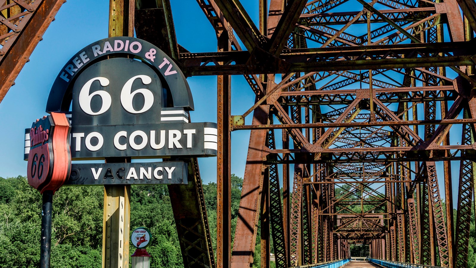
Chain of Rocks Bridge is one of the more interesting bridges in America. It’s hard to forget a 30-degree turn midway across a mile-long bridge more than 60 feet above the mighty Mississippi. For more than three decades, the bridge was a significant landmark for travelers driving Route 66.
The bridge’s colorful name came from a 17-mile shoal, or series of rocky rapids, called the Chain of Rocks beginning just north of St. Louis. Multiple rock ledges just under the surface made this stretch of the Mississippi River extremely dangerous to navigate. In the 1960s, the Corps of Engineers built a low-water dam covering the Chain of Rocks. That’s why you can’t see them today. Back in 1929, at the time of the construction of the bridge, the Chain was a serious concern for boatmen.
A massive undertaking in its day, the Chain of Rocks Bridge had a projected cost of $1,250,000. The bridge was to be a straight, 40-foot wide roadway with five trusses forming 10 spans. Massive concrete piers standing 55 feet above the high-water mark were to support the structure. Plans called for a four-mile fill along the road leading to the bridge’s north end.
All that proved true except for one major change--in direction. Riverboat men protested the planned bridge because it was to run near two water intake towers for the Chain of Rocks pumping station. Navigating the bridge piers and the towers at the same time, the river captains argued, would be extremely treacherous for vessels and barges. Besides, the initial straight line would have put the bridge over a section of the river where the bedrock was insufficient to support the weight of the piers. Either way, the bridge had to bend.
Construction started on both sides of the river simultaneously in 1927, and the piers were complete by August of 1928. A grand opening was planned for New Year’s Day 1929. The Mississippi River had other plans. Floods and ice slowed the work, and the Chain of Rocks Bridge finally opened to traffic in July of 1929.
Then, as now, actual expenditures for construction often exceed projected costs. Chain of Rocks Bridge cost just over $2.5 million--twice its original estimate. Fortunately, the public got its money’s worth. The bridge had beautifully landscaped approaches. A park-like setting around a pool and a large, ornate toll booth anchored the Missouri end. On the Illinois side, 400 elm trees lined the approach. The bridge brought travelers into St. Louis by way of the picturesque Chain of Rocks amusement park on the Missouri hills overlooking the river. On a clear day, crossing the Chain of Rocks Bridge was a real pleasure. That pleasure became an official part of the Route 66 experience in 1936, when the highway was rerouted over the bridge.
During World War II, Chain of Rock’s colorful red sections had to be painted green to make the bridge less visible from the air. At the same time, wartime gas rationing reduced traffic. To offset these costs, the City of Madison increased bridge tolls to 35 cents per car, with an additional five cents per passenger—a fee structure that sets on its head today’s system of special high-speed lanes reserved for cars carrying more, not fewer, people.
In 1967, the New Chain of Rocks Bridge carrying Interstate 270 opened just 2,000 feet upstream of the old bridge, which closed in 1968. The bridge deteriorated, and during the 1970s, Army demolition teams considered blowing it up just for practice. In 1975, demolition seemed imminent. Fortunately for the bridge, a bad market saved the day. The value of scrap steel plummeted, making demolition no longer profitable. At that point, the Chain of Rocks Bridge entered 20 years of bridge limbo--too expensive to tear down, too narrow and outdated to carry modern vehicles. In 1980, film director John Carpenter used the gritty, rusting bridge as a site for his science fiction film, Escape from New York. Otherwise, the bridge was abandoned.
Today you might say that the Chain of Rocks Bridge has completed a historic cycle. Built at the beginning of America’s love affair with the automobile, it is now a reflection of America’s desire not to ride in cars so often. During the 1980s, greenways and pedestrian corridors became increasingly popular, and a group called Trailnet began cleanup and restoration of the bridge. Linked to more than 300 miles of trails on both sides of the river, the old Chain of Rocks Bridge reopened to the public as part of the Route 66 Bikeway in 1999.
Because the bridge has not been significantly altered over the years, a visit there today conveys a strong sense of time and place, an appreciation for early-20th-century bridge construction, and outstanding views of the wide Mississippi River. The Chain of Rocks Bridge was listed in the National Register of Historic Places in 2006.
Chain of Rocks Bridge parallels U.S. 270 along West Chain of Rocks Rd. between Riverview Dr. in St. Louis, MO and Illinois 3 in Madison County, IL. Connections are present to the MCT Confluence Trail, Mississippi River Trail, and St. Louis Riverfront Trail, and free parking is available in Illinois at the bridge entrance and at North Riverfront Park, south of the bridge along the Riverfront Trail. A park with a pavilion, improved native habitats, event lawn and gated parking lot opened on the Missouri side of the bridge in 2024. Parking is available at the Illinois Bridge entrance and at North Riverfront Park, south of the Bridge along the Riverfront Trail. The bridge is open to bikers and pedestrians daily. Call 314-436-7009 for current information or visit the Great Rivers Greenway site.
See the Chain of Rocks Bridge National Register nomination form.
