Last updated: July 18, 2025
Place
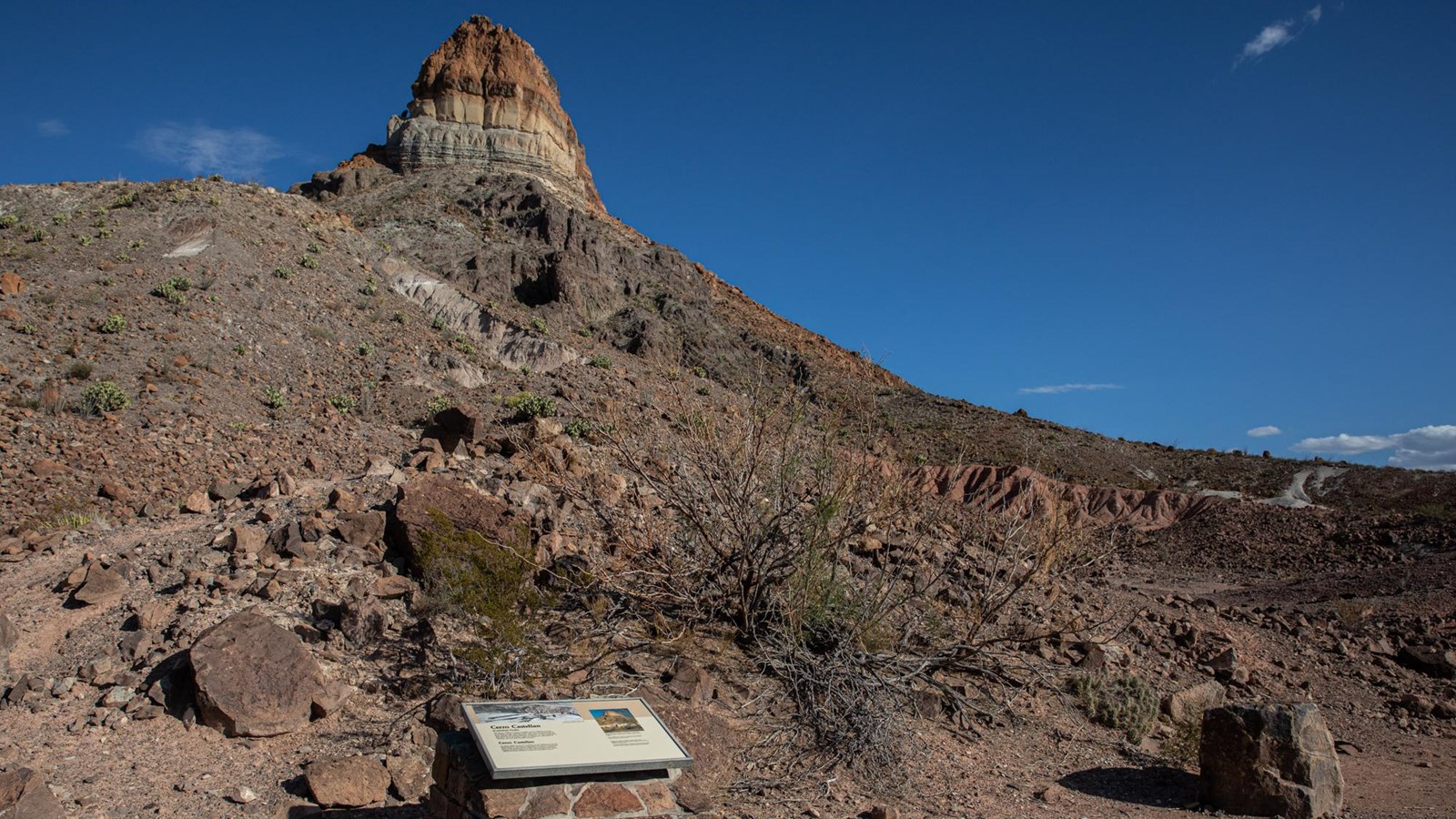
Cerro Castellan Exhibit
NPS/CA Hoyt
Quick Facts
Location:
20.4 miles from the northern end of Ross Maxwell Scenic Drive.
Significance:
Geology
Amenities
5 listed
Historical/Interpretive Information/Exhibits, Parking - Auto, Parking - Bus/RV, Scenic View/Photo Spot, Wheelchair Accessible
The layers of Cerro Castellan are striking evidence of millions of years of volcanic activity in Big Bend National Park. This exhibit explains how the peak was formed and how to recognize other volcanic formations within the park.
The text reads, "Cerro Castellan (Castolon Peak). The layers visible in Cerro Castellan reveal millions of years of volcanic events. Stacked in this tower are several lava flows and volcanic tuffs (ash deposits), with layers of gravel and clay from periods of erosion between eruptions. As you continue on the drive, look for further signs of volcanism--pale beds of volcanic ash and dark basaltic boulders."
To the right of the black and white images is a color image of Cerro Castellan with the different volcanic layers marked. Below the image is text: "Many of Big Bend's dramatic landmarks have molten origins. Though the Mule Ears Peaks, Cerro Castellan, and Chisos Mountains appear isolated from one another, they are closely related.
Cerro Castellan's cap rock is the same lava that formed the Chisos' South Rim. Ash layers older than Cerro Castellan's can also be found at Tuff Canyon."