



Last updated: June 8, 2026
Place
Cave Creek Nevada
Photo/L. Kreutzer
Quick Facts
Location:
The trailhead for the path to Cave Creek is on the west side of Ruby Valley Rd in Ruby Lake National Wildlife Refuge, about 130 yards south of headquarters entrance. GPS Trailhead 40.200770 -115.492638 GPS t-rail marker 40.201088 -115.492613.
Significance:
Cave Creek, on the Hastings Cutoff of the California Trail in Elko County, Nevada, flows from a cave at the foot of the Ruby Mountains. James Reed, of the Donner-Reed Party, made note of it in his journal entry of Sept. 19, 1846.
Designation:
Historic Site on the California NHT.
MANAGED BY:
Amenities
4 listed
Historical/Interpretive Information/Exhibits, Parking - Auto, Scenic View/Photo Spot, Trailhead
Cave Creek is a 4-foot-wide, gushing stream that bursts from a rocky hollow at the base of Pearl Peak on the east side of Nevada’s Ruby Mountains. The Donner-Reed Party, lagging weeks behind other westbound wagons on the newly opened Hastings Cutoff, camped near Cave Creek on Sept. 19, 1846. James Frazier Reed, perhaps muddled by stress and exhaustion, jotted a garbled entry in his journal that evening: “Encamped at a large Spring breaking out of from the and part of large Rock Stream la[r]ge enough to turn one pr [pair] Stone.”
He was probably referring to a pair of millstones, a common 19th century way of describing the power of a stream’s flow.
Curiously, no known 1850 emigrant journals mention Cave Spring by name or description. Travelers that year may have simply relied on the dozens of springs that bubbled from the floor of Ruby Valley. After 1850, emigrants abandoned the difficult Hastings route altogether.
A small settlement developed along Cave Creek in the 1860s to serve soldiers stationed at nearby Fort Ruby. The federal government purchased the land and established the area as a national wildlife refuge in 1937. Both Cave Creek and Fort Ruby lie within the refuge.
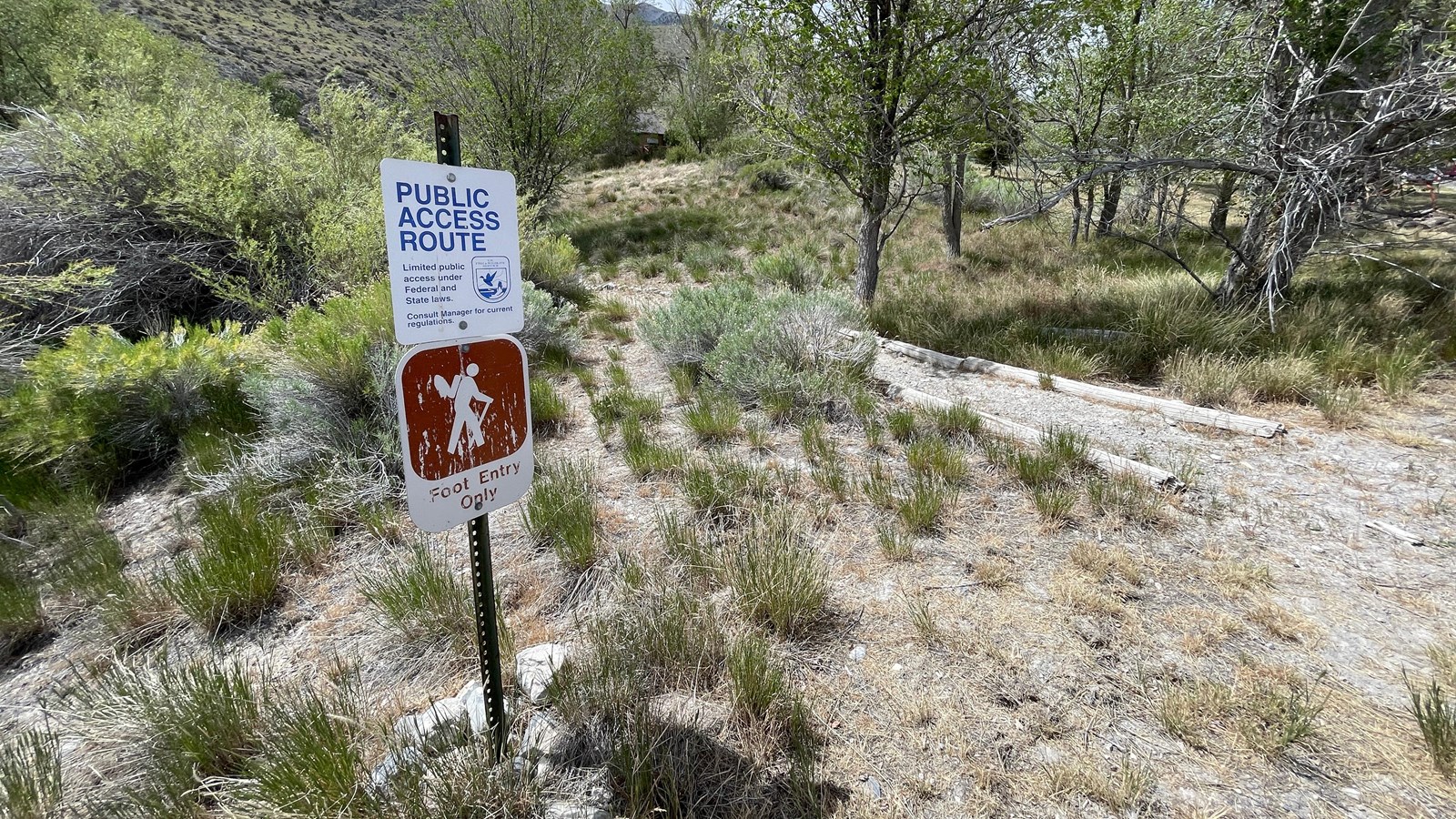
To visit Cave Springs, drive south from Wells, Nevada, on US-93 for about 28 miles, then turn right (southwest) on NV-229. After 15 miles, the road curves left (south) and merges with NV-767/Ruby Valley Rd. Continue about 33 miles to Ruby Lake National Wildlife Refuge. Park at the headquarters lot and walk along the road for 130 yards. The trailhead, on the right, is marked with “Public Access Route” and “Foot Entry Only” signs.
The trail climbs about ¼ mile to Cave Spring, gaining less than 75 feet in elevation. A metal gate blocks entry to the cave, but visitors can view the creek from the trail.
Site Information
Location (The trailhead for the path to Cave Creek is on the west side of Ruby Valley Rd in Ruby Lake National Wildlife Refuge, about 130 yards south of headquarters entrance. GPS Trailhead 40.200770 -115.492638 GPS t-rail marker 40.201088 -115.492613.)