


Last updated: October 15, 2026
Place
Carlin Canyon
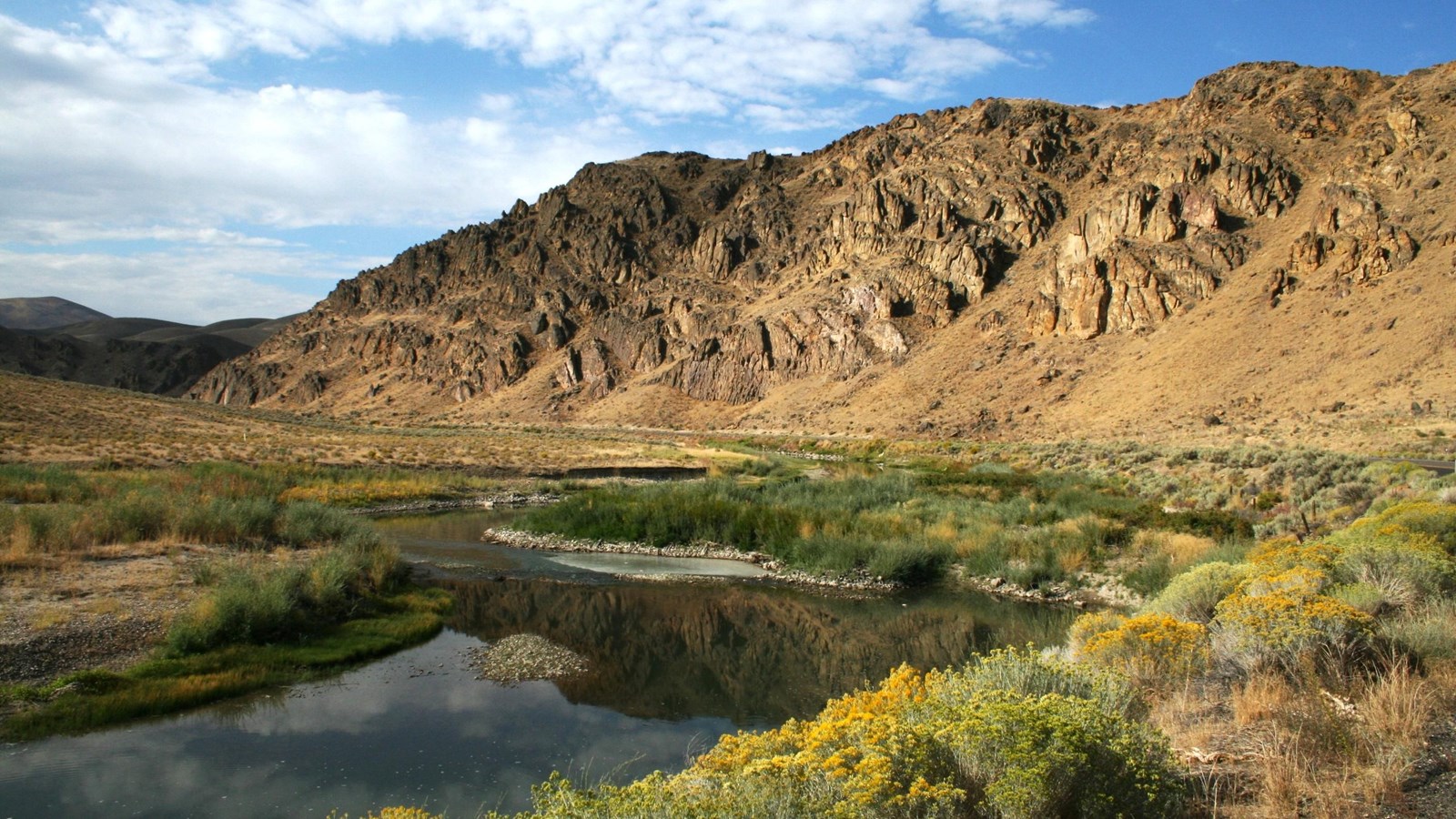
NPS Photo
Quick Facts
Location:
14 miles southwest of Elko and 4 miles east of Carlin, Nevada. GPS 40.727672 -116.019451. To visit, take I-80 Exit 282 toward East Carlin. Turn left (south) onto I-80 Business Loop/NV-221/Greenhorn Cutoff/Susie Creek. Way. Turn left (east) onto Chestnut St/Old US-40, and in 3.5 miles, follow the road as it curves under I-80 and enters Carlin Canyon. Return the same way.
Significance:
This 3-mile loop along the Humboldt River through Carlin Canyon was the route of the 1841 Bidwell-Bartleson Party and later, the main California Trail. This was also the route of the transcontinental railroad, built through here in 1868.
Designation:
Historic site on the California National Historic Trail.
MANAGED BY:
Amenities
5 listed
Benches/Seating, Historical/Interpretive Information/Exhibits, Parking - Auto, Parking - Bus/RV, Scenic View/Photo Spot
The Humboldt River winds through a broad oxbow loop in scenic, steep-walled Carlin Canyon, about 14 miles southwest of Elko, Nevada.
Home to the Western Shoshone people, this area later became part of the main California Trail, traveled by tens of thousands of overland emigrants between 1841 and 1869. In 1868, Chinese laborers constructing the transcontinental railroad laid track along the canyon’s oxbow, and the corridor later served as a route for some of the region’s earliest automobile highways.
Today, visitors can see traces of these historic journeys, including wagon ruts preserved beside the river, explore the canyon’s fascinating geology, and enjoy hiking, camping, fishing and birdwatching on surrounding public lands. Two interpretive kiosks and a Nevada state historical marker along the road provide additional information about the area’s natural and cultural history.
To visit, take I-80 Exit 282, several miles west of the canyon. Turn left (south) onto I-80 Business Loop/NV-221 (Greenhorn Cutoff/Susie Creek Way). Then turn left (east) onto Chestnut St/Old US-40. After 3.5 miles, follow the road as it curves under I-80 and enters Carlin Canyon.
Site Information
Location (14 miles southwest of Elko and 4 miles east of Carlin, Nevada. GPS 40.727672 -116.019451. To visit, take I-80 Exit 282 toward East Carlin. Turn left (south) onto I-80 Business Loop/NV-221/Greenhorn Cutoff/Susie Creek. Way. Turn left (east) onto Chestnut St/Old US-40, and in 3.5 miles, follow the road as it curves under I-80 and enters Carlin Canyon. Return the same way.)