Last updated: September 29, 2023
Place
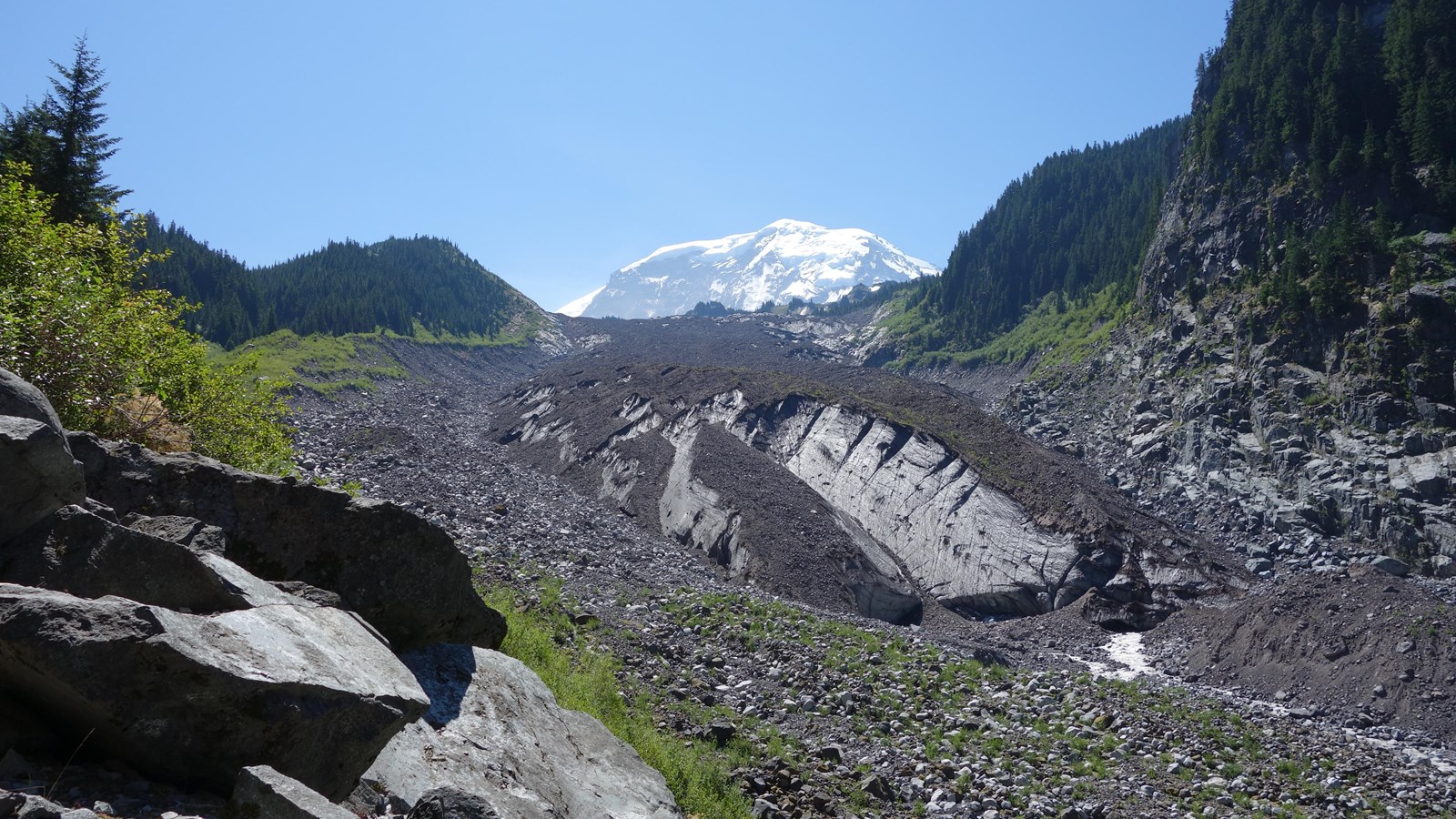
Carbon Glacier

NPS Photo
Carbon Glacier has the lowest terminus of any glacier in the contiguous United States at 3,617 feet. By area, it is the third largest glacier on Mount Rainier. Furthermore, it has the largest volume of any glacier on the mountain, a product of its unusual thickness. While most glaciers on the mountain have advanced and then retreated a mile or more, Carbon Glacier exposed only a half mile of deglaciated terrain between 1760 and 1966. This behavior and its thickness are the result of two factors. First, the glacier is well shaded because it is located on the north side of the mountain and surrounded by steep valley walls. Second, the lower end of the glacier is well insulated by rock covering. Both factors reduce melt rates.
During one episode in the last major ice age, Carbon Glacier probably flowed into the Puget Sound and merged with the Puget lobe of the Cordilleran Ice Sheet.
Viewing Carbon Glacier: You can see the glacier from several vantage points along the Carbon River trail. From the park entrance at Carbon River, hike or bike along the Carbon River Road (former road closed to vehicles) to Ipsut Creek Campground. Bicycles are not allowed past the campground. From the campground, walk approximately 3.5 miles (5.5 km) to see the glacier terminus. Continue up the trail an additional 3 miles (5 km) to Moraine Park for an impressive view of the upper glacier.
Carbon Glacier Statistics as of 2021 (Beason et al., 2023):
- Aerial Extent: 2.752 ± 0.146 square miles (7.127 ± 0.378 km2) (Rank: 3 of 29 glaciers on Mount Rainier)
- Highest Elevation (Head): 12,212 feet (3,722 m)
- Lowest Elevation (Terminus): 3,617 feet (1,102 m)
- Elevation Range: 8,594 feet (2,620 m)
- Length: 5.02 miles (8.08 km)
- Average Slope: 20.22°
- Average Flow Direction (direction the glacier flows towards): North (353°)
- Glacier Type: C - Cirque Glacier, or Glacier Head Starts Below Summit
