Last updated: December 30, 2021
Place
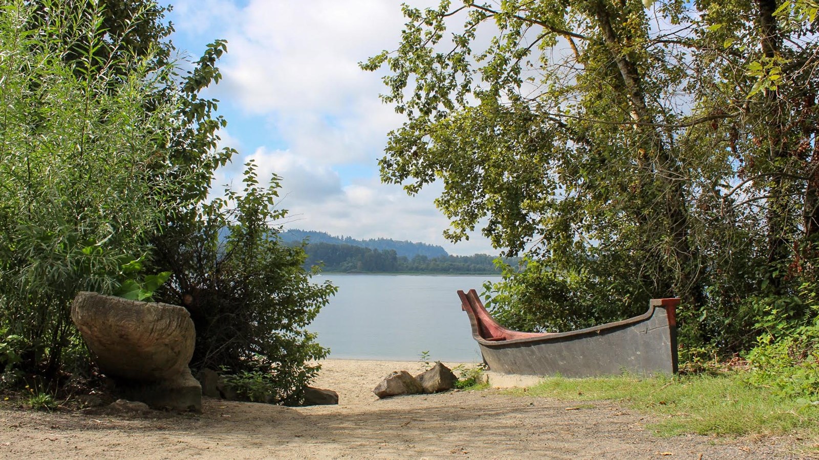
Captain William Clark Regional Park at Cottonwood Beach
Courtesy of Clark County Public Works, Washington
Quick Facts
Location:
Washougal, WA
MANAGED BY:
Amenities
16 listed
Beach/Water Access, Benches/Seating, Cellular Signal, Electrical Outlet/Cell Phone Charging, Grill, Historical/Interpretive Information/Exhibits, Parking - Auto, Parking - Bus/RV, Picnic Shelter/Pavilion, Picnic Table, Restroom, Restroom - Accessible, Trailhead, Trash/Litter Receptacles, Water - Drinking/Potable, Wheelchair Accessible
Lewis and Clark NHT Visitor Centers and Museums
This map shows a range of features associated with the Lewis and Clark National Historic Trail, which commemorates the 1803-1806 Lewis and Clark Expedition. The trail spans a large portion of the North American continent, from the Ohio River in Pittsburgh, Pennsylvania, to the mouth of the Columbia River in Oregon and Washington. The trail is comprised of the historic route of the Lewis and Clark Expedition, an auto tour route, high potential historic sites (shown in black), visitor centers (shown in orange), and pivotal places (shown in green). These features can be selected on the map to reveal additional information. Also shown is a base map displaying state boundaries, cities, rivers, and highways. The map conveys how a significant area of the North American continent was traversed by the Lewis and Clark Expedition and indicates the many places where visitors can learn about their journey and experience the landscape through which they traveled.
On March 31, 1806, after learning from native tribes that food was scarce to the east, Meriwether Lewis and William Clark ordered the Corps of Discovery to remain at “Provision Camp,” a location that is today known as Cottonwood Beach in Washougal, Washington.
In his journal, Clark noted that they “...formed a Camp in a Small Prarie on the North Side of the Columbia where we intend to delay one or two days to make Some Selestial observations, to examine quick sand river, and kill Some meat to last us through the Western Mountains which Commences a fiew miles above us.” Clark used this time to explore the area around Seal River, now called Washougal River, where he observed more than 100 small canoes used by the native women to gather wapato. Also known as “duck potato” or “arrowroot,” wapato is a wetland tuber that was an important part of native diets.
The Corps stayed at Provision Camp for six days, the longest period of time the expedition spent at any location in Clark County. Finally, satisfied that they had enough dried meat to last them the trip through the Columbia River Gorge, the Corps loaded their canoes and set off once again up the Columbia River towards Nez Perce territory on Sunday, April 6.
In 2006, several agencies came together to celebrate the Lewis & Clark Bicentennial by opening the Captain William Clark Regional Park, thus preserving this historic campsite, located roughly three miles from the mouth of the Washougal River.
This day-use-only park is comprised of 93 acres of forested land located along the river. It’s open from 7am to dusk everyday, and features fishing, accessible multiuse trails, historic interpretive exhibits, and restrooms. Two reservable, 50-person capacity picnic shelters are available for $75 a day. These shelters also have barbecue grills, electricity, and drinkable water.
For more information on the park or about how to reserve a picnic shelter, call the Park Dept. at (564) 397-2285 or visit their website at Captain William Clark Regional Park at Cottonwood Beach.