Last updated: September 3, 2025
Place
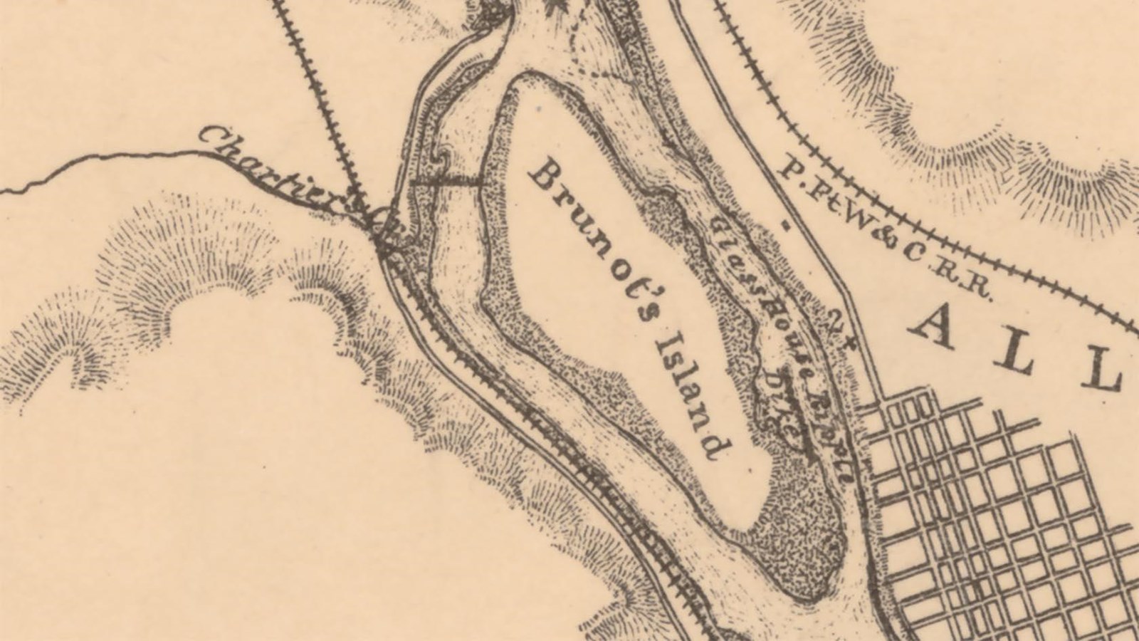
Brunot Island
U.S. Army Corps of Engineers, Library of Congress, Geography and Map Division
Quick Facts
Location:
Brunot Island
Significance:
Meriwether Lewis and his crew disembarked on Brunot Island on their westward journey in 1803.
Designation:
Lewis and Clark National Historic Trail
OPEN TO PUBLIC:
No
Lewis and Clark NHT Visitor Centers and Museums
This map shows a range of features associated with the Lewis and Clark National Historic Trail, which commemorates the 1803-1806 Lewis and Clark Expedition. The trail spans a large portion of the North American continent, from the Ohio River in Pittsburgh, Pennsylvania, to the mouth of the Columbia River in Oregon and Washington. The trail is comprised of the historic route of the Lewis and Clark Expedition, an auto tour route, high potential historic sites (shown in black), visitor centers (shown in orange), and pivotal places (shown in green). These features can be selected on the map to reveal additional information. Also shown is a base map displaying state boundaries, cities, rivers, and highways. The map conveys how a significant area of the North American continent was traversed by the Lewis and Clark Expedition and indicates the many places where visitors can learn about their journey and experience the landscape through which they traveled.
Three miles downriver from Pittsburgh was a large island, right in the middle of the Ohio River. It had been a stopping place for centuries.
In 1797, Dr. Felix Brunot, a Frenchman who had come to the continent to serve with the French Army during the American Revolutionary War, arrived in Pittsburgh and started a medical practice. In 1800, he purchased the 129-acre island three miles downriver and started a farm.20 Blaise Cenas (related to Brunot by marriage) lived there, along with several other settler families. Meriwether Lewis knew Cenas and some of these other men through the Pittsburgh Freemasons.
When Lewis and crew stopped at the island in 1803, they docked their keelboat and pirogue and came onshore—perhaps to say goodbye to their acquaintances, or maybe to pick up a few extra supplies. Whatever the reason, they stopped and chatted for a while.
One thing led to another, and they asked Lewis to show off his air gun—maybe he couldn’t help but mention it so soon after purchasing it. Lewis had bought this specialty gun mostly to impress and intimidate Indigenous people along the way—a muscle-flexing icebreaker, rather than as a tool for hunting.
However it came up, Lewis brought out the air gun and showed it around. Lewis shot it several times himself (“with pretty good success,” he later bragged in his journal). He then passed it to Cenas, who did not have as much success. Cenas shot a woman who was watching (perhaps a relative of his) in the head.
She ended up being fine, but it was maybe a little too eventful for a friendly visit. Lewis and crew packed up and headed downstream.
About this article: This article is part of a series called “Pivotal Places: Stories from the Lewis and Clark National Historic Trail.”
Brunot Island is a High Potential Historic Site (HPHS) of the Lewis and Clark National Historic Trail. Here is the text from the HPHS report:
Shortly after departing Pittsburgh on August 31, 1803, the expedition stopped on Brunot Island at the home of Dr. Felix Brunot. Lewis demonstrated his air gun to onlookers. He allowed Blaze Cenas, nephew of Dr. Brunot, to fire the weapon. But Cenas, “being unacquainted with the management of the gun”, misfired and struck a glancing blow to a woman in the distance. As Lewis wrote in his journal, “the ball passed through the hat of a woman about 40 yards distanc cuting her temple about
the fourth of the diameter of the ball; shee fell instantly and the blood gusing from her temple we were all in the greatest consternation supposed she was dead by [but] in a minute she revived to our enespressable satisfaction, and by examination we found the wound by no means mortal or even dangerous; called the hands aboard and proceeded to a ripple of McKee’s rock”.
Brunot Island remained rural farmland until 1894, when George Westinghouse purchased the island to construct an electric generating station. The island is still the site of a power plant and is not accessible to the public, but it may be viewed from Point of View Park in the Duquesne Heights neighborhood.