Last updated: March 1, 2023
Place
Blackbird Hill, Nebraska
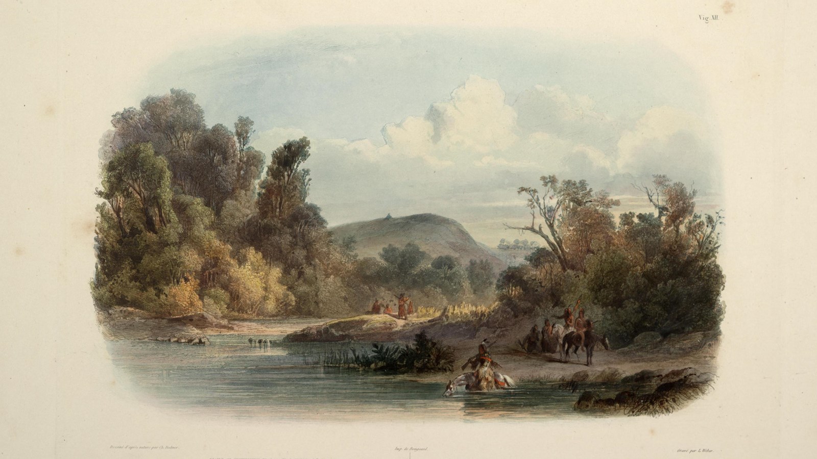
Karl Bodmer, Library of Congress, Rare Book and Special Collections Division.
Quick Facts
Location:
Blackbird Scenic Overlook
Significance:
Gravesite of an important Omaha leader, Wazhiⁿga’ sabe (Blackbird). Meriwether Lewis and William Clark left a custom-made flag at the site in an important diplomatic gesture between the United States and Omaha people.
Designation:
Lewis and Clark National Historic Trail, National Register of Historic Places
Amenities
4 listed
Historical/Interpretive Information/Exhibits, Parking - Auto, Pets Allowed, Scenic View/Photo Spot
Mid-morning on August 11, 1804, members of the Lewis and Clark Expedition rounded a curve in the Missouri River. Rising 300 feet above them, they saw a promontory known as Blackbird Hill. Meriwether Lewis and William Clark already knew about this landmark. At its top lay the grave of Wazhiⁿga’ sabe (Blackbird), a former Omaha leader.
Under Wazhiⁿga’ sabe’s leadership in the late 1700s, Omaha people became a strong force on the Great Plains. Wazhiⁿga’ sabe built alliances with other Indigenous nations to control access to the Upper Missouri River.
European traders recognized this power. In 1794, Frenchman Zenon Trudeau wrote of the need to maintain friendly relations with Wazhiⁿga’ sabe. He controlled the trade routes, and “without his consent,” they could not access Omaha or other Indigenous communities of the Upper Missouri.
The Spanish Governor of Louisiana gave Wazhiⁿga’ sabe a medal in 1796, to establish his vassalage—and trading obligations—with Spain, in the tradition that all European monarchs used these medals.
Wazhiⁿga’ sabe’s power and prestige could not save him from the ravages of disease, however. In 1800, a smallpox epidemic ravaged Omaha communities. It killed Wazhiⁿga’ sabe and nearly one-third of his community. His relatives buried Wazhiⁿga’ sabe on a hill overlooking the Missouri River, at a site where he could see for miles and watch for travelers on the river.
Lewis and Clark were aware of this history when they set out. They brought a specially made flag to leave at Wazhiⁿga’ sabe’s grave. On that day in 1804, Clark climbed to the top of the hill and “fixed a white flag bound with Blue white & read [sic] on the Grave.” They hoped that paying their respects at the gravesite would serve as an important diplomatic gesture to Omaha people.
About this article: This article is part of series called “Pivotal Places: Stories from the Lewis and Clark National Historic Trail.”
Lewis and Clark NHT Visitor Centers and Museums
This map shows a range of features associated with the Lewis and Clark National Historic Trail, which commemorates the 1803-1806 Lewis and Clark Expedition. The trail spans a large portion of the North American continent, from the Ohio River in Pittsburgh, Pennsylvania, to the mouth of the Columbia River in Oregon and Washington. The trail is comprised of the historic route of the Lewis and Clark Expedition, an auto tour route, high potential historic sites (shown in black), visitor centers (shown in orange), and pivotal places (shown in green). These features can be selected on the map to reveal additional information. Also shown is a base map displaying state boundaries, cities, rivers, and highways. The map conveys how a significant area of the North American continent was traversed by the Lewis and Clark Expedition and indicates the many places where visitors can learn about their journey and experience the landscape through which they traveled.