Last updated: March 7, 2026
Place
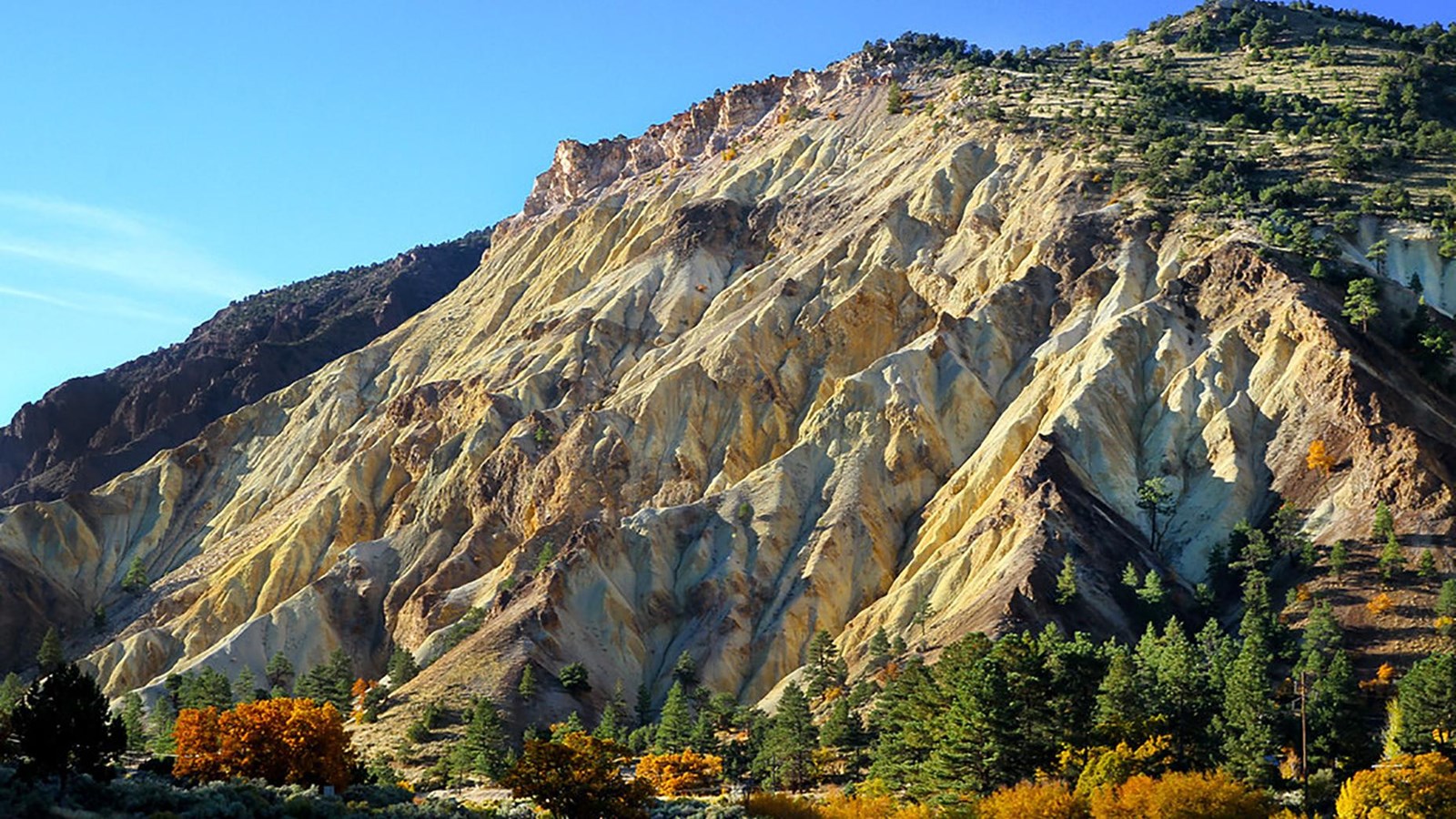
Big Rock Candy Mountain Bike Trailhead
Photo/Arbyreed/https://bit.ly/37xBrUu
Quick Facts
Location:
2727-2747 Sevier Hwy, Sevier, UT 84766
Significance:
The trail has an optional loop component that goes through Long Valley right on the Old Spanish Trail, allowing for a vicarious experience.
MANAGED BY:
Amenities
2 listed
Historical/Interpretive Information/Exhibits, Trailhead
The Big Rock Candy Mountain Loop Trail goes south through Marysvale Canyon and back through Long Valley. The portion through Marysvale Canyon is paved until you reach the Whistle Point Trailhead near the big Rock Candy Mountain Resort, where many amenities are available. From there the rest of the trail is unpaved trail and dirt roads until you return to the paved portion further north at the highway 89. ATVs are prohibited on the paved section but are allowed on the historical unpaved portion.
Back in the early to mid-1800s, traders along the Old Spanish Trail reached a difficult decision when they approached this section of trail. They had to decide to take Long Valley or Marysvale Canyon, both having advantages and disadvantages. The canyon followed the river, which was a crucial resource for travelers and their mules but was extremely difficult to pass due to the thick vegetation and rushing water leaving little space for travel. Long Valley was open and easier to traverse but was longer and lacked water. Ultimately the pack mule caravans chose Long Valley because they could rejoin the river after only a day.
The mountain itself was named after the song by Harry McClintlock in 1928. Known for its interesting caramel yellow color and beauty, this cluster of hills was named after a group of early Utah residents, who after hearing the song, placed a sign at the base where the Big Rock Candy Mountain Resort sits today. The same group named a nearby spring “Lemonade Spring,” which name has also stuck and is now a local popular spot.
Site Information
Location (2727-2747 Sevier Hwy, Sevier, UT 84766)
The trailhead is in Sevier, Utah, right next to highway 89. This section of the Old Spanish Trail follows the Northern route as pack mule traders traded good between Santa Fe, New Mexico, and Los Angeles, California. The trailhead has ample parking and restrooms, along with a trail sign and other interpretation providing information about the old railroad that used to run through the canyon.
The paved path heads south through Marysvale Canyon and is five miles long. It is mostly downhill and is rated as easy. It follows right beside the river and provides a cool breeze and shade from the canyon walls depending on the time of day. Grasses, shrubs, and trees surround you for most of this portion of the trail. As you head down the path you can see an old tunnel that was used for the railroad but has now since been abandoned.
The unpaved portion begins at the Whistle Point Trailhead near the Big Rock Candy Mountain Resort. This path is 19 miles long, rated as moderate to strenuous, and offers a harder challenge than the paved portion. The valley provides a more open space allowing for a wider viewshed of the area, especially at the valley overlook point indicated on the map. Vegetation is sparser here due to lack of abundant water, but shrubs and cottonwood trees are still prevalent.
Safety Considerations
More Site Information
Exhibit with Audio Description available
Old Spanish National Historic Trail
-
Sevier County - Big Rock Candy Mountain Bike Trailhead Exhibit Audio Description
Listen to the audio description of the Sevier County - Big Rock Candy Mountain Bike Trailhead exhibit.
- Date created:
- 09/09/2021