Last updated: November 27, 2020
Place
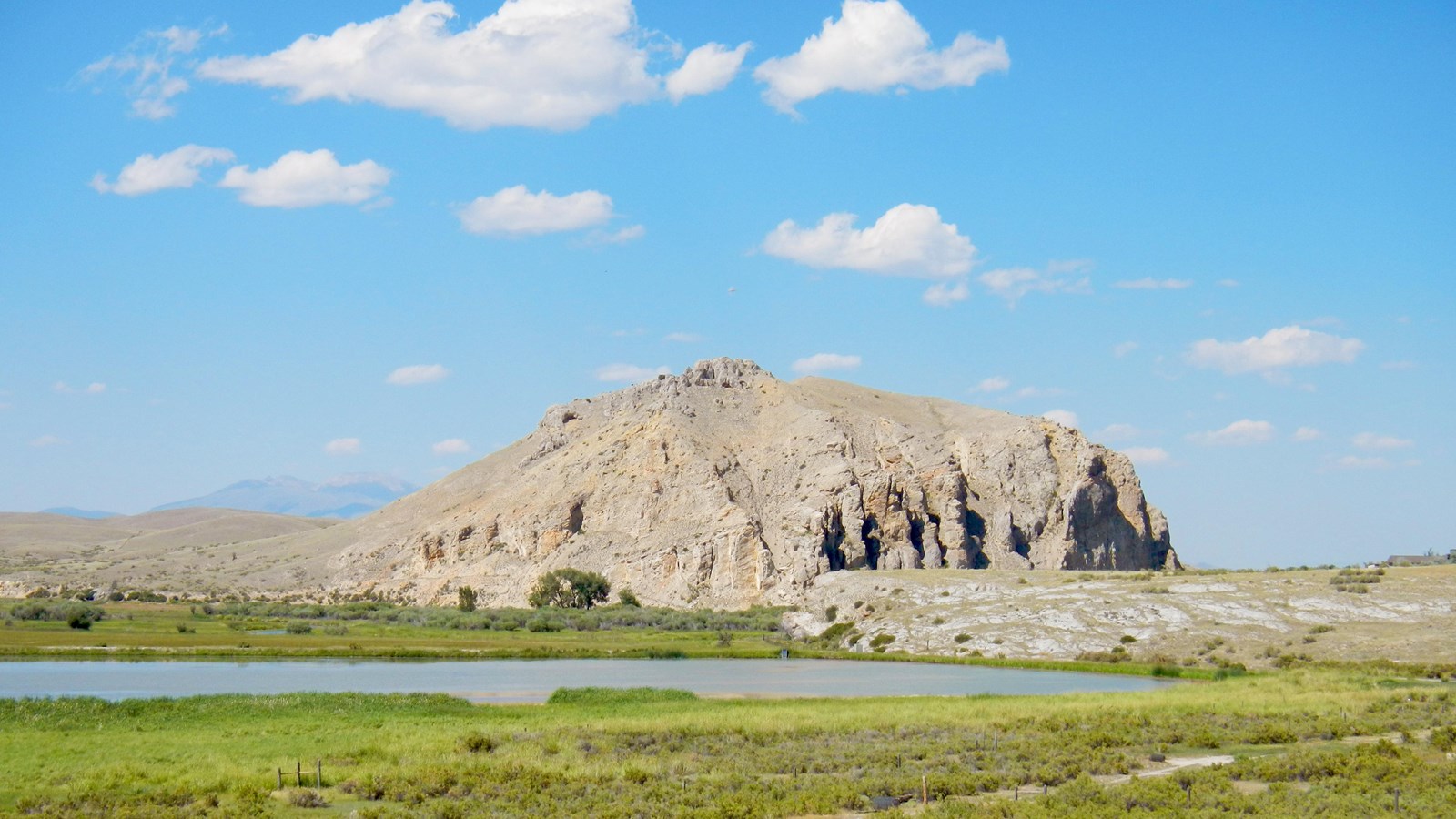
Beaverhead Rock
Quick Facts
Location:
Twin Bridges, MT
Significance:
This recognizable rock formation was a sign to Sacagawea that she was near the home of her relatives.
Designation:
Montana State Park
MANAGED BY:
Lewis and Clark NHT Visitor Centers and Museums
This map shows a range of features associated with the Lewis and Clark National Historic Trail, which commemorates the 1803-1806 Lewis and Clark Expedition. The trail spans a large portion of the North American continent, from the Ohio River in Pittsburgh, Pennsylvania, to the mouth of the Columbia River in Oregon and Washington. The trail is comprised of the historic route of the Lewis and Clark Expedition, an auto tour route, high potential historic sites (shown in black), visitor centers (shown in orange), and pivotal places (shown in green). These features can be selected on the map to reveal additional information. Also shown is a base map displaying state boundaries, cities, rivers, and highways. The map conveys how a significant area of the North American continent was traversed by the Lewis and Clark Expedition and indicates the many places where visitors can learn about their journey and experience the landscape through which they traveled.
Beaverhead Rock is a High Potential Historic Site on the Lewis and Clark National Historic Trail.
On August 8, 1805, Lewis wrote that Sacagawea “recognized the point of a high plain to our right which she informed us was not very distant from the summer retreat of her nation on a river beyond the mountains which runs to the west. this hill she says her nation calls the beaver’s head from a conceived remblance of it’s figure to the head of that animal. she assures us that we shall either find her people on this river or on the river immediately west of it’s source; which from it’s present size cannot be very distant. as it is now all important with us to meet with those people as soon as possible, I determined to proceed tomorrow with a small party to the source of the principal stream of this river and pass the mountains to the Columbia; and down that river untill I found the Indians; in short it is my resolusion to find them or some others, who have horses if it should cause me a trip of one month. for without horses we shall be obliged to leave a great part of our stores, of which, it appears to me that we have a stock already sufficiently small for the length of the voyage before us.”
Beaverhead Rock is within Beaverhead Rock State Park, located 14 miles south of Twin Bridges on Montana Highway 41. Although the rock is not publicly accessible, it is viewable from a parking area that includes interpretive wayside exhibits.