Last updated: September 20, 2025
Place
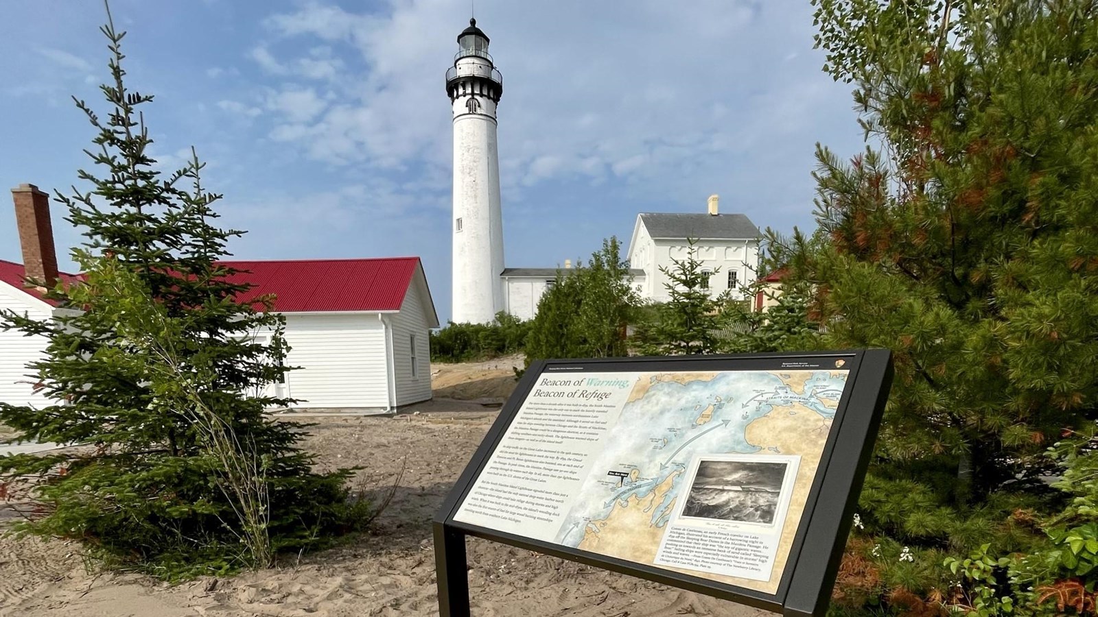
Beacon of Warning, Beacon of Refuge - SMI Wayside

NPS M. Baughman
“Beacon of Warning, Beacon of Refuge” is a slanted outdoor panel that is thirty-six inches wide by twenty-four inches high and attached to a frame with brown metal legs. On the left side, black letters on a beige background:
“Beacon of Warning, Beacon of Refuge”
For more than a decade after it was built in 1839, the South Manitou Island Lighthouse was the only one to mark the heavily traveled Manitou Passage, the waterway between northeastern Lake Michigan’s islands and the mainland. Although it saved on fuel and time for ships traveling between Chicago and the Straits of Mackinac, the Manitou Passage could be a dangerous shortcut, as it contains shifting sandbars and rocky shoals. The lighthouse warned ships of these dangers-as well as the island itself!
As ship traffic on the Great Lakes increased in the nineteenth century, so did the need for lighthouses to mark the way. By 1859, the Grand Traverse and Point Betsie lighthouses also beamed, one at each end of the Passage. In peak times, the Manitou Passage saw fifty to one hundred ships passing through its waters each day. In all, more than two hundred and fifty lighthouses were built on the U.S. shores of the Great Lakes.
But the South Manitou Island Lighthouse signaled more than just a shortcut-the island had the only natural deep-water harbor north of Chicago where ships could take refuge during storms and high winds. When it was built in the mid-1830’s, the island’s wooding dock was also the first source of fuel for large wood burning steamships traveling north from southern Lake Michigan.
On the right an outline of the blue waters of Lake Michigan with a tan land mass surrounding it. In the south, blue arrows point to the Point Betsie Light. Going north, an arrow labeled Manitou Passage is located between the mainland and South Manitou and North Manitou Islands. Continuing past the Manitou Passage the Grand Traverse Light is located on a peninsula. Moving further north, the lake widens and the islands are further away from the mainland. The next blue arrow moves past South Fox Island with a lighthouse, North Fox Island, and Beaver Island with a lighthouse in the south and north ends of the island. The next arrow moves past a scattering of lighthouses in the lake and on land as the Straits of Mackinac are approached and the corner is rounded to Mackinac Island and Bois Blanc Island at the top of the map. Arrows move around those islands and point back to the Straits of Mackinac.
At the bottom right corner enclosed in a beige box covering the map is a black and white illustration of many high waves. The white sand cliffs of Sleeping Bear Dunes are in the background and above them a dark cloudy sky. Below:
Comte de Castlenau, an early French traveler on Lake Michigan, illustrated his account of a harrowing night in 1839 off the Sleeping Bear Dunes in the Manitou Passage. He commented that their ship was “the toy of gigantic waves…pushing us towards an immense bank of sand called “Sleeping Bear.” Sailing ships were especially vulnerable in storms’ high winds and waves.-from Comte De Castlenau’s “Vues et Suvenirs de L’Amerique du Nord.” 1842. Photo courtesy of the Newberry Library, Chicago.
You may now go to the left to the panel, “Saving Lives and Cargo” or explore the panels and map inside the Fog Signal Building or move towards the Light Tower up a slight incline.
