Last updated: July 24, 2025
Place
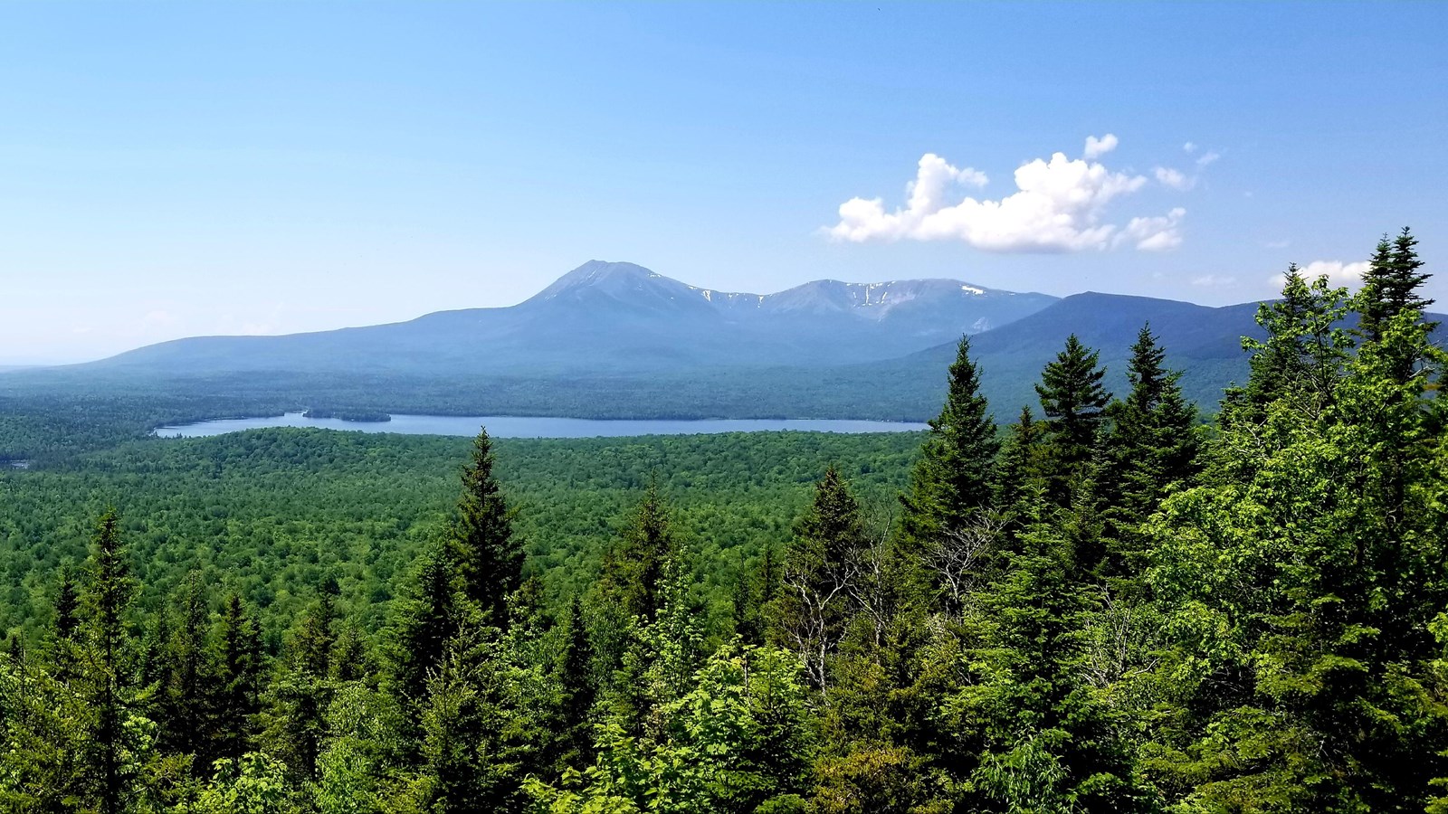
Barnard Mountain
NPS / Jason Gablaski
Quick Facts
Location:
45.93103,-68.75463
Amenities
2 listed
Picnic Table, Scenic View/Photo Spot
A 2 mile out and back trail leads to the top of 1,558ft (474 m) Barnard Mountain. Barnard Mountain offers an exceptional view of Katahdin, Katahdin Lake, and the valley below. The hike begins on an old logging road (also known as a tote road) and passes through deciduous forest at the lower elevations. As you gain elevation, you will pass through stunning boreal forest and glacial erratics.
Biking is not permitted on the trail up to Barnard Mountain.
Biking is not permitted on the trail up to Barnard Mountain.
Elevation Gain: 792ft / 241m
Distance (Round-Trip): 4 miles
Difficulty: Easy to Moderate
Restrooms: There is a vault toilet available at the trailhead.
Parking: The most direct access point to Barnard Mountain is at the trailhead located near mile 12 of the Katahdin Loop Road (45.91561,-68.76049).
Trail Etiquette: Leashed pets are allowed on this trail. Carry out all trash and food waste (fruit peels, shells, etc.). Do not feed the wildlife.