Last updated: June 3, 2024
Place
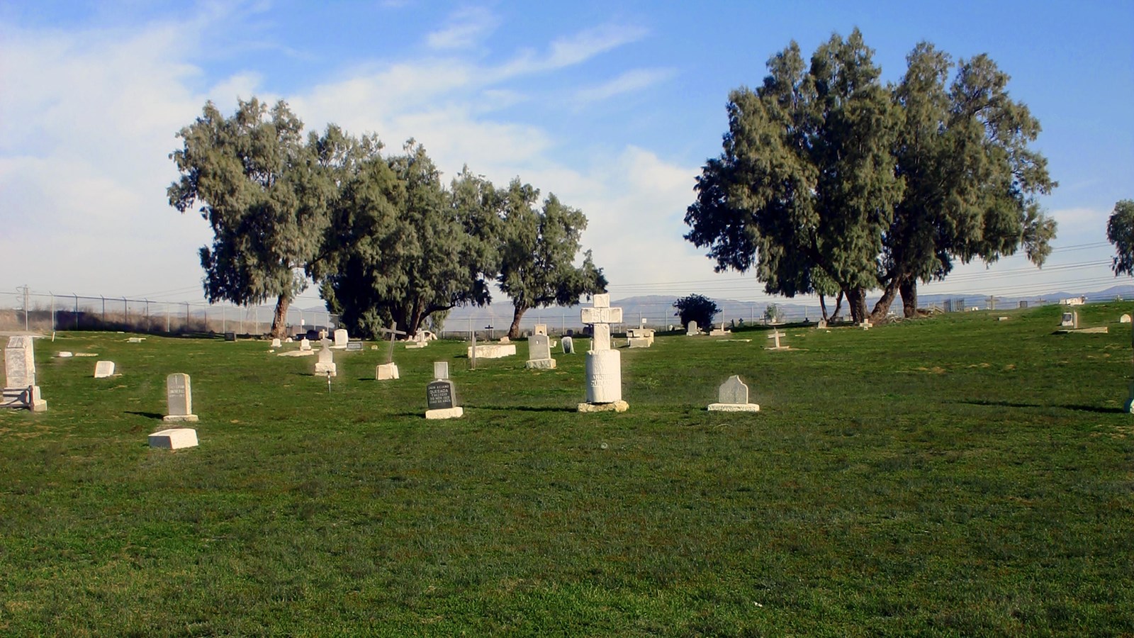
Agua Mansa Pioneer Cemetery

Photo/San Bernardino County Museum
Antonio Maria Lugo and Juan Bandini established the San Bernardino and Jurupa ranchos on former Mission San Gabriel property in the 1830s. By offering land, they convinced a group from Abiquiu, New Mexico, to travel along the Old Spanish Trail and settle on the upper Santa Ana River and serve as a buffer against raiders and outlaws along the trading route from Santa Fe to Los Angeles. The emigrants first colonized Politana on the Rancho San Bernardino in 1842. Ten of these families, led by Lorenzo Trujillo, moved from Politana to 2,000 acres on the “Bandini Donation” on the east side of the river, on the northern boundary of the Jurupa Rancho. This village was known as “La Placita de los Trujillos”, later called La Placita. A second group moved to the west side of the river at Agua Mansa, and by 1845 the twin communities were firmly established. Farmsteads were laid out, an extensive irrigation system was dug, and grapes, grain, vegetables, and fruit trees were planted. Horses, sheep, and cattle were pastured on the mesa to the southeast, at present-day Riverside.
Agua Mansa flourished until January 1862, when a great flood filled the Santa Ana River from bluff to bluff and destroyed the west bank community, leaving only the cemetery, the chapel, and Cornelius Jensen’s adjoining store, built in 1854. Most of the homes in La Placita were also damaged or destroyed. Although rebuilt, the farming community never regained its importance. The coming of the railroad, the rise of the cement industry, and the expansion of the citrus industry drew people away from these two farming communities. La Placita was a recognized community of Riverside until 1926. The Trujillo cantina closed in World War II, and the last burial in the cemetery occurred in 1963.
La Placita’s first church was a brush-covered enramada (bower or arbor). A permanent adobe church was built near the river bank in 1852; it collapsed in quicksand the day after the last row of adobe bricks was placed. Work on a third church, this time on the Agua Mansa side of the river, started immediately. The 11′ by 58′ chapel was completed in 1853 and dedicated in 1857 as “San Salvador”. The chapel withstood the 1862 flood, although the water rose to its steps. In fact, the ringing church bell alerted the Agua Mansans to the impending flood, and all escaped without loss of life. In 1867, however, the parish was moved to San Bernardino, and by 1883 the chapel stood abandoned and crumbling.
Site Information
Location (2001 Agua Mansa Rd, Colton, CA 92324)
The cemetery sits on a hill in an area now zoned for industry. The site is green in the wet winter months and dusty and brown during hot summers. A replica chapel sits at the northwest corner of the site and a circular drive encompasses the burials. There are approximately 2,000 people buried at the site, but only a few hundred headstones remain.
Safety Considerations
