Last updated: October 10, 2024
Place
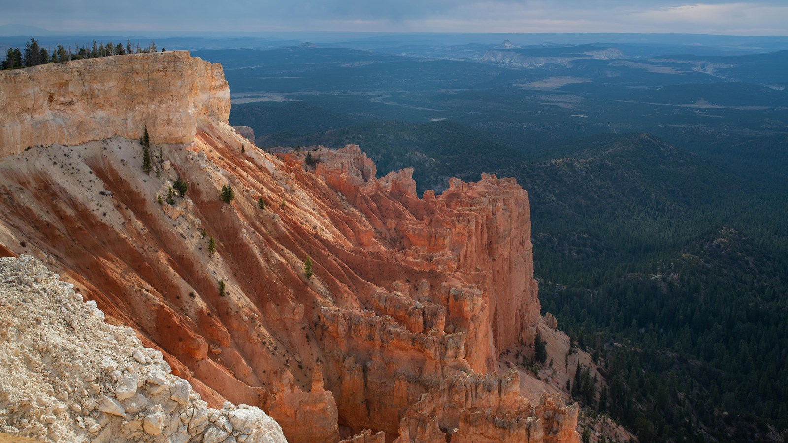
Yovimpa Point
NPS Photo / Peter Densmore
Quick Facts
Location:
Found at the southern end of the main park road
Significance:
Along with Rainbow Point it is the highest elevation viewpoint in the park.
Amenities
6 listed
Bicycle - Rack, Picnic Table, Recycling, Restroom, Trash/Litter Receptacles, Wheelchair Accessible
Along with Rainbow Point, Yovimpa Point is one of the highest viewpoints in the park. Tectonic uplift has lifted this entire scene from sea-level over the course of the last 20 million years to later be dissected by tributaries of the Colorado River. Tilting that occurred during uplift has situated the southern end of the park approximately 1,000 ft (304 m) higher than its northern end. Here you can gaze from the southern tip of the Paunsaugunt plateau and overlook the colorful cliffs of the Grand Staircase.
Trails
Access to both the Riggs Spring Loop and Bristlecone Loop can be found on the sidewalk leading from the parking lot to Yovimpa Point.
Landscape Features
To the South
One of the grandest, and longest views in the park, extending over 100 miles (161 km) across the tops of the colorful "steps", or cliffs, of the Grand Staircase. Below you and to either side are beautiful exposures of Bryce Canyon's Pink Cliffs, soft limey mudstones colored by iron-oxide (rust) being shaped into beautiful forms by rain and the power frost-wedging ice. Below them, obscured in part by forest, are the soft marine shales and silts of the Grey Cliffs. Beyond these are deep canyons carved into the sandstones of the White Cliffs, which are also beautifully exposed at Zion National Park further west. Note the feature known as "Molly's Nipple", which appears like a conical mountain among the White Cliffs. This is not a dormant volcano, but instead an area capped with a more erosion-resistant form of sandstone. The bottom two steps--the Vermillion Cliffs as well as the Chocolate Cliffs are dificult to discern from this distance. The horizon is the Kaibab Upwarp, which forms the northern rim of Grand Canyon. The five cliffs of the Grand Staircase that extend from this point to the Kaibab Upwarp contain one of the world's most complete sedimentary records of the last 300 million years of life and environment on the planet.
To the Southeast
Navajo Mountain looms on the distant horizon over 80 miles away near Page, Arizona. Called a laccolith, Navajo Mountain can be thought of as a volcano that never quite happened. As the Colorado Plateau was uplifted by tectonic forces, a plume of molten rock moved upward from deep inside the Earth causing a swelling much like a large blister. Unlike a volcano, Navajo Mountain never blew its top and so the plume cooled slowly, creating the hard core of the mountain that still exists today.