Last updated: April 14, 2023
Place
What Do Ice Ages Have to do With San Francisco Bay?

NPS
So, how did San Francisco Bay's dramatic landscape come to be? How and when did the bay and hills around you form? Geologically speaking, they are new features; the result of great tectonic plates colliding and grinding past one another, of sea level rising and falling as ice ages come and go, and of a rushing glacial-fed river cutting a new course to the ocean.
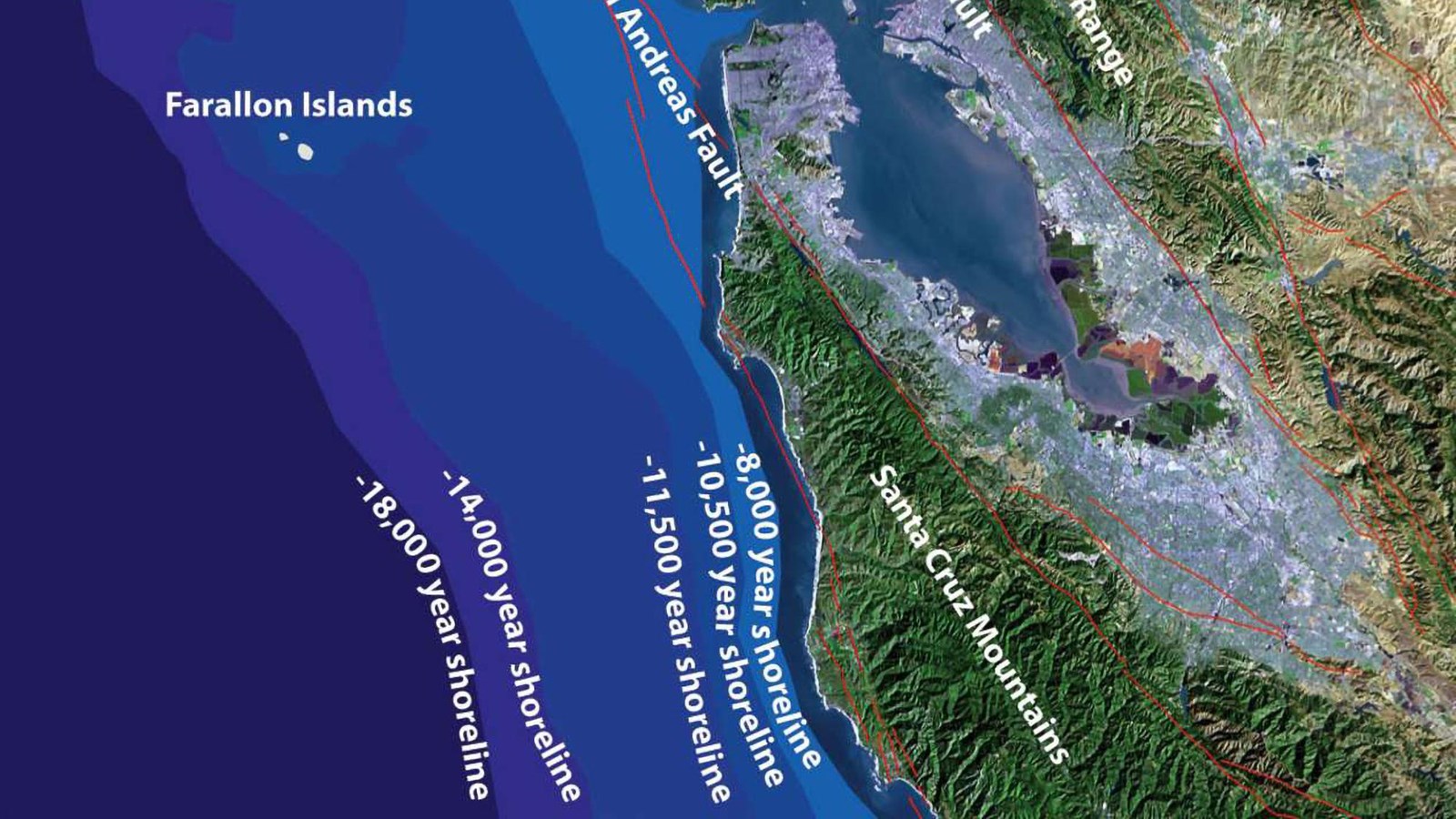
San Francisco Bay first filled only 650 thousand years ago, at a time when glaciers in the Sierra Mountains and the continent's interior melted and sea level rose. About that same time, a glacier-fed lake in central California, nearly the size of Lake Michigan overtopped a ridge and catastrophically flooded down to the bay and ocean, cutting the modern Sacramento River valley on its way. Since then, the bay has drained and filled six times, as glaciers have built up and retreated. Scientists predict the bay will rise between three and five feet in the next century due to global warming.
The rocks under your feet and other hills around the bay mostly formed on the sea floor over 100 million years ago, as the tectonic plate under the Pacific slid beneath North America-- a process called subduction. Then, about 12 million years ago, the San Andrea fault formed in this area. Now the Pacific Plate was sliding past the North American Plate instead of under it and the California coast of today started to emerge from the sea. But it wasn't until about 4 million years ago that today's coastal hills and mountains started to form when a shift in plate motion caused crumpling and folding along the San Andreas.
