Last updated: April 25, 2022
Place
Smith Road Trailhead

Restroom, Trailhead
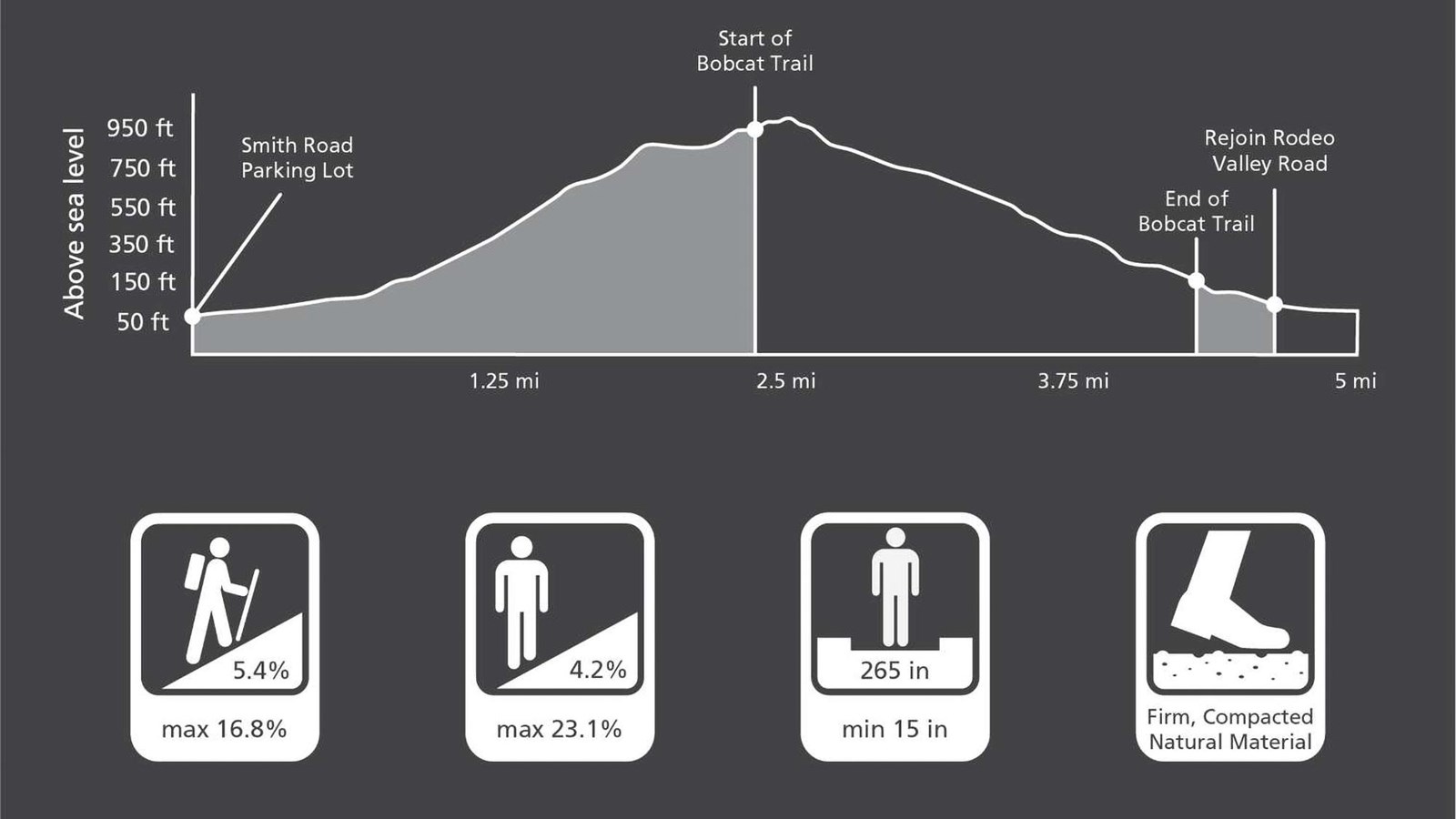
Smith Road Trailhead provides parking and access to a wide variety of trails including the Gerbode Valley Loop Trail. This multi-use trail climbs through coastal chaparral and grasslands to crest at 980 feet. Follow the Rodeo Valley Trail as it gradually winds uphill to turn north on the Alta Trail. Then return down the Bobcat Trail skirting the south side of Gerbode Valley to this parking lot. This 5 mile strenuous trek offers panoramic views of the Marin Headlands, the Pacific Ocean and the San Francisco Bay.
Gerbode Valley Loop Trail Overview
Distance: 5.0 mi (8.0 km)
Elevation Gain: 900 ft
Time: 3 hours
Trailhead: Smith Road
Slope: Avg 5.4% Max 16.8%
Side Slope: Avg 4.2% Max 23.1%
Width: Avg 265" Min 15"
Trail Surface: Firm
Safety
- Stay on the established trail. Keep an eye out for poison oak
- Dress in layers and be prepared for varying weather conditions. Sunny days along the coast can turn windy, foggy, and cold very fast.
- Horses have the right-of-way over hikers and bicycles. Equestrians should slow to a walk and stay on the trail while passing others.
Parking
There is trailhead parking at the Smith Road Trailhead including two ADA accessible spots.
Bathrooms
Restrooms can be found at the Field Rd parking lot.
Water
Drinking water is not available along the trail. Avoid becoming dehydrated or experiencing heat exhaustion. Drink plenty and drink often; pace yourself; rest in the shade; and eat salty snacks.
Dog and Trail Etiquette
Dogs are not permitted on the Gerbode Valley Loop Trail. Please remain on the established trail. Off-trail travel harms plants and causes erosion. Keep your food within arm's reach at all timesand do not feed the wildlife. Carry out all trash and food waste (fruit peels, shells, etc.).
