Last updated: January 20, 2026
Place
Point Bonita Lighthouse Trailhead
Quick Facts
Amenities
4 listed
Parking - Auto, Restroom, Scenic View/Photo Spot, Trailhead
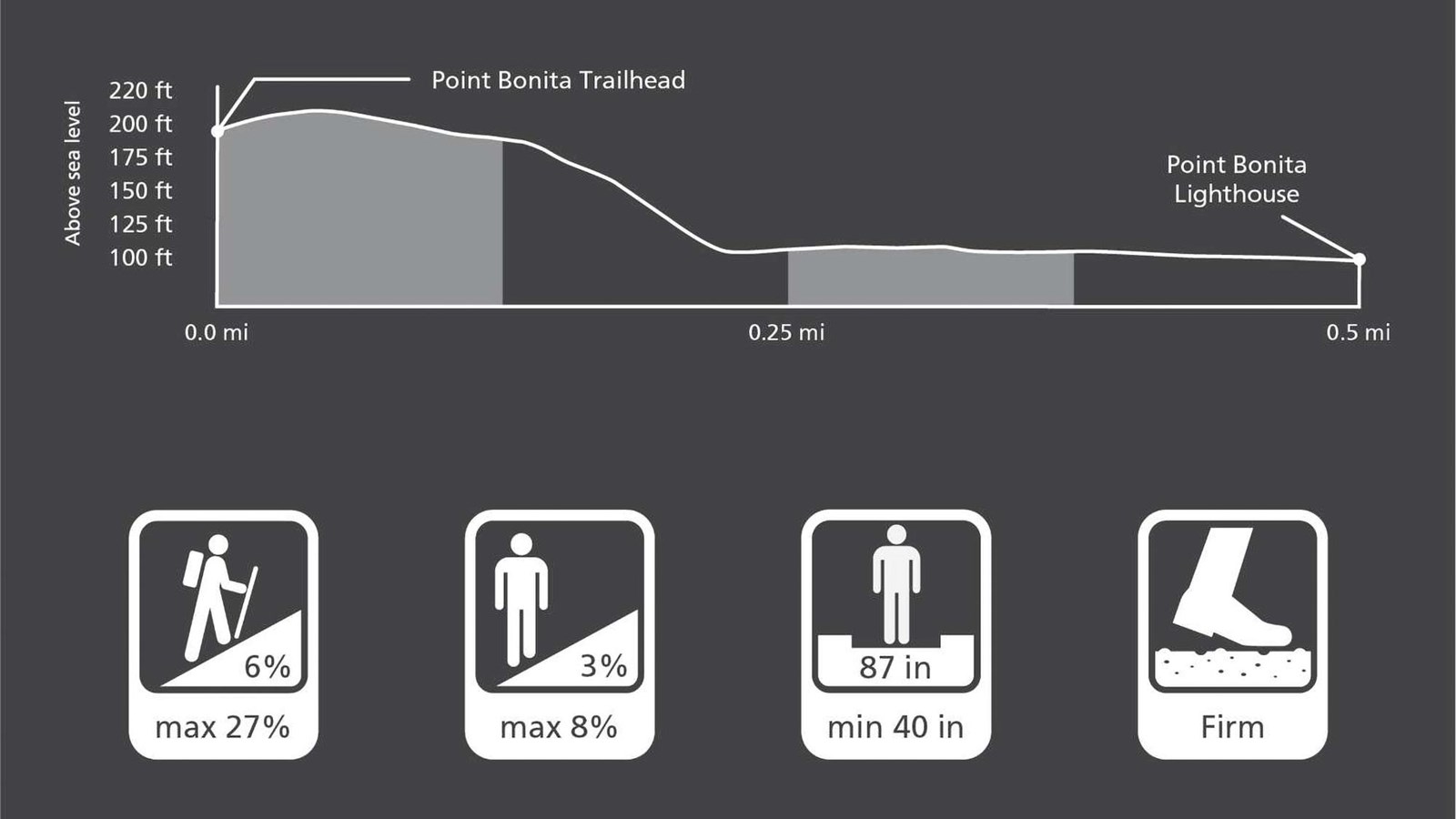
Point Bonita Trail Overview
Distance: 0.5 mi (0.8 km)
Elevation Gain: -75 ft
Time: 1 hour
Trailhead: Point Bonita
Slope: Avg 6% Max 27%
Side Slope: Avg 3% Max 8%
Width: Avg 87" Min 40"
Trail Surface: Firm
Trail Etiquette
No dogs, bikes, or smoking is allowed on the trail to the Point Bonita Lighthouse. Please stay on established paths. There are uneven surfaces, loose rock formations, and steep drop offs in the surrounding areas. Off-trail travel harms plants and causes erosion.