Last updated: October 10, 2024
Place
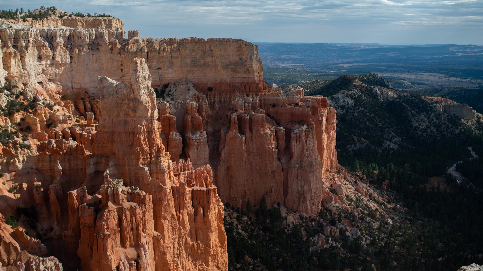
Paria View
NPS Photo / Peter Densmore
Quick Facts
Location:
Off the Bryce Point spur road
Amenities
1 listed
Wheelchair Accessible
The road to this viewpoint is closed to vehicles in winter months to provide for winter activities like cross-country skiing and snowshoeing.
A viewpoint for those who want to experience the quieter side of the park, Paria View overlooks a more than 500 ft (152 m) deep amphitheater formed by the headwaters of Yellow Creek, which drains east and south to the Paria River. Yellow Creek's erosion of the Grey Cliffs' softer marine layers directly below you currently undercuts the Pink Cliffs of Bryce Canyon, resulting in large slabs falling away at once. The sheer cliffs created by this undercutting characterize almost all viewpoints south of here. The southern end of the Paria Valley is easier seen here at at viewpoints further south than from the Bryce Amphitheater, and distant views of the dramatic White Cliffs and the dome of Navajo Mountain are wonderful at sunset.
Trails
A short paved path leads to a promontory viewpoint. No other trails depart from this area.
Landscape Features
To the Southeast
The headwaters of Yellow Creek have been at work for millions of years, slowly pushing back into the Paunsaugunt plateau and carving the deep amphitheater below you. Due to softer marine layers of rock below the iron-rich Claron formation's limestone cliffs, these rocks are being undercut and sheer away rather than slope in the ways seen within the Bryce Amphitheater to the north. Yellow Creek drains into the Paria River, and the Paria Valley and the upper steps of the Grand Staircase exposed within it present most of the view beyond this amphitheater. Observe the shale-rich badlands of the Grey Cliffs slowly transform to the sometimes iron-rich sandstones of the upper White Cliffs (Kodachrome State Park is located in this transition zone) which then transition into the less iron-rich white sandstones and deep canyons carved within the Navajo Formation further off. Navajo Mountain looms on the distant horizon over 80 miles (129 km) away near Page, Arizona. Called a laccolith, Navajo Mountain can be thought of as a volcano that never quite happened. As the Colorado Plateau was uplifted over the last 20 million years, a plume of molten rock moved upward from deep inside the Earth causing a swelling much like a large blister. Unlike a volcano, Navajo Mountain never blew its top and so the plume cooled slowly, creating the hard core of the mountain that still exists today.