Last updated: May 21, 2024
Place
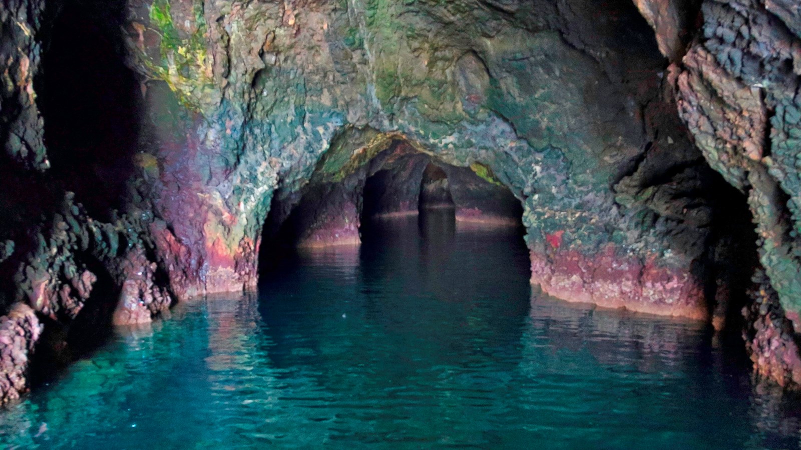
Painted Cave — hax̓inu mupʰ nuwaštipa
Tim Hauf, timhaufphotography.com
Quick Facts
Amenities
1 listed
Scenic View/Photo Spot
hax̓inu mupʰ nuwaštipa is the Chumash word for Painted Cave. It means 'big painted cave.'
Please see "Ethnographic Island Place Names" below for more information on island place names.
Painted Cave is located near the western end of the island on the north side, and is the largest sea cave in California. It is the world's 4th largest sea cave by length, after: #1 Matainaka Cave, on the Otago coast of New Zealand; Purple Cathedral Cave on South New Zealand; and #3 Sea Lions Cave in Oregon.
The cave is 1227 feet long, the length of more than four football fields. The entrance, located in 30 feet of water, reaches upward 160 feet above the water level to its ceiling, and is almost 100 feet wide. A large boat can be taken into its entrance with room to spare. The name "painted" is derived from naturally occurring colors created by various rock types, lichens and algae. Marine organisms, harbor seals, sea lions, and several species of birds inhabit this cave.
Ethnographic Island Place Names
Ethnographic island place names aid in native language revitalization, illustrate cultural values, and provide tangible connections to cultural landscapes and seascapes.
Many of these place names were recorded by ethnographers and anthropologists in the late 1800 and early 1900s. J.P. Harrington was an ethnographer who worked for the Smithsonian Institution in Washington, D.C., from 1915 to 1955. He interviewed American Indian consultants, including Chumash and Gabrielino Tribal members, and recorded information about native languages and culture.
Chumash Indians Fernando Librado (Kitsepawit) and Juan Estevan Pico were the main sources for island place names. They were both born and raised in Ventura. They learned of the island places from Chumash elders, most notably Ursula (of wima) and Martina (of limuw.) Pico's interviews of Martina resulted in a list of island place names given in order from east to west (or vice/versa,) to anthropologist, H.W. Henshaw. Anthropologists have cross-referenced Pico's list with the archeological record, baptismals, and marriage patterns.
Twenty-six new place names were recently identified and mapped by Matthew Vestuto (Barbareño/Ventureño Band of Mission Indians; Advocates for Indigenous California Language Survival) with assistance from Kristin Hoppa (Archeologist, Channel Islands National Park) and the Chumash community. These names reference island peaks, water, landforms, islets, trails, caves, and beaches.
Please note that lowercase is used because capitalization is a convention in English which poses problems in the writing of native languages.