Last updated: November 7, 2021
Place
Moormans River Overlook
Quick Facts
Location:
Skyline Drive (mile 92.0)
Amenities
1 listed
Scenic View/Photo Spot
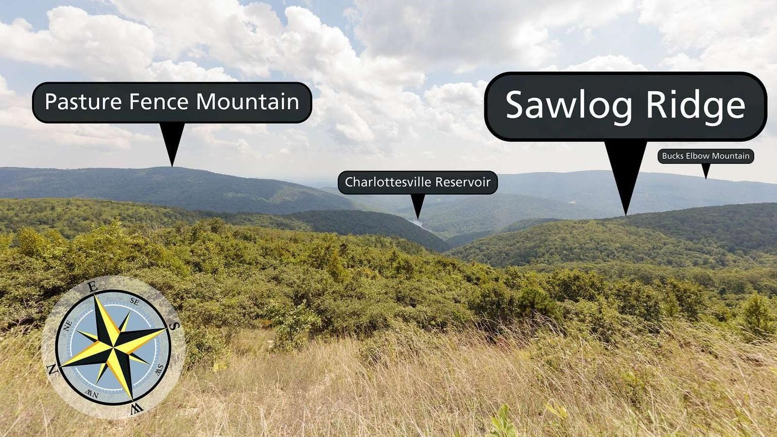
Facing east-southeast from an elevation of 2,975 ft (906 m), Moormans River Overlook looks straight out to the Charlottesville Reservoir, fed by Moorman's River. Moorman's River has flooded many times, notably in 1895, 1924, 1942, and most recently on June 27, 1995. The 1995 flooding caused nearly 100 landslides. The Charlottesville Reservoir, also called Sugar Hollow Reservoir, contained much of the debris flowing downstream and prevented damage to homes nearby.