Last updated: April 2, 2024
Place
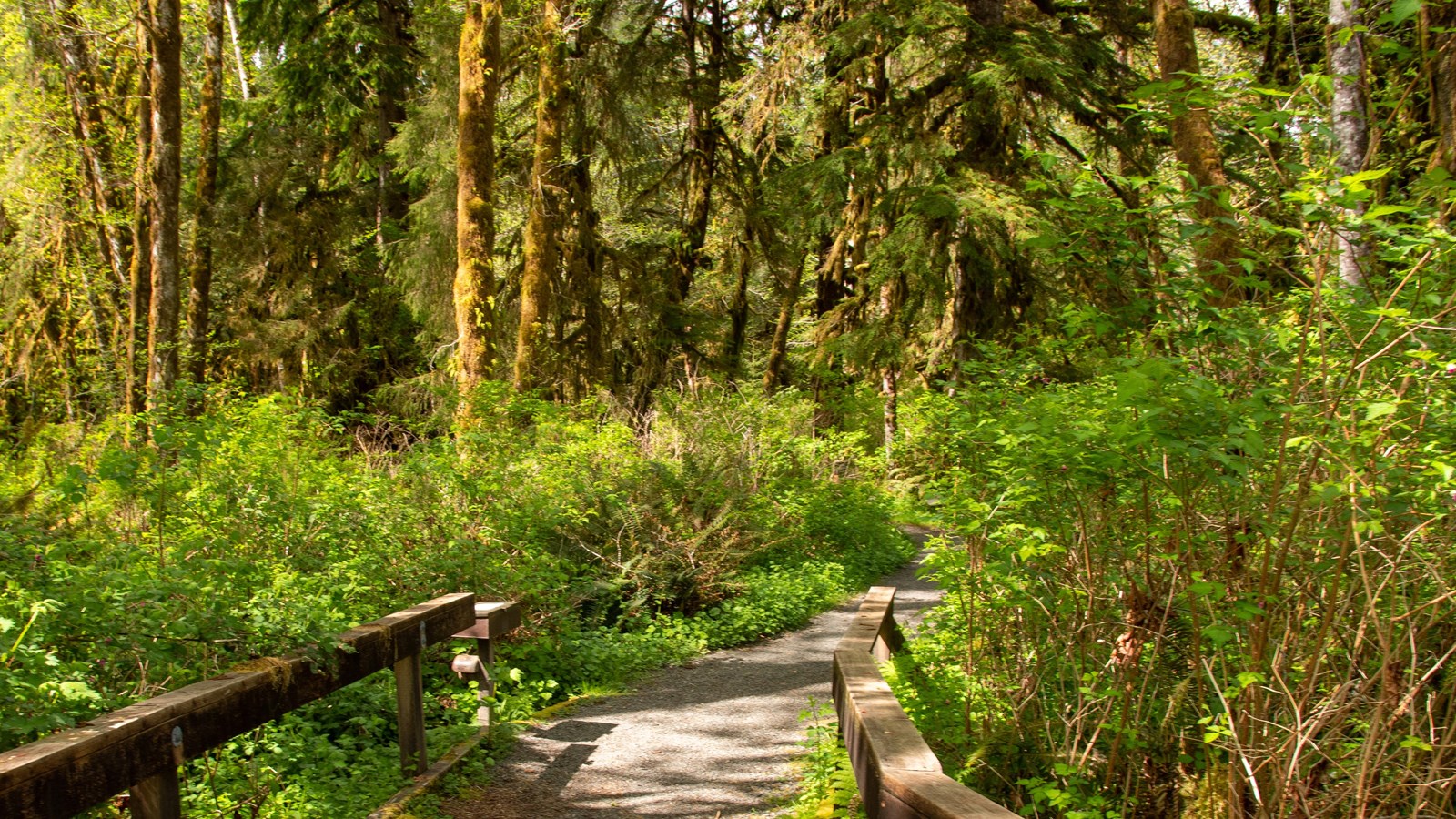
Maple Glade Rain Forest Trailhead
NPS/E. Goode
Quick Facts
Amenities
2 listed
Trailhead, Wheelchair Accessible
From the Quinault Rain Forest Ranger Station, enjoy this idyllic half-mile (0.8 km) loop through the big-leaf maples of the Quinault Rain Forest. For a longer walk, continue to the historic Kestner Homestead.
Full Accessibility Description
Length: 2,565 feet, .49 milesSurface Type: Compacted gravel
Typical Trail Width: 3-5 feet
Typical Running Slope: Less than 5% (maximum slope 7%)
Typical Cross Slope: Less than 1% (the first bridge has a cross slope of 4% for the last 15 feet)
Description: The trail starts at the west end of the ranger station parking area immediately beginning with a 60-foot ramp leading to a 50-foot bridge and then down a 30-foot ramp. The second ramp has a 10-foot section with 7% grade that is the steepest part of the trail. The bridge has settled on the west end and has a cross slope of 4% for the last 15 feet. Trail brochures for the Maple Glade Trail and the Kestner Homestead Trail are available at the bottom of the 30-foot ramp. The Maple Glade brochure describes forest elements at 13 marked points along the trail. 200 feet farther down the trail, proceed right at the junction to follow the brochure in numerical order.
The Quinault Rain Forest receives over 12 feet of rain annually. Portions of the trail may be flooded between the months of October and May, but the summer months are typically dry, and so is the trail. The rain contributes to escalated vegetation growth, so each side of the trail typically has low vegetation growth in the gravel surface, but it is still firm. Despite the gentle grade of the trail, the weather conditions make it difficult to maintain in accessible condition, so wheelchair users should proceed with caution.
Continuing from the junction, the trail proceeds for 2,370 feet through a quiet forest of mossy bigleaf maple trees, braided with stream channels, before looping back to the junction. The grade is gentle for the entirety of the loop and crosses numerous short wooden bridges. There are multiple locations along the trail where bridge ends, tree roots, and trail construction features rise 2 inches above the trail tread. At 425 feet, there is a cut through a downed tree with a 4-inch step. At 1,530 feet, continue to the left at the Kestner Homestead Trail junction to complete the loop. There is a trailside bench at 1,685 feet. The roughest stretch of trail is from 2,010 to 2,090 feet where there are two 8-foot sections of numerous crisscrossed exposed tree roots, followed by a 45-foot section where flooded has caused a 10-inch deep, 18-inch wide rut down the middle of the trail. When back at the first junction, go right to return to the parking lot.