Last updated: March 3, 2021
Place
Losing Ground Scenic View

Historical/Interpretive Information/Exhibits, Scenic View/Photo Spot
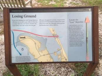
If you were standing here with Thomas Hariot in 1585, the view would be quite different than you see today. Back then, the island's shoreline was much farther out in the sound. Over the past 400 years, changing river currents, rising sea levels, and storms blowing from the northeast have eaten away at the north end of Roanoke Island, pushing the shoreline back 1,500 to 3,000 feet.
Locate the "Lost" Shoreline
Look out across the water from the edge of the clearing. Try and find the modern navigational buoys like the one pictured. (Hint- they are way out there!) These buoys help boats navigate the sound today. They also happen to mark the shoreline of Roanoke Island in the 1580s, as determined from geologic studies.
In 1587 the colonists may have built their settlement close to the waters of the sound, leaving some experts to theorize that evidence of their settlement is now underwater.
