Last updated: April 2, 2024
Place
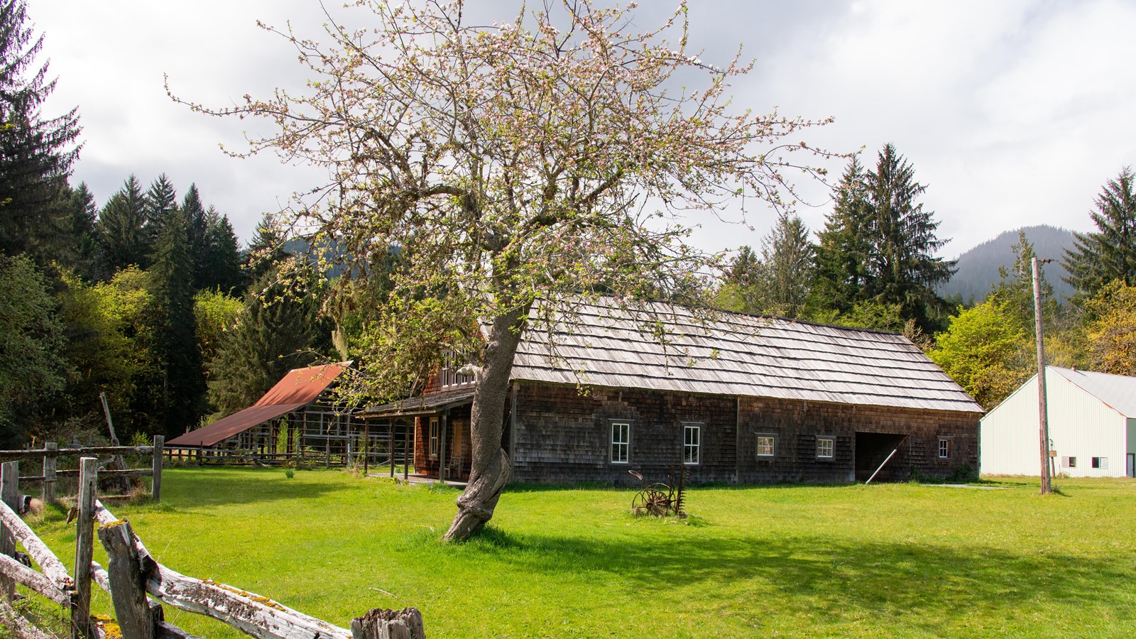
Kestner Homestead Trailhead
NPS/E. Goode
Quick Facts
Amenities
1 listed
Trailhead
Learn about homestead life on this flat, self-guided 1.3-mile (2.1 km) loop from the Quinault Rain Forest Ranger Station.
Full Accessibility Description
Length: 6,940 feet, 1.3 milesSurface Type: Compacted gravel
Typical Trail Width:3-5 feet
Typical Running Slope: From Maple Glade start to the homestead, less than 7% (Maximum slope 10%). From kiosk start to the homestead, less than 5%
Typical Cross Slope: Less than 1% (the first bridge has a cross slope of 4% for the last 15 feet)
Description: This loop trail may be travelled in either direction: Following the Maple Glade Trail going left at the first junction, and then left again at 1,050 feet when reaching the sign for the Kestner Homestead Trail; or starting at the information kiosk. Starting from the Maple Glade Trail, it is .77 miles to the homestead. After leaving the Maple Glade Trail, the trail rolls up and down through a forest heavy with maple trees, and the tread is generally clear of obstacles. There is a 40-foot bridge at 1,125 feet, followed by 2 slightly steep sections (10 feet at 7% at 1,560 feet and 30 feet at 6-8% at 1,710 feet) before reaching a mossy bench at 1,710 feet. From the bench, there is a gradual hill for 290 feet at up to 7% grade. At 2,080 feet, the trail narrows to 3 feet. There is a 30-foot 8-10% downhill at 3,770 feet followed by a 25-foot bridge at 3,715 feet. The boundary of the Kestner Homestead is at 4,075 feet. From this point back to the kiosk at the parking area the trail is mostly flat.
The first 170 feet of trail through the homestead is clumped with grass followed by a 110-foot section where the trail is all grass. Turning right at the homestead residence, the trail follows the original entrance road past the orchard for 500 feet before crossing a bridge over Kestner Creek. The decking of the bridge is pending replacement and a 2-foot-wide path of expanded metal is in place the length of the bridge to provide secure footing. Continuing around the gate at the end of the bridge, the trail turns right just before reaching the North Shore Road. From here it is 1,840 feet back to the trailhead kiosk at the parking area. There is a short stretch after turning along the road that is 3-feet wide and there is an adjacent ditch. Wheelchair users should exercise caution. There are roots that rise 2” above the trail tread at 5,800 and 6,490 feet.
For those wishing to visit the homestead on a less-strenuous hike, depart from the trailhead kiosk and return the same way. This is a 1.1-mile round trip.