Last updated: February 1, 2021
Place
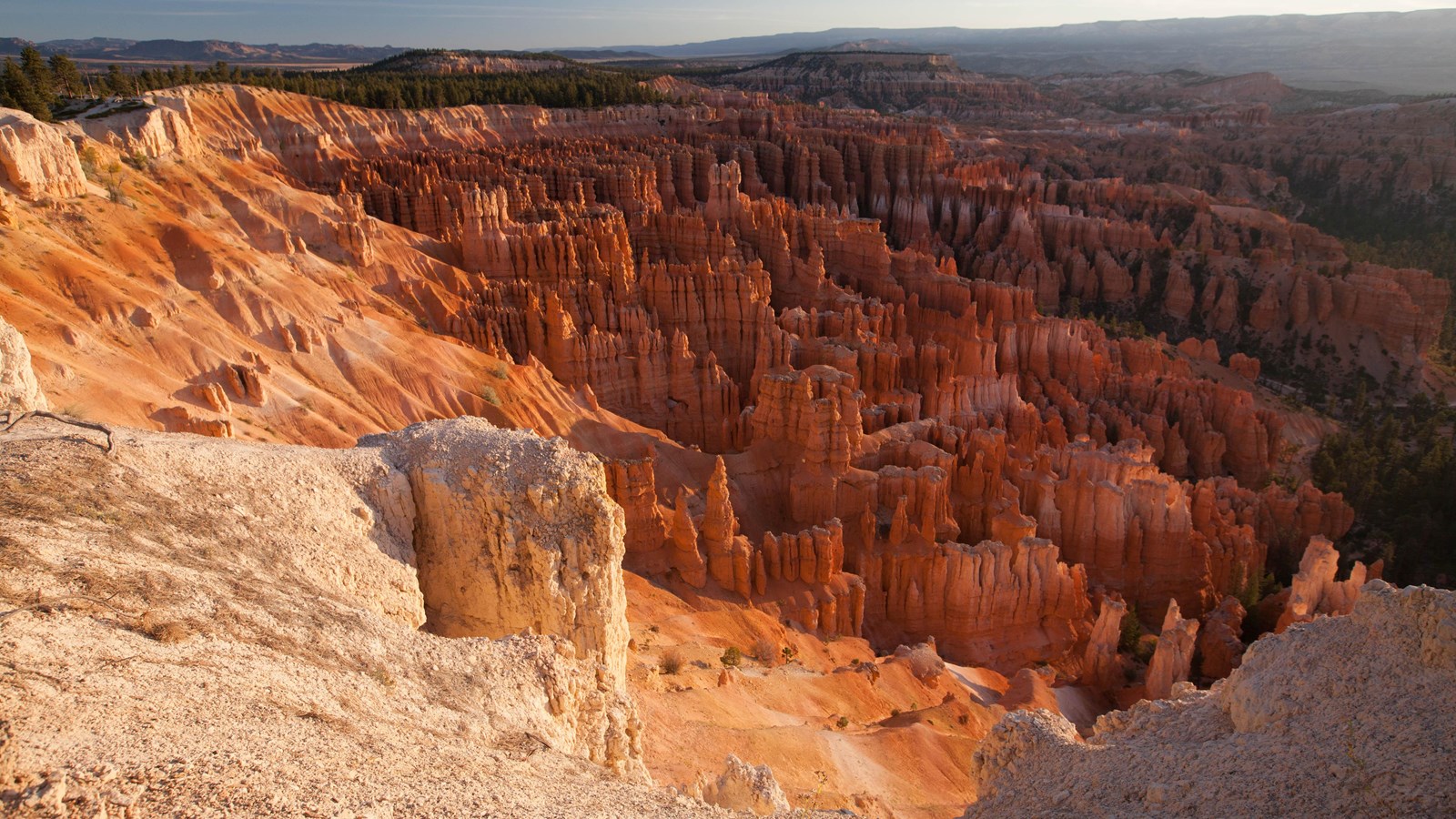
Inspiration Point.
NPS Photo
Quick Facts
Location:
Within the Bryce Amphitheater area of the park just before Mile 3 of the main park road
Significance:
One of 4 major viewpoints of the Bryce Amphitheater
Amenities
7 listed
Bicycle - Rack, Bus/Shuttle Stop, Historical/Interpretive Information/Exhibits, Recycling, Restroom, Trash/Litter Receptacles, Wheelchair Accessible
Along with Bryce Point, Inspiration Point provides a birds-eye view of the world's largest collection of rock spires called "hoodoos" found within the Bryce Amphitheater. The viewpoint here consists of three levels that provide varied spectacular perspectives in all directions. The Claron Formation consists of two members, the lower Pink Member, a "dirty" limestone that contains sand, silt, and iron that lends the rock its reddish color, and the upper White Member, a purer freshwater limestone. This upper White Member of the Claron Formation is visible below Inspiration Point, although few hoodoos form in this softer rock.
Trails
The 5.5 mile (8.9 km) Rim Trail begins in the south at Bryce Point. From Inspiration Point it is 1.5 miles (2.4 km) to Bryce Point. Note this section is closed in Winter. To the north it is 0.7 miles (1.2 km) to Sunset Point. It is 1.2 miles (2.0 km) to Sunrise Point. The section between Sunrise and Sunset Points is paved and has minor elevation changes. The path is wheelchair accessible except in severe weather. This is the only section of the Rim Trail pets are allowed on; all pets must be on leash and owners must pick up after them. It is 3.8 miles (6.1 km) to Fairyland Point. During shuttle season, hikers may use stops here, at Bryce, Sunset, and Sunrise to complete one-way hikes. Fairyland Point has no shuttle service.
Landscape Features
To the North
The view to the north looks along the eroded edge of the Paunsaugunt plateau. Dense rows of rock walls known as the Silent City are seen just south of Sunset Point. Following the plateau rim, Sunrise Point tilts upward. Beyond this the head of Campbell Canyon and the flat-topped feature of Boat Mesa. From upper views, one can see beyond the plateau's ponderosa forest and overlook its meadows. Evidence of massive volcanic activity approximately 20 million years ago is seen in the Black Mountains further north atop the plateau and the Tushar Mountains seen even further off to the Northwest.
To the East
Inspiration Point looks down upon Bryce Creek, the main drainage of the Bryce Amphitheater. It is typically a dry wash, only flowing with water during summer rain or melting winter snow. It exits the amphitheater to the right of Bristlecone Point and the left of an unnamed promontory. Both Bristlecone Point and Sinking Ship to its left reveal a tilt associated with the presence of the Paunsaugunt fault line, which displaced this plateau 2,000 feet (610 m) lower than rocks east of these features. This brought the park's limestone layers to be even with soft marine shales seen in the Grey Cliffs that form the basin of the Paria Valley. It also explains the difference in elevation between the colorful Table Cliffs across the valley 13 miles (21 km) distant and the Bryce Amphitheater. Tracing the horizon south, the next prominence is Canaan Peak, which is also crested with the colorful Claron Formation. From here, the Kaiparowits Plateau forms the horizon until it meets with Navajo Mountain, approximately 80 miles (129 km) distant and visible on clear days.
To the South
Views to the south are best appreciated from the uppermost viewpoint. Here one looks toward Bryce Point with the Wall of Windows extending out below. Views from below are possible along the Peekaboo Loop trail, which can be seen emerging from a feature known as the Cathedral below. A forest of moisture-loving Douglas Fir grows and can be enjoyed along the 1.5 mile (2.4 km) stretch of the Rim Trail connecting Bryce Point to Inspiration Point. Note this section is closed in winter due to narrow trails and snow cornices.