Last updated: April 2, 2024
Place
Hall of Mosses Trailhead
NPS/L. Napolitano
Quick Facts
Amenities
1 listed
Trailhead
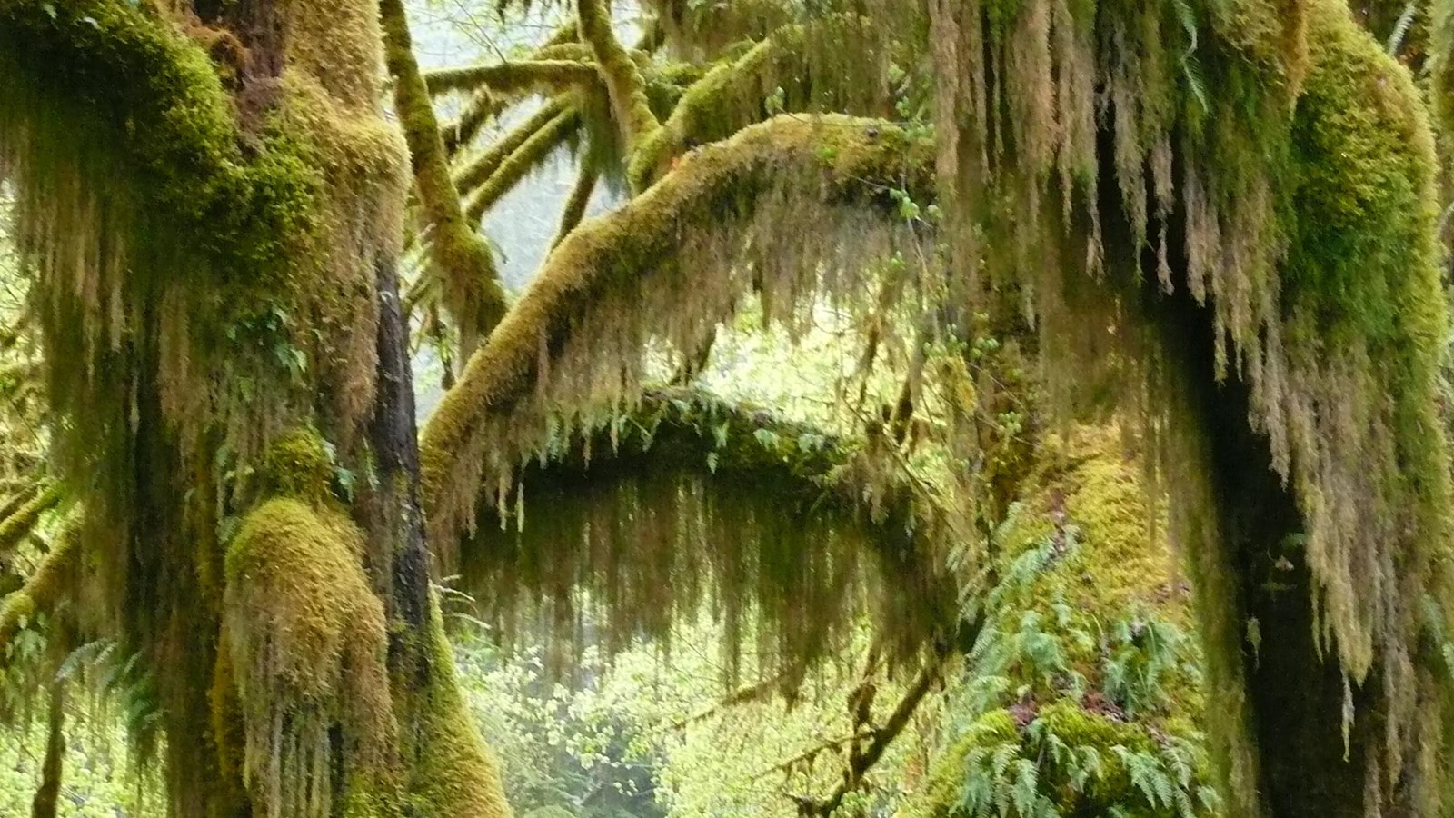
This short and sweet loop is the definitive rain forest experience. Look for young Coho salmon as you cross Taft Creek, then wander through a wonderland of moss, trees, and ferns - including an iconic moss-draped archway. The trail is just 0.8 miles (1.3 km) long, but you may be tempted to stay for hours!
Full Accessibility Description:
Length: 5,515 feet, 1.04 miles; Loop: 4,535 feet, .86 miles
Surface Type: Compacted gravel
Typical Trail Width: Between 3 and 6 feet
Typical Running Slope: First 400 feet: under 5%; remainder fluctuating uphill and downhill with numerous steep grades, typically less than 50 feet in length, ranging from 7-25%, interspersed with gentle stretches
Typical Cross Slope: Less than 2%
Accessible Parking: Van-accessible parking immediately across from park information boards
Description: The Hoh parking area has five van-accessible parking spaces. Head towards the information boards that are visible from the accessible parking spaces. A trail intersection, 310 feet from the boards, leads to a sign indicating where the Hall of Mosses trail starts. At this intersection, follow to the left for another 450 feet and then turn right at the next trail intersection. The next 10 feet of trail cover a 5-10%-grade increase to the 30-foot bridge over Taft Creek. There is an 8-inch step off the far end of the bridge onto sloping ground for 10 more feet.
At 650 feet, the trail narrows to 4 feet wide and climbs at a steep 9-14% grade. There is an exterior handrail along the trail starting at 650 feet and ending at 900 feet. The trail turns to the left and continues uphill at steeper grades from 17-22% for 70 feet, before reaching the start of a loop that circles through a forest of bigleaf maple trees. Turn left at the intersection and continue uphill. From 970 feet to 1,020 feet is the steepest part of the trail at 24% for 30 feet, followed by 20 feet at 12%.
From 1,020 to 1,050 feet, the trail goes downhill at a 15% grade, followed by another 40 feet downhill at 9%. Following a small step down at 1,110 feet, the grade drops to under 5% for the next 700 feet. At 1,805 feet there is a 200-foot spur trail to the left. The spur, under 5% grade, is fenced on either side and ends at a fenced area with views of a group of moss-covered bigleaf maples. Continuing back along the main trail from the spur, the trail remains under 5% grade to 2,210 feet. Those seeking the least-strenuous version of this hike may wish to go back along the same route at this point, as the east side of loop is more rugged than the portion already traveled. The trail begins to climb uphill at 10-14% grade from 2,210 feet to 2,990 feet. From 2,990 feet to 2,390 feet, the trail continues uphill, fluctuating from 7-14% before reaching a 30-foot stretch dense with large roots. There is a brief, level spot at 2,440 feet before a 16% uphill increase that includes 6 steps interspersed with roots and rocks.
The trail remains rocky and begins sloping back downhill at 9-12%, interspersed with a few gentler areas to 2,645 feet. From 2,645 to 2,735 feet the grade sharply increases to 20%, then reduces to 8% from 2,735 to 2,810 feet. Continue down 7 stairs at a 10% grade to 2,850 feet. This concludes the most difficult section of the east side of the loop. There are many amazing sights along the remainder of the loop, including examples of mature trees grown from nurse logs and fallen giants on the trail side. The trail tread again becomes wide, smooth and under 5% grade from 2,850 feet to 3,355 feet. At 3,355 feet there is a 30-foot downhill at 15-20% with numerous roots and rocks. From 3,385 to 3,900 feet, grades remain under 5% until reaching five stairs climbing a 15% grade increase for 45 feet. From 3,945 feet the trail is again smooth and level until a 25-foot uphill increase of 10-12% at 4,380 feet. The final gentle stretch extends from 4,405 feet to 4,500 feet. At 4,500 feet, continue down a steep hill at 20-25% grade to reach the beginning of the loop. Retrace the initial approach to return to the parking area at 5,515 feet.