Last updated: October 20, 2023
Place
Geology Tour - Yosemite Underwater: Twentieth Century Floods

Historical/Interpretive Information/Exhibits
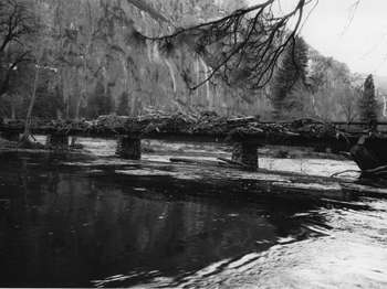
On most days, the Merced River flows peacefully beneath Superintendents Bridge. However, on January 2, 1997 the Merced was a raging torrent. The 1997 flood is the most damaging in Yosemite's recorded history. In the center of the valley, floodwaters were more than 10 feet, or 3 meters, deep. The flood damaged roads and infrastructure, resulting in prolonged closure of Yosemite Valley. The metal marker attached to the bridge indicates the height of the five largest floods in recorded history. Compare your height to the flood water level of 1997 to get a sense of the depth of water above the bridge. Now compare it to the four other major floods. What do these floods all have in common besides their large size? Here's a hint: What time of year did these floods occur? That's right, they all occurred during the winter months.
Yosemite, like the rest of California, receives most of its annual precipitation in just a few months, usually between November and March. During these cold winter months, especially at high elevations, the precipitation falls as snow. In the high country, snow depths can be tens of feet deep. Typically, the snow will melt as temperatures warm in the summer and the rivers gently rise in response. This means that there is usually a several month-long lag between the time when the snow falls and when the rivers rise. However, in some years warm, tropical storms originating near Hawaii make their way to California. The warm air accompanying these storms raises the snowline to a higher elevation. The snowline is an elevation line, controlled by air temperature, that divides rain from snow. In Yosemite, the wintertime snowline is usually around 6,000 feet, or about 1,800 meters, but during these warm storms, snowline can rise to 10,000 feet, or more than 3,000 meters, elevation. If the snowline is higher, this means that more rain is falling over the watershed instead of snow. You've probably seen heavy rain running off a parking lot. Well, heavy rain running off large areas of granite bedrock looks similar. The combination of heavy rain and melted snow across the entire watershed produces extreme flood events. It is under these conditions that the largest, most damaging floods in Yosemite's history have occurred. As global temperatures warm the snowline in Yosemite is likely to increase in elevation also increasing the likelihood of future floods.
Our next stop is at a huge boulder behind the Chapel, across Southside Drive. To get there, please use one of the two crosswalks crossing Southside Drive and watch for cars. The trail picks up at the far end of the parking lot next to the Chapel.
