Last updated: September 2, 2025
Place
Gaylor Lakes Trailhead
Quick Facts
Amenities
2 listed
Animal-Safe Food Storage, Trailhead
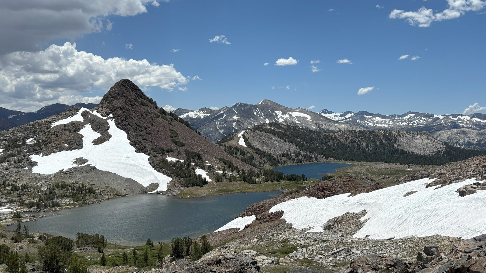
This short but steep hike offers spectacular high-country views, wildflowers in the summer, and lake views. From the trailhead, located right next to Tioga Pass, climb steadily to a ridge with views of the high Sierra including Mt. Dana and Dana Meadows. At the ridge crest, the trail drops 200 feet to Middle Gaylor Lake.
Distance: 2.6 miles (4.2 km) round-trip
Elevation gain: 500 ft (152 m)
Time estimate: 2-3 hours
Route variation: if desired, continue along the trail to Upper Gaylor Lake for a slightly longer hike. This adds about 1 mile (1.6 km) round-trip as well as a small amount of additional elevation gain.
Tips & Seasonal Information
Vault toilets are available at this trailhead. Parking is limited.
Although this trail is short, it begins at nearly 10,000 feet (3,000 km) above sea level. You may become tired more quickly than expected or even feel sick. Take breaks, drink plenty of water, and adjust plans if needed.
This trailhead is only reachable by vehicle when Tioga Road is open, typically late May or early June to sometime in October or November.
Tioga Road closes after the first significant snowfall. Overnight parking on this road, including this trailhead, ends October 15. For current road and weather information, please call 209/372-0200 (press 1, then 1).