Last updated: March 15, 2021
Place
Fort Funston - Sunset Trail
Quick Facts
Amenities
1 listed
Trailhead
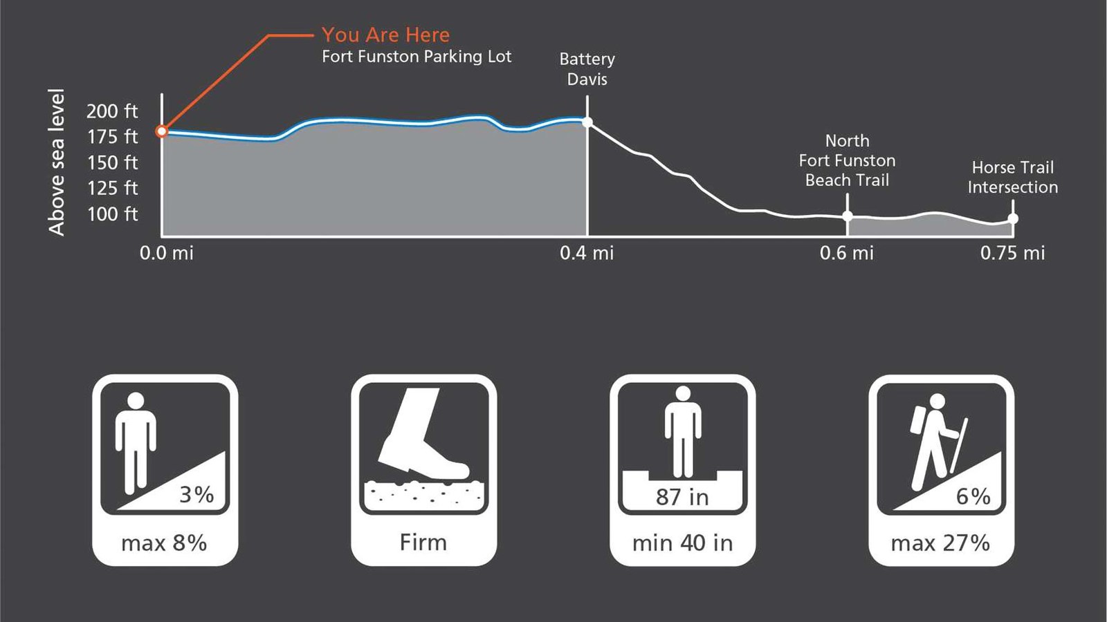
Fort Funston's paved Sunset Trail meanders along the ocean and dunes, the first wheelchair-accessible trail to be built along the California coastline. This 0.75 mile-long, flat, seaside trail is easy for all. The trail takes visitors past Battery Davis, offering picnic tables and benches along the way. After Battery Davis, the trail heads downhill towards the northern beach access trail. For a flat walk, with no inclines, Battery Davis is a good place to turn around.
Sunset Trail Overview
Distance: 1.5 mi (2.8 km)
Time: 1 hour
Trailhead: Sunset Trail
Slope: Avg 6%, Max 27%
Side Slope: Avg 3%, Max 8%
Width: Avg 87 in., Min 40 in.
Trail Surface: Firm
Safety
- Stay on the established trail. Keep an eye out for poison oak.
- Observe warning signs and railings-these exist for your safety.
- Dress in layers and be prepared for varying weather conditions. Sunny days along the coast can turn windy, foggy, and cold very fast.
- Do not climb on the coastal bluffs or edges, the sand and rocks are loose and eroding and dangerous!
- People have fallen from these cliffs -- and died!
Parking
There is parking at Fort Funston, including ADA accessible parking.
Bathrooms
Bathrooms are located near the parking area.
Dog and Trail Etiquette
Dog walking is allowed in areas for on-leash or voice/sight control. Dogs are not allowed in the Habitat Protection Area, the marked Sensitive Habitat area and the area surrounding the Native Plant Nursery. Off-trail travel harms plants and causes erosion. Keep your food within arm's reach at all times and do not feed the wildlife. Carry out all trash and food waste (fruit peels, shells, etc.).