Last updated: September 25, 2025
Place
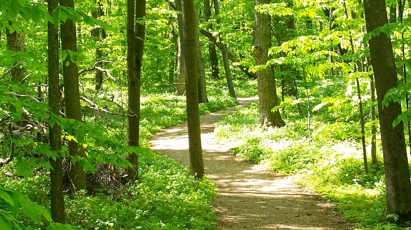
Empire Bluff Trail
NPS credit
Quick Facts
Location:
GPS Coordinates: 44.7993,-86.0587
Amenities
5 listed
Information, Parking - Auto, Picnic Table, Toilet - Vault/Composting, Trailhead
Empire Bluff Trail
Distance
Round trip is 1.5 miles
Terrain
Hilly
Vegetation
Beech-maple forest, fields, and dune plants
Trailhead
A vault toilet is available at the trailhead. A small picnic area is at the trailhead.
Pets
Leashed pets are allowed on this trail.
Comments
The trail leads to a high bluff overlooking Lake Michigan. A QR code is available at the trailhead for download of a trail map. For your safety and to protect the environment: please do not descend the bluff. The trail ends at the wooden boardwalk.
First time hiking in the lakeshore? Follow these tips
Breathtaking . . . water so clear and blue . . . bucket-list worthy . . . best view anywhere on the shoreline . . . amazing . . . incomparable sunset . . .picture-postcard sight. . . jaw-dropping . . . not like anything else in the Midwest.
Interested? Then don't miss the Empire Bluff Trail. The 1.5-mile round-trip trail climbs through a beech-maple forest rife with wildflowers to a high, coastal bluff featuring the iconic double-dune view that's the subject of paintings, posters, and postcards. Boardwalks and an observation deck atop this lofty perch look out over Lake Michigan and a large chunk of the national lakeshore. A few hill climbs (with some stairs built into the trails) on the way up to the bluff make this a moderate hike: one well worth it!
As a hike, Empire Bluff is an excellent and popular choice for families and can be done by most people in under an hour. Pack a lunch and enjoy it with looking out at a view with few rivals. Benches line the trail and there are several spots at the top to kick back and soak it all in.
And the sunsets! Bring a flashlight and arrive at near dusk on a clear evening for a sunset second to none. Just a short time after those spectacular sunsets are over, the stars come out in a brilliance and profusion that you can rarely find on Lake Michigan. The pure darkness here makes this a favorite destination for viewing meteor showers. But come early, this place will be full of families out to enjoy the show.
And bring your camera with you.
Take the Self-Guided Tour. Look for posts with numbers.
Stop 1:
The hilly terrain and scattered boulders are evidence of glaciation.
Only about 11,800 years ago, the last glacier melted from this area. As Glaciers move across the land, they pick up rock and soil, and as they melt, they deposit the debris irregularly to form hills and valleys. Glacially transported boulders located far from their point of origin are known as erractics, literally "travelers." The bedrock in this area is made up of sedimentary rocks such as limestone and shale, but is buried under several hundred feet of glacial deposits.
The boulder is a glacial erratic. It must have come from a distant place, perhaps Michigan's Upper Peninsula or Canada.
Stop 2:
The glacial soils around Sleeping Bear are quite sandy and not very fertile for farming. However, certain crops, including hay, can be grown here successfully. From post #2, you can see a metal sculpture. Oh, but wait, that's actually a piece of rusted farm equipment from the time of the Great Depression.
This McCormick Deering No. 7 mowing machine was manufactured between 1929 and 1940. The horse drawn mower cuts a swath about five feet wide. The enclosed gearbox, a significant improvement over earlier models, allowed for efficient gear lubrication, prevented hay from getting tangled in the gears, and provided safer operations for man and animal.
With the development of modern farm equipment, many such pieces of old machinery were abandoned in the fields. A number of old farms are scattered throughout the park and help to preserve the flavor of another era.
Stop 3:
Stop and look around at post #3. This section of trail shows one of the most important types of Northern Hardwood forest in Michigan, the Beech-Maple forest. This forest consists of primarily sugar maple, red maple, and beech. Though, in disturbed areas where sunlight shines below the tree canopy, more sun-loving species, such as paper birch and quaking aspen are often found. White pine is commonly intermixed with the beech maple and depending on sunshine, soil, climate, and time, white pine forest may displace some of the beech-maple.
Over the years the natural process of plant decay has improved the fertility of the sandy glacial soils. Still they can hardly be called rich. In the summer the trees cast a dense shade. Plants of this forest must be able to tolerate low light levels. Many of the forest wildflowers such as the trillium, bloodroot, and Dutchman's breeches bloom in the early spring before the leaves appear on the trees. Young trees deprived of sunlight grow very slowly. If a nearby tree falls, allowing sunlight to reach the young trees, they show a rapid spurt of growth. Before long the gap in the leafy canopy is closed and dense shade prevails again.
Stop 4:
While the sandy tree-covered dunes of this region are not rich farmland, the temperature, drainage, growing season, and available soil nutrients in these somewhat humus-enriched "gray dunes" work well for many species of trees. In particular, the Grand Traverse region, known as the Cherry Capital, is well suited to growing various kinds of fruit trees. In about 1910, the Empire Lumber Company planted extensive orchards on the logged-over lands.
An orchard extended all the way from the Village of Empire (you may be able to catch a glimpse of it to the north, through the trees) up the hill to this tree-studded meadow. The apple and plum trees growing here today do not seem to be from these old orchards, but may have sprung up from fruit discarded in the area.
Lake Michigan plays an important role in moderating the local climate. After the long cold winter, the icy waters keep air temperatures cool in the spring. This helps to prevent fruit trees from blooming too early when a killing frost might still occur. Orchards on sloping ground benefit from natural air drainage. Heavy, cold air seeks low ground, while slopes and uplands stay slightly warmer. Thus, the hilly glacial terrain makes ideal orchard country.
Stop 5:
Near the post marked 5 and actually many locations along the trail, you can see various decomposing logs and fallen trees. Bacteria, lichen, fungus, moss, and seedlings take advantage of the nutrients, moisture, and sunlight made available to them by these fallen trees. Large trunks and limbs of which are often referred to as nurse logs. Why do you think that is?
These rotting logs are an important part of the life cycle of the forest. Their decomposition frees nutrients, which would otherwise not be available.
Bacteria and insects are among the first organisms to make use of the dead wood. They break it down for use by other life forms. Fungi and mosses also break down dead wood and use its nutrients. As decomposition advances, more complex plants such as flowers and tree seedlings get their nutrients, moisture, and shelter from the rotten wood. Advanced decomposition also adds nutrients and organic matter to the soil, which benefits other organisms.
Stop 6:
About .5 miles from the Empire Bluffs trailhead is a bench marking the South Bar Lake overlook. From here, you can take in the stunning view towards the north from which you can see South Bar Lake and the sweep of Lake Michigan's Platte Bay all the way to the Sleeping Bear Dune.
A bar lake is formed when winds and currents build a sandbar across a bay, isolating that bay from the larger lake. Declining lake levels can, and in this case did, greatly accelerate this process. As vegetation takes hold, the exposed sandbar traps more sediments and decaying vegetation starts to build up soil, further heightening and stabilizing the barrier between parent and daughter lake.
To the north of South Bar Lake is the equally imaginatively named North Bar Lake, a popular spot for wading and swimming.
End
Here you go . . . the breathtaking part, you are perched about 400 ft. above Lake Michigan on a perched dune (a dune made of several feet of sand on top of hundreds of feet of glacial moraine, geological debris, in this case from the last Ice Age). From here, weather permitting, you can see the following:
Point Betsie in Benzie County on Lake Michigan about 10 miles to the southwest
South Manitou Island about 14 miles to the northwest, and about 7 miles offshore. Among its points of interest are an 1871 lighthouse, historic farms, perched sand dunes, and a grove of large, old white cedar trees
The southern portion of the Sleeping Bear Dune plateau about 6 miles to the north
A lot of Lake Michigan : your line of sight horizon on Lake Michigan is about 25 miles in any unobstructed direction. If the scenic outlook were six times as high you could see Wisconsin, about 60 miles straight west across the Lake, but from where you stand the curve of the planet blocks that view.
And you can see most of what's in between those points, including the sweep of Platte Bay, Platte River Point, the Empire embayment to the north, and the beautiful South Bar Lake, once part of Lake Michigan, now separated by a sandbar beach.
Lobes of ice once occupied Platte Bay to the south and the Empire Embayment to the north. Glacial meltwaters deposited the sandy layered sediments of the Empire Bluff. South Bar Lake, just north of the Village of Empire, was once a part of Lake Michigan. Longshore currents deposited the sand bar that now separates the two lakes.
Beyond the Empire Embayment, the Sleeping Bear Dune itself-or the mother bear-which gives its name to the entire dunes complex, the National Lakeshore, and the other features in the area, appears as a small hill on the top of the high, sandy bluff. Historically, the dune was a landmark for travelers on Lake Michigan. Its location and dark vegetation drew attention to it. Now erosion has destroyed much of the dune.
The entire National Lakeshore includes about 105 square miles and was authorized by Congress in 1970 to preserve the outstanding natural features of this area: glacial phenomena, sand dunes, beaches, and forests
Directly ahead you see a section of boardwalk that extends for 500 feet south along the shoulder of the Empire Bluff. This boardwalk has been installed to prevent erosion and gullying of the fragile bluff face. Please do not descend the bluff for your own safety and to protect the natural setting.
Invasive plants
Invasive plant species are a significant threat to both native plants and wildlife.
Spotted Knapweed, purple loosestrife, autumn olive and other invasive plants displace native species and often have few or no predators, that is, they are not eaten by native insects, birds, or animals.
Take a few seconds here and remember to brush off our shoes, to stay on the trails, and to check clothes for seeds, burrs, and other "hitch-hikers" to slow the spread of invasives.