Last updated: September 19, 2025
Place
Empire Bluff Trail - Scenic Overlook
NPS credit
Quick Facts
Location:
GPS Coordinates: 44.8013,-86.0716
Amenities
1 listed
Scenic View/Photo Spot
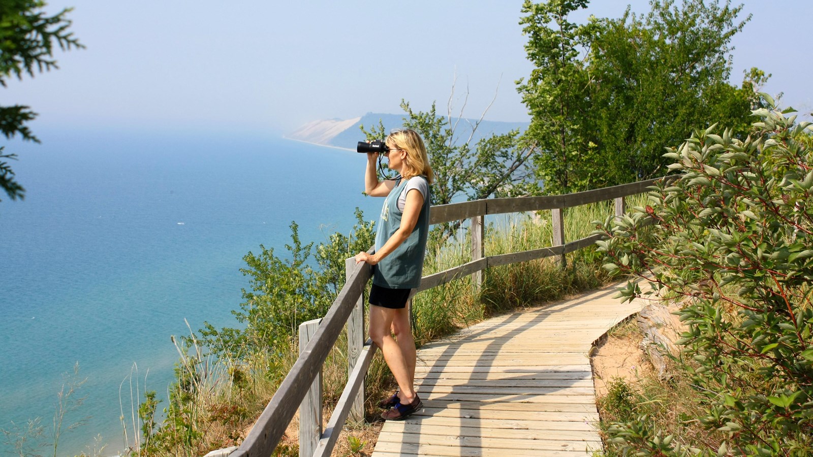
Here you go . . . the breathtaking part. At post 6, you are perched about 400 ft. above Lake Michigan on a perched dune (a dune made of several feet of sand on top of hundreds of feet of glacial moraine, geological debris, in this case from the last Ice Age). From here, weather permitting, you can see the following:
Point Betsie in Benzie County on Lake Michigan about 10 miles to the southwest
South Manitou Island about 14 miles to the northwest, and about 7 miles offshore. Among its points of interest are an 1871 lighthouse, historic farms, perched sand dunes, and a grove of large, old white cedar trees
The southern portion of the Sleeping Bear Dune plateau about 6 miles to the north
A lot of Lake Michigan : your line of sight horizon on Lake Michigan is about 25 miles in any unobstructed direction. If the scenic outlook were six times as high you could see Wisconsin, about 60 miles straight west across the Lake, but from where you stand the curve of the planet blocks that view.
And you can see most of what's in between those points, including the sweep of Platte Bay, Platte River Point, the Empire embayment to the north, and the beautiful South Bar Lake, once part of Lake Michigan, now separated by a sandbar beach.
Lobes of ice once occupied Platte Bay to the south and the Empire Embayment to the north. Glacial meltwaters deposited the sandy layered sediments of the Empire Bluff. South Bar Lake, just north of the Village of Empire, was once a part of Lake Michigan. Longshore currents deposited the sand bar that now separates the two lakes.
Beyond the Empire Embayment, the Sleeping Bear Dune itself-or the mother bear-which gives its name to the entire dunes complex, the National Lakeshore, and the other features in the area, appears as a small hill on the top of the high, sandy bluff. Historically, the dune was a landmark for travelers on Lake Michigan. Its location and dark vegetation drew attention to it. Now erosion has destroyed much of the dune.
The entire National Lakeshore includes about 105 square miles and was authorized by Congress in 1970 to preserve the outstanding natural features of this area: glacial phenomena, sand dunes, beaches, and forests
Directly ahead you see a section of boardwalk that extends for 500 feet south along the shoulder of the Empire Bluff. This boardwalk has been installed to prevent erosion and gullying of the fragile bluff face. Please do not descend the bluff for your own safety and to protect the natural setting.