Place

Cubo Line

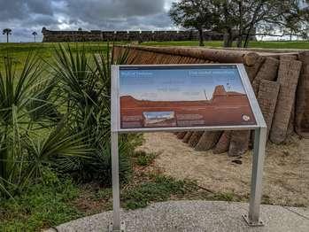
On the top half of the panel is a color illustration of the Cubo Line, an earth and palm-log embankment used to defend the city of St. Augustine.  At the left, elevated land leads down to cleared land and a 5-foot deep moat. To the right, just before the rising embankment, a vertical brown stick marks the palisade wall of pine stakes that stood in the moat. To the right, the 9-foot high embankment, made of reddish-brown dirt and palm logs hid soldiers from the invaders’ view. Below, extending from the left side to the pine stake, a white, horizontal line and text in white: “Outside the Cubo line: countryside.â€, To the right, just past the pine stake, a second white horizontal line and the text: “Inside: the protected city.â€,  Above the reddish-brown land, a pale blue sky. Along the top of the panel, at left and right, black text in English and Spanish reads:  Wall of Defense. The log wall at your left is a replica of the Cubo Line. The earth-and-palm-log embankment extended from the Castillo to the San Sebastian River a half-mile behind you. 2 defensive walls enclosed the city: the Cubo and Rosario lines. The Cubo Line marks St. Augustine's northern edge   End of Text  At the bottom, left side of the panel, a small rectangular map of the city of St. Augustine. At the top left of the map, northwestern corner, the Castillo de San Marcos. Along the city’s top, horizontal eastern edge, in blue, the Mantanzas River. At the left, a dotted yellow line follows the vertical, northern edge; the Cubo Line. Along the bottom, horizontal western edge, a second yellow dotted line with 8 small triangles pointing downward represent redoubts; the Rosario line. Below the city map, in the center of the Rosario Line, a white vertical line connects to the text: “Redoubts.â€,  On either side of the map, white text in English and Spanish, reads:  A series of enclosed gun platforms, called redoubts, connected by palm log and earth walls formed the fortified town walls critical to St. Augustine’s land-based defense. Today, you can see the rebuilt Santo Domingo/Tolomato Redoubt near the corner of Cordova Street, one of 3 defensive positions along the Cubo Line.  End of Text  At the bottom right, a small circle divided into 4, triangular wedges. Each wedge has a portion of a flag and date range for an important period in the fort's history. 1 wedge is bright, indicating the time period of the panel story and the other three wedges are muted. From the top, moving clockwise: Great Britain: 1763-1784; Spain: 1784 to 1821, is bright; the United States: 1821-1900; and Spain: 1672-1763.  Below the circle, black text in English and Spanish reads:  Second Spanish Military Era.  To the left of the panel is the Cubo Line replica wall which extends toward the fort. 5 light-colored round logs are stacked 4-feet high, one on top of each other. To the left of the wall, a higher grassy area. To the right of the panel, a well-worn earthen path, with grass on either side. Beyond the panel, is the fort.

Quick Facts

Historical/Interpretive Information/Exhibits, Wheelchair Accessible

The log wall at your right is a replica of the Cubo Line. The earth-and-palm-log embankment extended from the Castillo to the San Sebastian River a half-mile behind you. Two defensive walls enclosed the city: the Cubo and Rosario lines. The Cubo Line marks St. Augustine's northern edge.

Castillo de San Marcos National Monument

Last updated: February 12, 2021