Last updated: April 2, 2024
Place
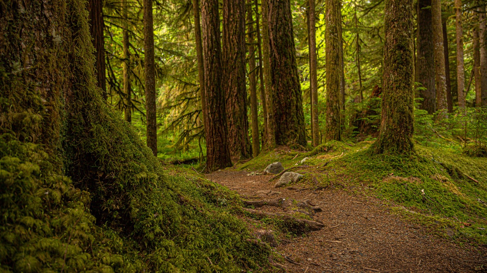
Ancient Groves Main Trailhead
NPS/D. Sullivan
Quick Facts
Amenities
1 listed
Trailhead
At just 0.6 miles (1 km), this lovely loop trail is a bit of peace just off the Sol Duc Hot Springs Road. Within moments, you are immersed in the deep green of classic Olympic Old Growth. The Olympic Peninsula lowlands, with their mild climate, deep soils and generous rainfall, grow giant trees. These old survivors record centuries of history in their massive trunks. When scientists use the term old growth, they are usually referring to Douglas-fir/western hemlock forests with trees older than 200 years, abundant downed wood on the ground, a multi-layered canopy of small plants, shrubs and trees, and standing dead trees called snags. Many different species of wildlife depend on intact old growth forest. As little as 5% of the original lowland forest is left, making protected places like Olympic National Park even more vital.
Full Accessibility Description
Length: 3,015 feet, .57 milesSurface Type: Compacted gravel
Typical Trail Width: 2 feet
Typical Running Slope: Approximately half the trail is alternating ups and downs with steep grades from 9-20%. In between are gentler rolling sections with multiple boardwalks and short bridges
Typical Cross Slope: Less than 2%
Elevation Gain/Loss: Less than 25 feet
Accessible Parking: Van-accessible parking along parking area
Description: The Ancient Groves Nature Trail departs from a roadside pullout approximately 8.8 miles up the Sol Duc Valley Road. Though short in length, the trail has many ups and downs at steep grades. It traverses through a beautiful old-growth forest, and has a brief section along the edge of the bluff overlooking the river.
From the parking area, the trail runs beside the road at a level grade for 100 feet before dropping into the woods to the right. The trail continues for 170 feet of fluctuating steep downhill, with 10-18% grades, to a level boardwalk followed by gentle grades for the next 130 feet. Running along a gentle hill for 50 feet at grades under 7%, the trail meets an intersection and leads to the right towards the river. The next 170 feet is uphill at varying grades from 9-13%. This is followed by a moderate downhill for 265 feet. The trail crosses a short bridge before dropping down a steep 45-foot hill to reach the section above the river.
The trail continues uphill along the river for 220 feet with some steep sections, particularly when climbing back up to turn left away from the river. The next 370 feet are a gentle rolling downhill through the forest. A steep section of trail climbs at 12% before a second bridge crossing at 1,585 feet, approximately half-way along the trail.
From 1,585 feet to 1,840 feet the trail rolls up and down through the forest. At 1,625 feet, there is an intersection with a second access point to the trail that originates from another road pullout past the recommended starting point. Continuing to the left, at 1,840 feet there is a 185 foot stretch of steep downhill with grades ranging from 10 to 20%. Crossing another section of boardwalk, the trail fluctuates grades for 110 feet with brief steep sections up to 20%. From here, 430 feet of rolling downhill trail with some steep sections leads back at the intersection. At the intersection, the trail to the right retraces back to the parking area.