Last updated: March 3, 2021
Place
9 - Waterside Treasure

WAYSIDE PANEL TITLE: Waterside Treasure
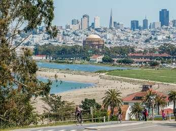
TEXT: This place is a national treasure! It feeds the soul and provides a recreational playground for locals and globe travelers alike. But the very ocean we enjoy here threatens the existence of this beach and promenade. Earth's warming temperatures-mostly caused by human actions like burning fossil fuels-melt glaciers and make sea water expand. Rising seas will submerge our seaside retreat. Should we reduce carbon emissions or build levees?
DESCRIPTION OF IMAGE #1: The background image is a photograph of the San Francisco Bay Trail on a sunny day with many visitors walking east and west along the edge of Crissy Field and the bay. The southern tower of the Golden Gate Bridge is prominently featured in the background, with the cables and road span stretching to the north over the water. Further in the background are the hills of the Marin Headlands.
DESCRIPTION OF IMAGE #2: Superimposed on this background photo is another photo of the Golden Gate Bridge, taken from the perspective of the waterfront near the entrance of Fort Point. In the photo, gray clouds loom and frothy waves crash onto the shore in front of a chain fence.
CAPTION: Storm waves already crash over the sea wall to the west. As sea waters rise, storm surge and swells get bigger.
DESCRIPTION #3: At the bottom center of the panel is another superimposed photo, showing a small bird, a snowy plover. It has a brown head and wings, and its breast, tail bottom and space just over its eye are white.
CAPTION: Snowy plover. The beach offers snowy plovers a life-saving food-and-rest stop.
DESCRIPTION OF CHART: On the right side of the panel is a vertical chart that measures sea level. The chart shows an illustration of a pole, with different heights from 0 feet to 16 feet, marked and annotated.
CAPTION: Measure for Sea Level. This pole marks projected sea level and storm surge to show how rising waters affect your recreation and migrating birds. Projections are from the Intergovernmental Panel on Climate Change in 2013.
0 feet: Average high tide in 2009
3 feet: Projected high tide in 2100, elevation of plover resting area
4 feet: Current storm surge plus wave pile-up
7 feet: Projected high tide in 2100 plus storm surge, elevation of promenade
12 feet: Projected high tide in 2300
16 feet: Projected high tide in 2300, plus storm surge
DIRECTIONS TO NEXT WAYSIDE: Walk west 350 feet and you'll arrive at the next wayside on the southern side of the trail.
