Last updated: March 3, 2021
Place
5 - Soldiers Guarding the Coast

WAYSIDE DESCRIPTION: The wayside panel is to the right of the previous wayside. It is the third of three panels located here and faces south west out over the wide expanse of the Pacific Ocean.
PANEL TITLE: Soldiers Guarding the Coast.
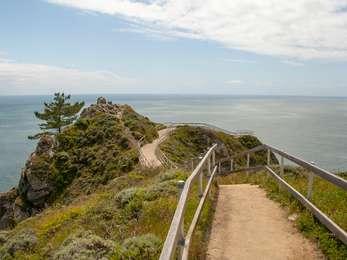
VIEW FROM WAYSIDE: Behind the waysides across the path is a WWII fire control station dugout. The dugout, or "gopher hole" is a partially submerged cement structure big enough for two men to stand inside. It has a pill-like shape, a rounded top with a gentle curve. A one-quarter section of "the pill" is missing, so that men could climb in and look out at the ocean. There is a concrete lip around the bottom of the dugout's opening about a foot high. Opposite the dugout to the south west are three interpretive wayside panels. Inside, the dugout has smooth sides and a cement pole on the left-hand side.
TEXT: Relics of tense times. Early in World War Two, the United States was reeling from Japan's attack on Pearl Harbor and moved to augment the defense of San Francisco Bay from enemy ships. Base end "fire control" stations proliferated along the coast in those fearful times. Built to house soldiers on the lookout for enemy ships, and equipped with a very powerful spotting scope, they could relay ship coordinates to a central communications and plotting center, so powerful guns in nearby batteries could take accurate aim at their targets.
Here you can investigate four historic base end stations, nicknamed "gopher holes" by the soldiers. Two of them served gun batteries in the Marin Headlands. One served Fort Miley south of Ocean Beach in San Francisco, and the fourth was assigned to a minefield, which paralleled the shipping channel along the Marin shore.
DESCRIPTION OF IMAGE: In the top center section of the panel is a profile diagram of a gopher hole. It shows two men for scale. One is peering through a sighting scope on the left, the other is climbing down into the dugout via ladder under a hatch. Two small bunks are suspended one over the other from the back wall.
TEXT: The soldiers' main duty was to scan the ocean for enemy ships. Each base end station had two men on duty at all times. Most base end stations were a single room, furnished with bare necessities. Two narrow bunks and a stove made them livable, but duty in these "gopher holes" could be cold and miserable. In an old motor court at nearby Muir Beach village, the Army leased cabins for a cookhouse and to house soldiers stationed in this area.
DESCRIPTION OF IMAGE: To the right of the diagram is a black and white photo of two soldiers, one wearing a brimmed hat and a jacket open in the front with a dark t-shirt underneath. One of his eyes is closed, as the other peers through a large sighting scope on a mount that swivels side-to-side. The other soldier is only partially visible, obscured as he is by the sighting scope. He's looking at his partner staring through the scope and wearing headphones.
CAPTION: A powerful mounted spotting telescope was used to scan for enemy shops and track targets during target practice. The telescope sat on a steel pedestal bolted to the floor.
TEXT: Wearing Parkas in Summer. On many days, this was a cold, damp, windy, foggy, isolated place to be stationed during World War Two. During the summer of 1944, an officer commanding one of the stations here put in a supply request for cold weather parkas and fur lined boots for the men. A few days later, he received a call from a supply sergeant at an army depot. Why, the sergeant wanted to know, did the coast artillery need Arctic-type clothing...in California? He had just shipped an order of summer-weight shorts and shirts to the Army air force base at Hamilton Field. Weren't the two posts just a few miles apart? The lieutenant replied: "You'd have to be from the Bay Area to understand."
DESCRIPTION OF IMAGE: A diagram is located in the bottom right hand corner of two black and white crosshairs. These represent base end stations on either side of a red dot, representing a gun battery. The three structures, the two base end stations and battery are arranged in a straight line labeled "base line" at the bottom of the image, parallel to a coastline. At the top of the diagram at its center, is a purple rectangle with one pointed end like a pencil labeled "target" in a blue field representing the ocean. Radiating from the target out to the three respective structures are three dotted lines.
CAPTION: Using a method called "triangulation" and data provided by two lookout posts (base end stations) positioned in key spots along the coast, a plotting crew could pinpoint targets miles out to sea.
DESCRIPTION OF IMAGE: In the bottom center of the panel is a black and white photograph of five men in uniforms huddled around a table in a room Four of the men wear headphones while a man with light hair and glasses is bent over a table with a pencil to paper, with three straight edges scattered overtop the page.
CAPTION: Plotting room crews received base end station sightings and computed firing instructions for gun batteries in the Marin Headlands.
