Last updated: March 24, 2021
Place
20 - Daring Pilots, Youthful Heroes

WAYSIDE PANEL TITLE: Daring Pilots, Youthful Heroes
PANEL DESCRIPTION: The panel faces north, on the northern side of the trail.
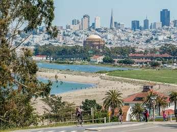
VIEW FROM WAYSIDE: The wayside faces north across the inland side of Crissy Field. You can see the long, manicured expanse of green grass that extends from here all the way to the coast of the San Francisco Bay. You're standing at the edge of Mason Street, between two paths that cut different trajectories across Crissy Field. To your right, a trail cuts north east across the field, and to your left, another trail cuts straight north across the field. To the left of this trail are trash and recycling bins. Off to the left in the distance behind a row of palm trees and white colored buildings with red roofs is the Golden Gate Bridge. An asphalt trail borders the field, you can take it east towards East Beach or west towards Fort Point.
TEXT: The 91st Observation Squadron. Crissy Field was home to many daring pilots who made their mark on aviation history. Among these famous flyers were Major Dana H. Crissy, who died in a crash attempting to fly to the East Coast from here, and Major Hap Arnold, who later led U.S. Army Air Forces during World War II. In 1924, Lieutenant Russell L. Maughan flew from the East Coast to Crissy Field in one day from "dawn to dusk," and Lieutenant Lowell H. Smith landed here after flying around the world.
DESCRIPTION OF IMAGE #1: A black and white photograph of young man with a receding hairline and subdued smile wearing an elaborate uniform with gold, braided epaulets, a stiff, high collar and twin rows of brass buttons running from his chest to his belt. The sleeves of his uniform are decorated with three loops like a clover, and two small lines that cross each other in an "X" with a circular button at their center, just above a broad stripe marking the cuff.
CAPTION: The airfield's namesake, Major Dana Crissy, commander of Mather Field in Sacramento, crashed while attempting a transcontinental flight that left here in 1919. The airfield was named in his honor in 1921.
DESCRIPTION OF IMAGE #2: A photograph of two men dressed in heavy coats down to their thighs with thick fur collars, knee high boots and cowls with goggles resting on their foreheads standing at opposite ends, holding a white, tubular sheet in front of the tail end of a biplane. The sheet has several prominent circular tears, as though something has punched through it.
CAPTION: Air Corps members show off a target sleeve after a practice mission with antiaircraft gunners.
DESCRIPTION OF IMAGE #3: To the right of the photo of the Air Corps members, is one of many women dressed in long coats, cowls, goggles and boots. Several of them are holding small children, all of whom are wearing winter hats and coats. Behind the women, clearly visible above their heads, is the propeller of a plane, upon which sit three toddlers in pullovers and shorts.
TEXT: Behind the Flight Line. Officers and their families were housed on the bluff by the Golden Gate. Enlisted men lived in the three-story barracks behind you. The mothers, wives and children of the aviators were authorized to go aloft on special occasions to "eliminate worry" about the risks their daring men were taking. Their happy expressions suggest the strategy worked.
DIRECTIONS TO NEXT WAYSIDE: Walk east just under one half mile to reach the next wayside located on the northern side of the trail.
