Last updated: August 25, 2025
Person
John White
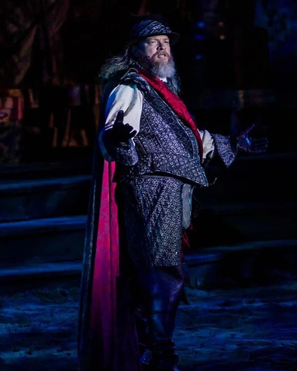
The Lost Colony, Roanoke Island Historical Association
Quick Facts
Significance:
Artist and Governor of 1587 Expedition
Place of Birth:
England
Date of Birth:
C. 1545
Place of Death:
Newtown, Kilmore, Ireland
Date of Death:
C. 1590s
"As we entered up the sandy bank, upon a tree-in the very brow thereof-were curiously carved in the fair Roman letters, CRO. These letters we knew to signify the place where I should find the planters seated, according to a secret token agreed upon between them and me at my last departure from them."
-John White, August 1590
When studying the history of English Colonization on Roanoke Island, few names are as well known as John White. An artist by trade, White eventually became governor of the ill-fated Lost Colony, and the only colonist to return. His impact as an artist helped shape European views on the New World, while his time as governor cemented his place in history as an integral part of the Lost Colony mystery.
Born sometime around 1540, nothing is known about John White's early life. In 1566, he married Thomasyn Cooper and they had two children. Their son, Thomas, died young, but their daughter, Eleanor, survived to adulthood. During this period, White trained and then worked as an artist.
His first appearance in the historical record as an artist occurred in 1577. An English captain and privateer named Martin Frobisher led multiple voyages to Greenland and Baffin Island in search of a Northwest passage to Asia between 1576 and 1578. While it is not known for sure whether or not White was on the 1577 voyage, he did create detailed paintings of what Frobisher found. The paintings included a man in a kayak, an Inuit woman and child, as well as an Inuk man. White falls back into obscurity again after this project.
John White reappears with Sir Walter Raleigh's colonization attempts in the 1580s. Again, there is speculation as to whether or not White was on the first voyage in 1584, but he was on the voyage in 1585. White was hired to paint what the English found on their voyage to the New World. They left in April of 1585 with six hundred men split between seven ships planing to create a military colony and privateering base. Other notable members of the voyage included scientist Thomas Hariot, as well as Carolina Algonquian translators Manteo, and Wanchese. The ships were led by Sir Richard Grenville, an experienced admiral and privateer. While traveling across the Atlantic, a storm separated the fleet. White, being on the flagship Tyger with Grenville, arrived in Puerto Rico before the rest of the fleet. Grenville waited for the rest of the fleet by engaging in some privateering. This upset Ralph Lane, governor of the military colony, who wanted more time to prepare for winter.
When the fleet finally arrived off the coast of Ossomocomuck (the Outer Banks), storms damaged the ships and the Tyger, piloted by Simon Fernando, ran aground trying to pass through a shallow inlet. The Tyger was carrying most of the supplies, which were damaged by sea water and became unusable. They could no longer support a colony of 600 men. Tensions between Lane and Grenville grew more strained as Lane prepared to support a smaller colony.
John White's concerns were not about food supplies or fortresses. He instead began doing the work he was hired for: creating a visual representaion of the people, plants, animals, and way of life in the New World. He created at least 75 images from Puerto Rico and the Outer Banks. It's likely more exisited, but were lost when the Tyger ran aground. John White's art gave Europeans their first glimpse of what life was like in the New World. White's most important paintings were of the Carolina Agonquian. These paintings are some of the only pieces of information we have on the tribes of the Outer Banks before colonization and disease changed their way of life. He also worked with Thomas Hariot to create a remarkablely accurate map of the Outer Banks and part of the Chesapeake Bay.
When Grenville left 107 men under the direction of Lane on August 25, 1585, it is unclear which group White was with. There are arguments both for White staying with the military colony and for him going to back to England with Grenville. While we do not know whether or not John White was in the military colony in 1585-86, he was eventually appointed governor of Raleigh's new colony attempt, the "Cittie of Ralegh." White was also tasked with recruiting for this new colony in the New World. 117 people agreed to make the voyage, including White's daughter and son-in-law, Eleanor and Ananias Dare. They planned to settle in the Chesapeake Bay, about 90 miles north of Roanoke Island.
The colonists departed England on April 26, 1587 with a flagship, flyboat, and a pinnace. They traveled south until they were able to use the Westerlies to reach the island of St. Croix. From there, the colonists traveled to Puerto Rico for supplies, then along the coast of Hispaniola (Dominican Republic) before heading north. They arrived of the coast of Roanoke Island on July 22, 1587. John White and a few other men went ashore to try and find the 15 men left by Grenville in 1586. They found no trace of them, but their luck only worsened. Upon returning to the ships, pilot Simon Fernando, the same pilot from 1585, refused to take the colony any further north. He told them it was too late in the summer to continue north, and the colony would be left here.
The colonists were put ashore at Roanoke Island. They went to the site of Ralph Lane's military colony and repaired the buildings. Just a few days later, colonist George Howe was killed by members of the Roanoke tribe. The colonists, led by John White, retaliated, but unknowingly attcked the Croatoan tribe instead of the Roanoke. With tensions mounting, the colonists began to insist that John White go back to England and get more supplies and help. White was reluctant to do so. His granddaughter, Virginia Dare, had just been born and baptized. His daughter Eleanor and son-in-law Ananias Dare were colonists. But White eventually agreed to return to England, leaving 35 days after they arrived.
John White's voyage back to England was harrowing. The ship was struck by storms, disease, and dangerously low supplies. The ship limped it's way back to back to port, arriving in Ireland on October 16. White quickly traveled to London to meet with Sir Walter Raleigh and, hopefully, Queen Elizabeth I. Unfortunately, fate was not on his side. In 1588, tensions between England and Spain reached a breaking point, and the Spanish Armada gathered to attack. Queen Elizabeth I had no standing navy. She comandeered every English ship into the English Navy to defend against Spain. This meant John White had no available ship to return him to the colonists on Roanoke Island.
It was not until 1590 that John White found passage back to Roanoke. A privateering ship agreed to bring him to the island and hopefully, drop him off with the colony. They left England on March 20, 1590. Because this was a privateering trip and the colony was added on, the ship did not reach the Outer Banks until mid-August. On August 18, 1590, Virginia Dare's third birthday, John White went ashore to look for his family and the other colonists. Instead, they found a palisade, houses missing, and no people. The only clue as to what may have happened was "CRO" carved into a tree and "CROATOAN" carved into a post in the palisade. John White believed this meant the colonists had relocated to the island of Croatoan (modern-day Cape Hatteras) and joined Manteo and the other members of the Croatoan Tribe. White asked the ship to bring him there to search, but a hurricane blew the ship off course and back out to deeper waters. By the time they saw land again, they were at the Azores off the coast of Spain. They arrived back in England on October 24, 1590.
Very little is known about John White after this point. He moved to Ireland and settled in Newtown in Kilmore, an unknown location today. In 1593, he sent his journal and a letter to Richard Hakluyt (who would later publish them). After this point, there is speculation as to when White died, with dates as early as 1593, to as late as 1606. Other than the seven-year period that Sir Walter Raleigh attempted to start a colony, John White's life is difficult to trace. Perhaps it is somewhat fitting that the life and fate of the Governor of the Lost Colony is a little mystery of its own.