| The War in the Pacific |
|
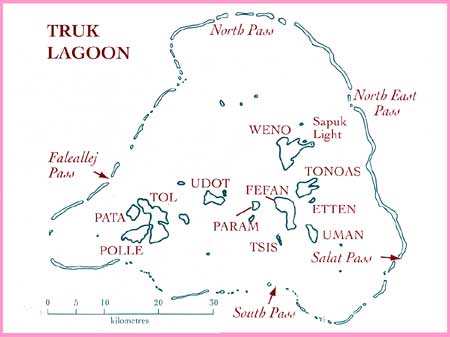
War in Paradise Chuuk Geography Chuuk is one of the four states in the Federated States of Micronesia (FSM), the other three being, Yap, Pohnpei and Kosrae. It is located approximately 7 degrees north of the equator and on a line of longitude approximately the same as the eastern coast of Australia. The FSM, this 'sea of islands'—having a total land mass of 701 sq. kilometres in a current economic exclusion zone of 3 million square kilometres—is also referred to as the Caroline Islands and together with the other island groups, the Marshalls and the Marianas, have been referred in the historical record as Micronesia. Chuuk consists of 19 'high' islands located inside a lagoon called Truk Lagoon, 10 atolls and 225 'low' coralline islands, of which many are located outside the lagoon. The high islands are composed of volcanic rock and are the peaks of a mountainous land mass, their total mass above water being 91 sq. kilometres. The lagoon is about 64 kilometres in diameter and has been formed by a barrier reef enclosing an area of 2,125 sq. kilometres of relatively deep and protected water. The islands are fringed with many mangroves that support a large and diverse marine life. The fertile high islands contain native trees and plants comprising breadfruit, coconuts, mango, banana and taro that, in association with fish, have supported a subsistence lifestyle for the Chuukese for many years.
|

