|
Raising the Roof of the Rockies
A Geologic History of the Mountains and of the Ice Age in Rocky Mountain National Park |
The Last Seas
Eventually the sea began to encroach over the region again and, by about 100 million years ago, it had covered most of the Park, where it remained for more than 30 million years. Thousands of feet of sand and clay (now sandstone and shale) and some calcareous sediment (now limestone) were successively deposited on its floor, buried, forced down into the earth, and solidified into rock. Life in the sea included ammonites whose shells evolved through a remarkable series of coiled forms with the passage of time. Finally, about 70 million years ago, the sea withdrew from Rocky Mountain National Park and has never returned. Outcroppings of shale, probably deposited about 75 million years ago, have been found in the saddle east of Lead Mountain in the northwest part of the Park. The sea withdrew gradually, taking about 16 million years to leave all of Colorado.


The Rockies Begin to Rise
The sea withdrew because the crust of the earth was being forced upward. This upward force caused the ancient foundation rocks to break along steep fractures into great blocks which were uplifted irregularly in a north-trending region that is now the Front Range of Colorado and includes the Park. The previously deposited sediments, now rocks, were stretched into broad folds across the irregularly rising blocks. Eventually the sedimentary rocks broke along the western side of the uplift, near the present west boundary of the Park, and great masses of the granite and gneiss core of the mountains spread or slid slowly westward over younger rocks toward lower terrain.
At the surface, streams attacked the slopes of the land as it rose from the sea, stripping away the soft marine deposits. About 68 million years ago volcanoes broke out in the Front Range south of the Park, and volcanic ash from them blew into the receding sea. There it was buried in the deposits where it is now preserved as layers of bentonite. After the sea had withdrawn from Colorado, streams carried large quantities of silt and clay east and west to great swampy plains on which flourished a luxuriant subtropical vegetation destined to be come bituminous coal.
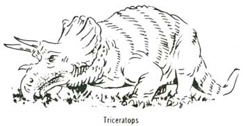
By about 67 million years ago the streams had eroded away nearly 5,000 feet of sedimentary rocks from the mountains and had cut into the underlying ancient gneiss, schist, and granite. They deposited the eroded material on broad plains along the foot of the mountains. At that time, summit areas were perhaps as much as 3,000 feet above sea level and rose 2,000 to 2,500 feet above the surrounding lowlands. It was on these flood plains that the last of the dinosaurs, the great three-horned Triceratops, died out about 65 million years ago. Bones of these large reptiles have been found in deposits of this age near Greeley, east of the Park.


And Rise Some More
From about 65 million years ago to about 54 million years ago continued uplift raised the mountains to greater heights. Each upward pulsation invigorated stream erosion on a grand scale. About 54 million years ago volcanoes broke out again in the Front Range. One of these erupted in the Park, in the area of the present east and south slopes of Mount Richthofen. Here the remains of lava flows, composed of a volcanic rock called andesite, rest on the ancient gneiss and schist; and a plug of similar andesite, formed in the throat of the volcano, appears to cut through the deposits of the last seas.
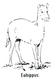
The mountains at this time were possibly 4,000 to 6,000 feet above sea level, though the summits of the volcanoes were probably a few thousand feet higher. To the north in southeastern Wyoming, the Laramie, Medicine Bow, and Park Ranges were also highlands, from which streams carried gravel and sand into adjacent broad lowland basins. It was in the warm humid, temperate to subtropical forests of these low lands that small mammals developed, among them the tiny horse, Hyracotherium, commonly called Eohippus.


| <<< Previous | <<< Contents >>> | Next >>> |
richmond/sec3.htm
Last Updated: 8-May-2007