|
NATIONAL PARK SERVICE
Pacific Coast Recreation Area Survey |

|
UNDEVELOPED SEASHORE AREAS IN CALIFORNIA (North Central Portion)
|
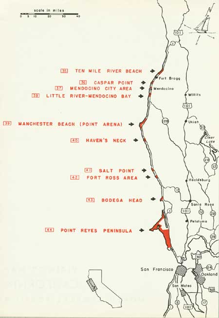
| California — North Central Portion (Vicinity Map) (click on image for an enlargement in a new window) |
35
Ten Mile River Area
North Central California
LOCATION: Beginning about 3 miles north of Fort Bragg and extending northward for 4-1/2 miles.
ACCESSIBILITY: By car from State Highway 1. All but the extreme northern portion is closed to the public.
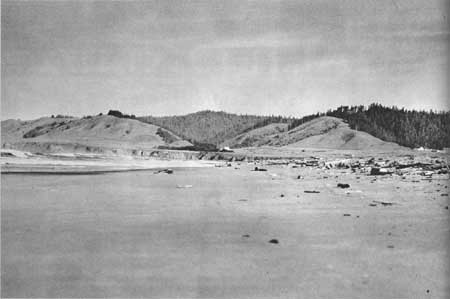
DESCRIPTION OF AREA: At the southern end of the area is Laguna Point and MacKerricher Beach State Park. The northern extremity of the area is marked by Abalobadiah Creek and a small but attractive beach. Ten Mile River cuts across the area some three-quarters mile south of the creek. North of the river, the shoreline is characterized by reefs, tidepools, spectacular offshore rocks, and surging, billowing surf. South of the river is a continuous beach some 15 to 30 yards wide, with fine textured, firm, and dark buff to nearly black sand. A considerable amount of driftwood and large logs have accumulated. The underwater slope is generally rather steep with probable undertow. The average inland depth of the area is about one mile. There are several groups of mixed coniferous and deciduous trees, but essentially the inland portion is made up of low, unstable sand dunes.
PRESENT USE: South of Ten Mile River, the area is traversed by a hard surfaced, high speed logging road which serves as a major supply artery for the Union Lumber Company at Fort Bragg. Some general farming takes place near the highway, but is limited by the dunes.
ANALYSIS: The general region is sparsely populated, and there is no immediate urgent need for extensive beaches in the vicinity. Although present use precludes any public recreation, future needs may justify ultimate acquisition of the area, in which case the existing logging road could provide public access and circulation. The area would be suited to such activities as general beach use, surf fishing, limited picnicking and camping, plus riding and hiking. The outlet of Ten Mile River is given high priority in the Mendocino County Master Plan for acquisition as either a State beach park or for beach access. The entire area as described above would logically tie in with the present expansion of MacKerricher Beach State Park, and would result in the preservation of some eight and one-half miles of beaches and scenic headlands.
|
| Ten Mile River Beach |
36
Caspar Point
North Central California
LOCATION: Five miles south of Fort Bragg, and adjoining the community of Caspar on the west and north.
ACCESSIBILITY: Existing gravel roads, formerly used for lumber mill operations, afford access from State Highway 1 throughout the southern part of the area. The remainder is served by private road but is closed to the public.
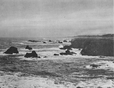
DESCRIPTION OF AREA: The area includes about two miles of scenic shoreline. Rock bluffs, some 40-50 feet in height, drop abruptly from a flat grassy tableland to the ocean. Small coves and inlets, shallow reefs, and numerous offshore rocks add to the scenic interest. Tidepools support various forms of marine life, and abalone colonies thrive in the deeper but yet accessible waters farther offshore. A grove of wind-blown, picturesque Bishop pine is located near the highway. At the southern end of the area is Caspar Creek, with a small but attractive beach of clean, light-colored sand.
PRESENT USE: Several business houses and residences of Caspar line the highway in the southern part of the promontory. A row of abandoned lumber mill employee cabins and two old warehouse buildings are in the same vicinity. Four or five residences also occupy the central portion of the area. On the north side of Caspar Creek are the remains of the old lumber mill. Two small dwellings are situated at the southern end of the beach. Grazing of sheep occurs on the major portion of the area. The southern portion is used for picnicking, sightseeing, and photography. Rock fishing and abalone hunting take place along the shoreline.
ANALYSIS: The area has excellent natural seashore values and its acquisition for public use is amply justified. Inclusion of the beach at Caspar Creek and the undeveloped portion of the promontory north to Jughandle Creek would make a logical, well-rounded unit. Early action will be required if the area is not to be lost to subdivision developments. The Mendocino County Master Plan proposes acquisition of the beach for public access to the ocean.
|
| Caspar Point |
37
Mendocino City Area
North Central California
LOCATION: Immediately north and west of the City of Mendocino, and nine miles south of Fort Bragg.
ACCESSIBILITY: No roads exist within the area. However, it adjoins Highway 1 on the west, and provision of suitable access would be no problem in its development and public use.
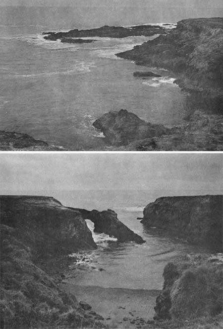
DESCRIPTION OF AREA: This area incorporates about 1-1/2 miles of quite scenic shoreline, with rocky bluffs up to 60 feet in height. Offshore rocks and numerous small coves along the irregular bluffs add to the scenic interest. The geologic character of the shoreline, with its many tidepools and submerged rock formations, provides habitat for varied forms of marine life. The inland portion of the area extends back from the shoreline an average distance of one-quarter mile. It is rather flat, with a gentle slope toward the sea. Grasses make up the vegetative cover.
PRESENT USE: The southern one-third of the area is within the limits of Mendocino and has the usual municipal developments such as businesses, residences, churches and schools. The remainder is devoted to grazing and public use is not permitted at the present time.
ANALYSIS: The area is of value primarily for its immediate shoreline and foreshore. The scenic qualities and varied marine life which they possess are of general public interest and appeal.
The owner of the undeveloped portion plans to donate the property for public park purposes, and it is recommended as a State Beach in the California Five Year Plan and the Mendocino County Master Plan. Both documents assign it a high priority. Its acquisition and development will help to serve a definite existing need for public access to and enjoyment of seashore values. This need is rapidly becoming more acute throughout this general
|
| Mendocino City Area |
38
Little River-Mendocino Bay
North Central California
LOCATION: Thirteen miles south of Fort Bragg and adjacent to existing Van Damme Beach State Park.
ACCESSIBILITY: Directly off State Highway 1. The present owners do not permit public access over the area.
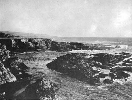
DESCRIPTION OF AREA: Two and one-half miles of highly scenic shoreline are involved. Certain distinctive, inspirational qualities set it apart from most other similar areas in the general region. Chief among these qualities are the deep feeling of intimacy with the sea and the vivid impression of its immensity and power which one gains as he stands on the irregular, rock-studded shore with its many tidepools and reefs. There is also excellent geologic interest and an abundance and variety of marine life. Inland, the area is composed of open grazing land. Low hills screen the highway from view and give way to gentle slopes or nearly flat land nearer the shore.
PRESENT USE: There are 2 or 3 widely scattered farmhouses near the highway, and 2 residences, including that of the Supervisor, Van Damme Beach State Park, are at the southern end of the area. Otherwise, the area is used for grazing.
ANALYSIS: The area has a rather windy, exposed location, and the 50-60 foot rock bluffs do not offer generally easy access to the shoreline. Although its recreation potential is somewhat limited, the inherent scenic, inspirational and scientific values amply warrant preservation of this segment of unspoiled, rugged California coastline.
About one-half mile of shoreline at the southern end of the area is proposed for addition to Van Damme Beach State Park as a part of the Division of Beaches and Parks Five Year Master Plan.
|
| Little River-Mendocino Bay |
39
Manchester Beach (Point Arena)
North Central California
LOCATION: Five miles north of the town of Point Arena and two miles west of Manchester.
ACCESSIBILITY: By car from State Highway 1.
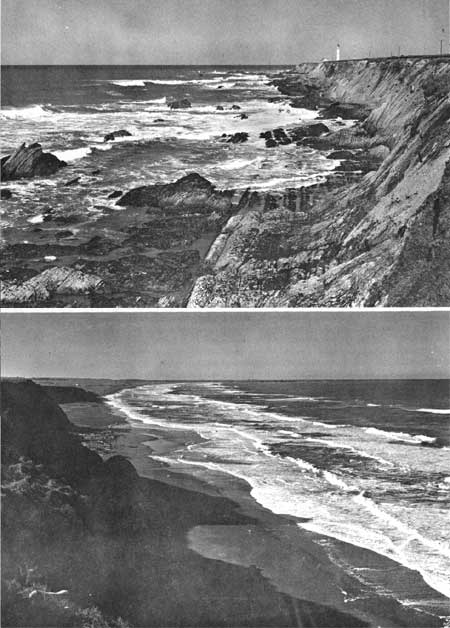
DESCRIPTION OF AREA: The area includes 5 miles of shoreline extending from Alder Creek on the north, to 1 mile south of Point Arena. North of Point Arena, the shoreline consists of a wide, attractive beach, varying in width from 100 to 200 yards at low tide. Considerable driftwood has accumulated in places. South of Point Arena, the shoreline is composed of low cliffs, rocky reefs, tidepools and offshore rocks. This scenic portion supports various species of marine life typical of the Pacific Coast. Most of the shoreline is backed by low slopes and sand dunes, and covers much of the inland area north of Point Arena. Trees are largely limited to the borders of several streams which cross the area. The Division of Beaches and Parks owns some 260 acres of undeveloped land, with 1.2 miles of beach, in the central part of the area. Also, a 20-acre tract including a lighthouse at Point Arena is under U. S. Coast Guard jurisdiction, and an Air Force radar station is situated north of the state-owned property. Some 80 percent of the area is privately-owned.
PRESENT USE: Except for the dunes portion, the private lands are devoted to grazing. Present public access is restricted mainly to the mouth of Alder Creek and the state-owned property. Activities at these points consist of surf and river fishing for salmon and steelhead and minor picnicking.
ANALYSIS: This is one of the few extensive beaches along the northern California coast that still retains its natural seashore qualities. The area is of state wide importance. Cool water temperatures are not conducive to extensive swimming, and fishing probably will continue as the dominant recreation pursuit. The area is also suited to beachcombing, hiking, exploring, picnicking, camping, nature study and photography. The portion of the area from Point Arena to Alder Creek is included in the master plans of Mendocino County and the State Division of Beaches and Parks as a proposed extension of the present State park property.
|
| Manchester Beach (Point Arena) |
40
Havens Neck
North Central California
LOCATION: Eleven miles south of Point Arena.
ACCESSIBILITY: From State Highway 1 or by boat.
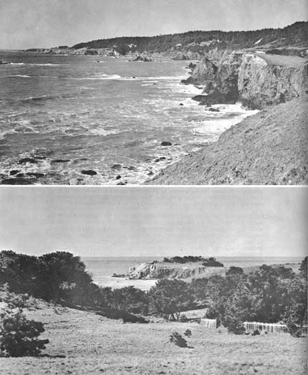
DESCRIPTION OF AREA: This spectacular and highly scenic headland rises some 100 feet above the sea. A very narrow neck of land, with a small sheltered beach on its north side, separates this high, rocky promontory (known as Havens Neck) from the mainland. The promontory offers magnificent views of the rugged California coastline past Ship Rock to the north and past Fish Rock to the south. The adjacent mainland portion of the area is a pleasant upland of excellent pine woods interspersed with grassy meadows. This upland area averages somewhat more than 1,000 feet in width and has several wide, wooded gulches. The barking of sea lions can often be heard from their resting places on the off-shore rocks.
PRESENT USE: No agricultural or ranching use is made of the area. Development is limited to a few private homes near the northern and southern limits of the area. The promontory is popular among the residents of the vicinity who walk to Havens Neck for sightseeing. According to local information, a private corporation is interested in acquiring Havens Neck for a restaurant development, but no definite action yet has been taken. Fish Rock Gulch, at the southern extremity of the area, has a concession development for picnicking and beach access. It is open to the public on a fee basis. The area is largely under one private ownership.
ANALYSIS: In addition to its outstanding scenic qualities, the area affords unusual opportunity for camping, picnicking, hiking and photography. The portion of the mainland west of the highway extending north from Fish Rock Gulch for two miles, plus the prominent headland, should be set aside for public recreation use.
A small mainland acreage and the headland are included in the Mendocino County Master Plan for beach access, to be provided by the State Department of Fish and Game.
|
| Havens Neck |
41
Salt Point
North Central California
LOCATION: Eighteen miles north of Jenner.
ACCESSIBILITY: The headquarters buildings of the Salt Point Ranch are accessible by car from State Highway 1. Access to the area by the general public is not permitted at present.
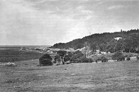
DESCRIPTION OF AREA: The area considered includes about five and one-half miles of irregular, rocky, scenic shoreline. The white surf constantly plunges and boils among the many off-shore rocks and over shallow reefs. The shore is indented by several large, pleasant coves. During the migration season, whales venture quite close to the shore, seemingly spouting for the particular benefit of the observer, and the tidepools and reefs support an abundance of abalone and other forms of invertebrate marine life. Stands of pine interlaced with rolling grassy meadows, and numerous limestone outcrops impart a highly pleasing character to the uplands.
The northern half of the area as identified averages slightly less than one and one-half miles in width. Except for the coves, which closely approach the highway, the southern half is about 250 yards in width.
PRESENT USE: Cattle and sheep grazing are the dominant land uses. The present lessee of the Salt Point Ranch, which includes most of the area, permits fishing on a fee basis and has installed a boat ramp. Except for the ranch buildings at the north boundary and a small concession providing picnicking and trailer camping facilities at the south, it is completely undeveloped.
ANALYSIS: This area has excellent natural seashore values and a variety of interests. It affords one of the very few opportunities in this part of the California coast for the successful launching of boats. It is amply qualified for preservation as a public recreation area and should include a portion of the densely wooded hills on the east side of the highway, as well as the lands between the highway and the ocean. Eighty-eight acres of land at the southern end of the area, with about three-quarters mile of shoreline, are proposed for acquisition in the Sonoma County Master Plan.
|
| Salt Point |
42
Fort Ross Area
North Central California
LOCATION: Twelve miles north of Jenner.
ACCESSIBILITY: By State Highway 1.
DESCRIPTION OF AREA: The area considered includes about one and one-quarter miles of ocean frontage. It extends inland some three-quarters mile to the top of a wooded ridge east of the highway. Fort Ross State Historical Monument incorporates four acres of land within the area. This was a Russian military post established in 1812 as a base of operations for sea otter hunters ranging California waters. The stockade and most of the buildings are reconstructed.
The shoreline is composed mainly of steep, rocky bluffs 40 to 50 feet in height. A promontory which served as a lookout post for the fort rises to a height of 125 feet. It affords excellent views of the coastline to the south, and whales are frequently seen in the distance during the fall and spring. A small sandy beach is located at the mouth of Fort Ross Creek. The uplands consist of pleasing, rolling hills with patches of woodlands. Several specimens of rare California nutmeg grow on the ridge. The old cemetery and a still-vigorous apple orchard, established in connection with the fort, are features of historic importance. Also, ships used by the fort occupants were built and maintained in one of the coves.
PRESENT USE: Fort Ross State Historical Monument is managed and operated as a unit of the State Park System. The remaining lands are privately owned and are devoted largely to sheep ranching, with a minimum of private development. The immediate shorelands and the foreshore are popular for sight seeing, fishing and abalone hunting.
ANALYSIS: The area is primarily of historic importance, but it possesses good scenic and recreation interest as well. Public ownership of the area is highly desirable for the preservation of its natural and historic values. The lands between the highway and the ocean are proposed for acquisition in the Sonoma County Master Plan and the entire area is included in the Five Year Master Plan of the Division of Beaches and Parks.

|
| Fort Ross Area |
43
Bodega Head
North Central California
LOCATION: Nine miles south of Jenner and 42 miles north of San Francisco.
ACCESSIBILITY: By car via one mile of spur road from State Highway 1. The area is privately owned, and only authorized persons are permitted access. There are no roads to the interior of the area.
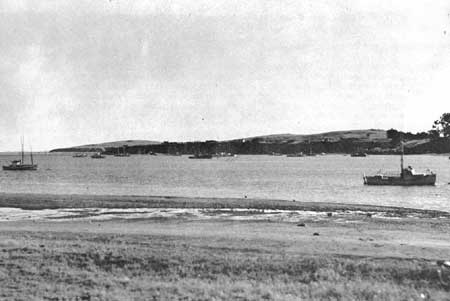
DESCRIPTION OF AREA: Bodega Head is a two and one-half mile long peninsula bounding Bodega Harbor on the west. The peninsula is approximately a mile in width at its widest point. The shoreline, about six miles in length, is mainly of narrow sandy beach. The southwest end of the peninsula, however, has a rocky shoreline and typical off-shore rocks. A portion of the shoreline, including Horseshoe Cove, is noted for its marine biology and its scenic qualities. The uplands rise to a height of about 150 feet and consist of partially stabilized to shifting sand dunes and hummocks. The southwest portion of the peninsula is well grassed.
The area adjoins the south boundary of existing Bodega Bay State Park. Doran Beach County Park is situated on a long sandspit on the eastern side of the narrow inlet to Bodega Harbor. The harbor also has extensive tidal mudflats, with clams and associated invertebrate marine life. It is valuable habitat also for waterfowl, shore birds, marine birds and many songbirds.
PRESENT USE: Grazing is the dominant land use. Beach house development is beginning to creep into the area from the north, but as yet it is almost entirely undeveloped.
ANALYSIS: Except as noted above, the area is not of outstanding scenic value. It is, however, rich in both history and archeology. It is also one of the significant biologic areas on the Pacific Coast and warrants preservation from that standpoint alone. It would make a logical addition to the Sonoma Coast parks, of which Bodega Bay State Park is a part. Bodega Harbor would make a particularly fine landlocked harbor for small pleasure craft. The area is included in the Sonoma County Master Plan and the Five Year Master Plan of the State Division of Beaches and Parks.
|
| Bodega Head |
44
Point Reyes Peninsula
North Central California
LOCATION: The southern limit of this area is approximately 15 miles north of the entrance to the Golden Gate Channel (Point Bonita). Tomales Point is at the northern terminus.
ACCESSIBILITY: Via U. S. Highway 101 and county spur roads, or directly by State Highway 1, a distance of approximately 35 miles from San Francisco.
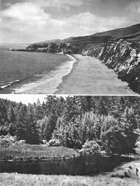
DESCRIPTION OF AREA: This coastal area extends from a point just south of Double Point in Drakes Bay north to Tomales Bay. The area within the Peninsula consists of approximately 28,000 acres, including about 45 miles of shoreline. The shoreline varies in character, with wide sandy beaches, wave-swept caves, offshore rocks, steep coastal bluffs and one three-mile long sandspit. The upland consists of sand dunes and grassland (15,000 acres) graduating into chaparral (1,500 acres) and magnificent fir and pine forest (11,500 acres). Also included are such features as Drakes Estero with its 28 miles of shoreline, 9 inland fresh-water lakes plus Abbotts Lagoon of several hundred acres, several fresh and salt water marshes, and an interesting variety of birds and mammals.
PRESENT USE: There has been relatively little development in the entire area. Ownership is mainly in large ranch holdings. The U. S. Coast Guard maintains two installations on Point Reyes. An oyster packing plant and a fish packing plant are the only known commercial developments.
ANALYSIS: The transition in this relatively undeveloped region from its 45 miles of seashore to the forest-covered Inverness Ridge, a scant 2 miles away, provides a combination of scenic, recreation, and biologic interests which can be found nowhere else in this country as near to a large center of population. This coastal area is believed to warrant national status. If the possibility of acquisition for public ownership exists, positive action should be initiated immediately and cooperatively to that end by the County, State, and Federal Governments.
|
| Point Reyes Peninsula |
| <<< Previous | <<< Contents>>> | Next >>> |
rec_area_survey/pacific/ca2.htm
Last Updated: 25-Jun-2007