|
PADRE ISLAND
Padre Island National Seashore Historic Resource Study |

|
ILLUSTRATIONS
|
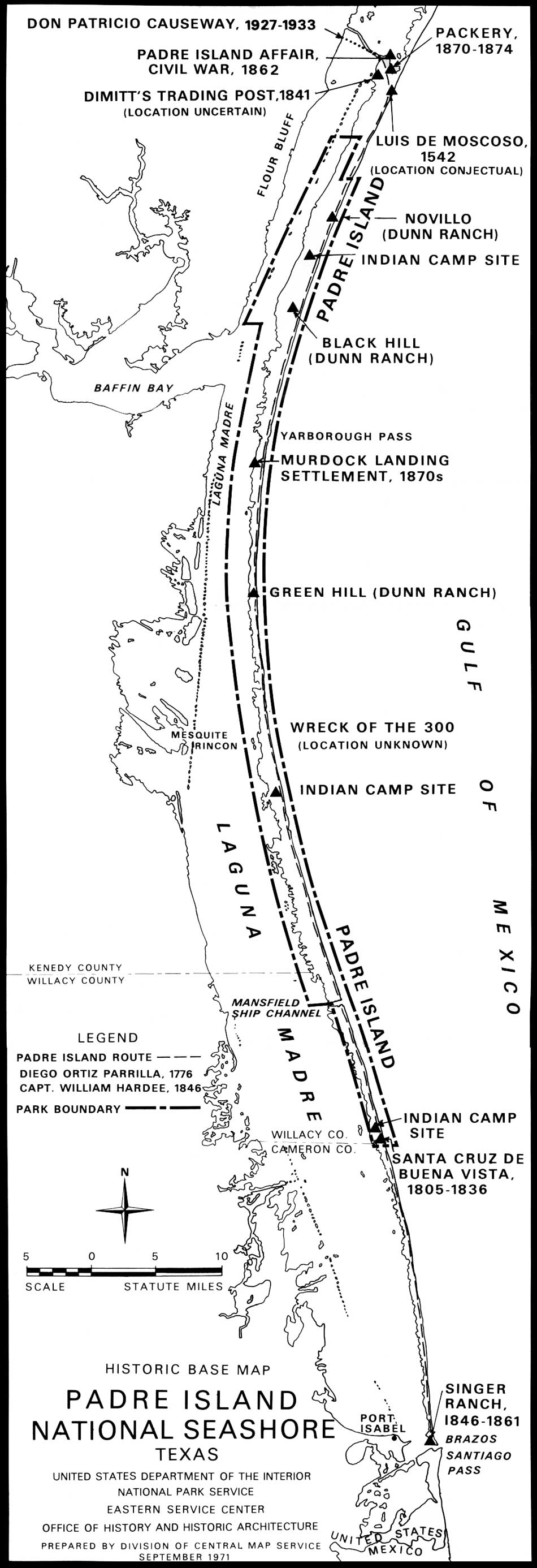
| Historic Base Map. (click on image for an enlargement in a new window) |
|
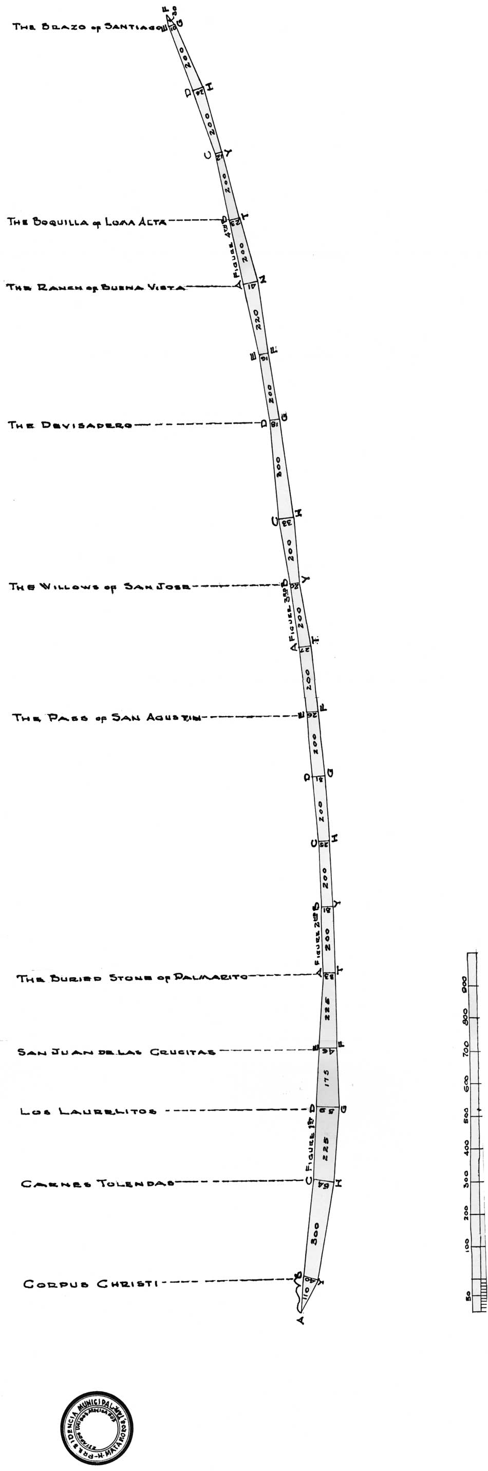
| PLATE 1. This is a copy of the 1828 Padre Island survey which confirmed Padre Nicolas Balli's ownership of the island. The surveyor measured Padre in varas. Note the location of Padre Balli's Buena Vista ranch. (Nueces County Court Records). (click on image for an enlargement in a new window) |
| <<< Previous | <<< Contents>>> | Next >>> |
pais/hrs/plate1.htm
Last Updated: 16-Mar-2007