|
Jean Lafitte
Historic Resource Study (Chalmette Unit) |

|
ILLUSTRATIONS
|
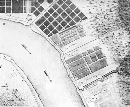
| Illustration 6. Map showing location of Line Montreuil, excerpted from "Plan of the City and Suburbs of New Orleans," 1815, by J. Tanesse, City Surveyor. (Louisiana Collection, Tulane University Library) |
|
|
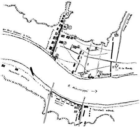
Illustration 7. Map of the Battle of New
Orleans, January 8, 1815, redrawn from Alexander Dickson's sketch, with
action as follows: 1. Flank battalion led by Lieutenant Colonel Jones attacking through wood. 2. Major General Gibbs's column. 3. Major General Keane's column. 4. Reserve under Major General Lambert advancing in support. 5. Flank battalion of Colonel Rennie attacking redoubt. (From Alexander Dickson, "Journal of Operations in Louisiana, 1814-1815," Louisiana Historical Quarterly, XLIV (January-April, 1961)) |
|
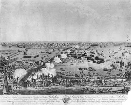
| Illustration 8. Hyacinthe Laclotte's view of the Battle of New Orleans, January 8, 1815. Engraved by Debucourt. (New York Public Library) |
|
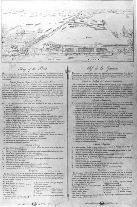
| Illustration 9. Key to the Hyacinthe Laclotte view of the Battle of New Orleans, January 8, 1815. (See preceeding photo) (Historic New Orleans Collection) |
|
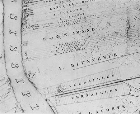
| Illustration 10. A section of "Topographical Map of New Orleans and its Vicinity," by Charles F. Zimpel, 1834, showing the battlefield area of 1814-15. (Library of Congress) |
| <<< Previous | <<< Contents >>> | Next >>> |
jela/hrs/hrsi2.htm
Last Updated: 05-Sep-2004