
|
Geological Survey Bulletin 1238
Volcanic Hazards at Mount Rainier, Washington |
CONTENTS
Lava flows and pyroclastic eruptions
Anticipation of debris flows and eruptions
FIGURES
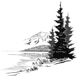
Frontispiece. Yellowish-orange postglacial avalanche deposit veneering gray glacial deposits at Paradise Park on the south side of Mount Rainier. The avalanche probably originated at or near the summit of the volcano
1. Map showing location of Mount Rainier with respect to the Cascade Range and Puget Sound lowland
2. Location map of Mount Rainier
3. Aerial view of the summit cone of Mount Rainier
4. Photograph of pyroclastic deposits exposed in a roadcut at Yakima Park
5. Photograph of avalanche debris which originated in rockfalls at Little Tahoma Peak in December 1963
TABLES
1. Postglacial eruptions, debris flows, and avalanches at Mount Rainier
2. Types of eruptions that have occurred at Mount Rainier in postglacial time, anticipated effects and frequency of similar eruptions in the future, and possible warning signs of an impending eruption
United States Department of the Interior
WALTER J. HICKEL, SecretaryGeological Survey
William T. Pecora, DirectorFirst printing 1967
Second printing 1969Library of Congress catalog-card No. GS 67-166
U.S. GOVERNMENT PRINTING OFFICE : 1967

|
| Yellowish-orange postglacial avalanche deposit veneering gray glacial deposits at Paradise Park on the south side of Mount Rainier. The avalanche probably originated at or near the summit of the volcano. (Frontispiece). |
| <<< Previous | <<< Contents >>> | Next >>> |
bul/1238/contents.htm
Last Updated: 28-Mar-2006